


The weather’s pretty quiet in the Alps right now – mostly sunny, mostly dry, cool but not cold. So today we thought we’d fire ourselves up with some Rocky-Mountain powder porn instead.
As regular Snow Report readers will know, the season get off to a pretty disappointing start over there – especially in Colorado. But this month winter has got its mojo back, and storm after storm has come rolling across the region. The amount dropped has varied widely from resort to resort. Some dumps have been pretty heavy: little Powderhorn in Colorado reported half a metre of fresh snow yesterday, while Snowbird in Utah notched up 33cm. At other times, it’s been more like 10cm. But what’s really remarkable is the way the snow’s have kept on coming: and according to the widely-followed Colorado snow blogger Joel Gratz , there’s more on the way. He reckons Steamboat in northern Colorado could see 15cm of fresh snow tonight, and that there will be more widespread snow again on Sunday night and Monday.
Advertisement
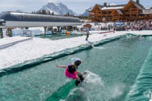
Right then, that’s the situation. Here’s that powder porn I was talking about…And if anyone from an Alpine ski resort is watching can I ask – why don’t more resorts in Europe produce material like this when it snows?
First, from Breckenridge, here’s the winner of Welove2ski award for “Most Infectious Sense of Fun in a Powder Porn Video”.
Next up, winner of “The Video That Almost Makes Us Want to Get onto a Snowboard. Almost” category, from Vail.
From Steamboat, here’s the winner of the “Cheesiest Soundtrack”
And, from Jackson Hole, this video won the award for “Most Gutless Cup of Coffee We’ve Ever Seen in a Powder Porn Video”. There’s no arguing with the snow, though.
We could show you many more – from Aspen, Beaver Creek, Keystone, etc, etc. Needless to say, we wish we could be there…
A long spell of sunshine in the Alps

Back to the Alps. After fresh snow in Italy at the beginning of the week the weather has calmed down, and high pressure is taking over. There’s quite a bit of cloud around in the southern Alps, and there was fresh snow overnight in the resorts of western Italy (there was about 10cm in Val d’Isere, over the border with France, too). But from now on sunshine is in the Alpine forecast, almost everywhere.
Temperatures are rising slightly too. In Lech in Austria, the freezing level is at 1800m today and could reach 2200m on Monday. In France, Meteo Chamonix is forecasting the 0C point to be at 1500m, rising to 2100m over the weekend. That means skiers will have to adopt spring-skiing tactics in the lower resorts – to cope with the daily freeze-thaw cycle on the slopes.
Generally, across the northern Alps, the avalanche risk off-piste is low – except in resorts lining the Italian border, which saw fresh snow (and high winds) at the start of the week. The snow is starting to bake south-facing slopes however, and you’ll need to ski above 2000m to avoid its effects. All the popular off-piste runs are now tracked out – but conditions are very good for ski touring, in fact the guides at Piste to Powder are talking about the “best ever” ski-touring conditions in St Anton and the Arlberg.
Here’s a sample of the webcams today. Remember, snow depths are good or excellent almost everywhere. Clearly, it’s a cracking day to be out on skis.


Fresh snow in Scandinavia
Meanwhile, up in Are in Sweden, it’s snowing today. 5-10cm of fresh is expected, with more to come at the weekend. As you’d expect, there’s not much to look at in the webcams today.

| France: the snow’s still deep almost everywhere, and there’s some cracking skiing to be had at altitude. However, it is starting to warm up. Aim high for the best-quality snow. In Val Thorens the top temperature today will be -3C. The snowpack is 160-330cm deep. In Flaine the snow’s 94-400cm deep. | |
| Switzerland: there’s bright sunshine across much of Switzerland today. Currently, Engelberg has 130-500cm of settled snow on its pistes, and a temperature of +2.5C at village level. In Davos it’s +4C in town and the snow is 84-159cm deep. | |
| Austria: The snow-pack’s stable and conditions are perfect for ski touring across much of the Austrian Alps today. However, in the lower resorts it is starting to warm up – and slopes will be getting slushy by mid-afternoon. Currently, high-altitude Obergurgl has 110-255cm of snow, the Skiwelt 100-170cm and St Anton 80-230cm. | |
| Italy: This week it’s been Italy’s turn to see snow while much of the rest of the region has been dry. In the Dolomites, Canazei reports 50-180cm of settled cover. Above the Aosta Valley, Cervinia has 85-240cm of settled cover. | |
| Andorra: there’s great cover across the pistes in Andorra’s ski resorts, and temperatures have been cool for several days. Currently, the Grand Valira – Andorra’s biggest ski area – reports 140-250cm of snow on its slopes, and a top temperature of -2C at resort level. | |
| Western USA: See our main report. In Utah, Snowbird the snow report talks of 218cm, mid-mountain; in Jackson Hole in Wyoming that figure is 160cm, and in Breckenridge, Colorado 140cm. Meanwhile, above Lake Tahoe in California, Heavenly reports 106cm of settled snow. | |
| Western Canada: Whistler’s done well lately – 62cm of snow in the last seven days. The mid-mountain snow-pack is currently 217cm deep. Inland Fernie reports 72cm of snow in the last week and a settled snowpack of 276cm. Above Lake Louise the snow is 138cm deep, mid-mountain. |


Feeling jaded? Losing focus? Then get your ski mojo back with an eyeful of Rocky-Mountain powder. https://t.co/Fvq3FQVCPT