


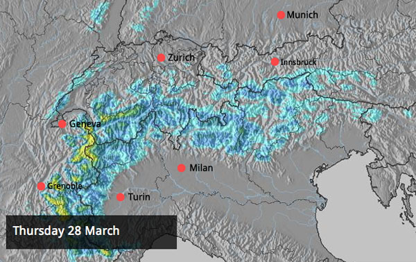
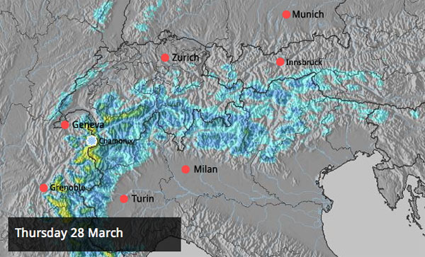
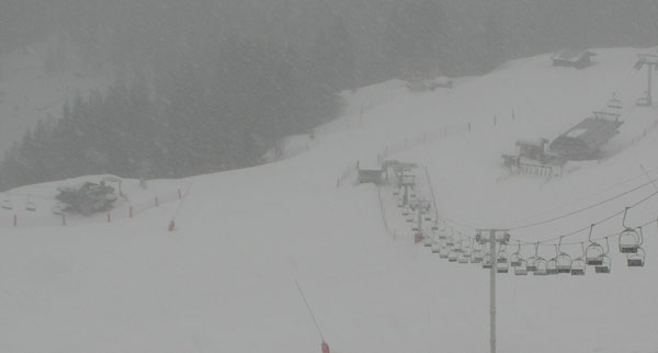
There’s fresh snow falling in the Alps today – with more to come over the weekend. Temperatures are going to stay fairly cool too, given the time of year. So if you’re heading out there for an Easter skiing holiday, and you’re hoping for wintry conditions, you can relax: at altitude in the French and Swiss Alps you’re going to find a pretty good skiing surface. On sheltered slopes away from the wind and the sun, it should be excellent.
In fact, in resorts such as Chamonix and Tignes there should be enough snow not just to get the pistes back into tip-condition, but also to cover the crust and crud off-piste too. Bear in mind, however, that the snow is coming in on a south-westerly wind, and is pretty wet below 2000m.
In Meribel, our blogger Alf Alderson has just sent us this snow report: “After a great day of spring skiing yesterday it’s snowing heavily again in Meribel Village. The outlook is pretty good for next few days, too, so conditions on and off piste should improve (there’s been lots of hard icy stuff around the last few days). However, visibility may be an issue!”
On Sunday, there’s going to be snow over the eastern Alps too. Only 10cm will fall in most places – but that should be enough to refresh the pistes. Parts of southern Austria and the Italian Dolomites should see more: up to 20-30cm. Check out our Alpine snow forecast for details.
Advertisement
Looking ahead, further into next week, the signs are that cool, snowy weather will persist. One mid-range weather model is predicting a bout of even colder weather to move in around April 7 – although it’s to soon to be sure of that yet. What I can’t see in any of the charts, however, are signs of a warm, sunny spell.
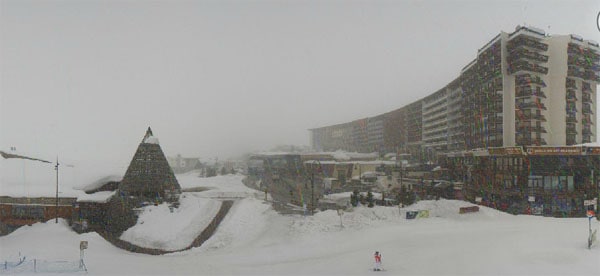
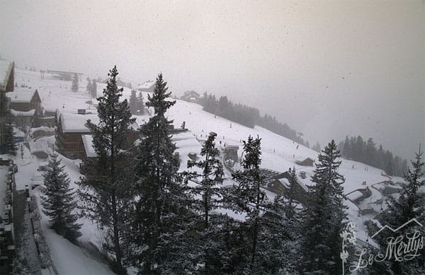
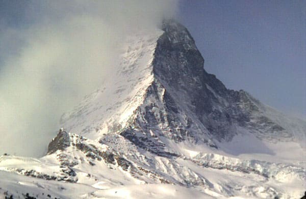
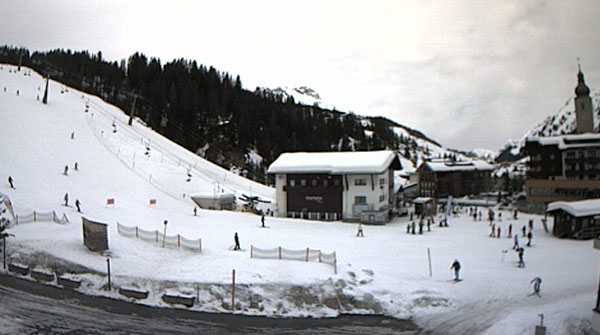
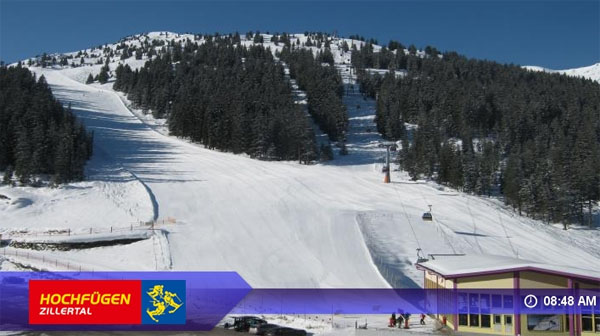
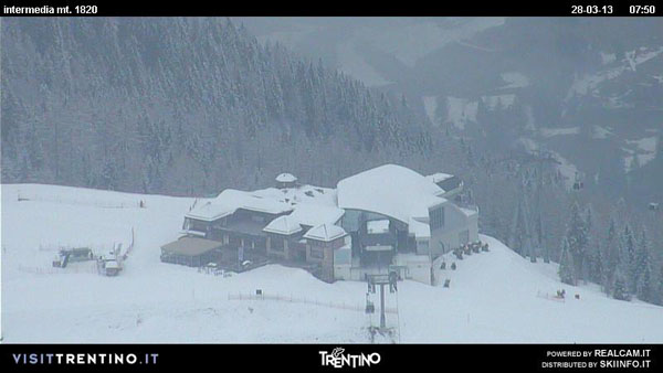
Right then – here’s a sample of the day’s webcams.
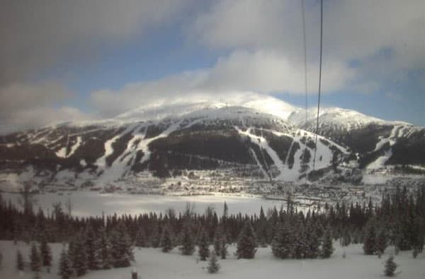
In Scandinavia, winter loosens its grip – a little
Up in Are, Sweden, it’s been a long, steady winter. Today, there’s a little fresh snow about (up to 5cm) and the temperature is -1C at the bottom of the lift system. But it looks as though things are going to warm up slightly over the next four days with the mercury rising to a balmy +2C on Monday. More snow is expected, although it may be raining lower down.
Across the Pond, it’s warming up
For powder hounds, the second half of winter in the American Rockies has been a lot better than the first – and the dominant trend in the weather has been for lots of little top-ups of snow, which can amount to significant totals in the course of the week. Here’s a rather lovely video from Vail in Colorado last weekend, which was celebrating 50cm of snow in the course of a week. Odd, isn’t it, that you so rarely hear female artists singing on ski vids?
There was another top-up of snow in Colorado this week (Breckenridge reported 10cm on Wednesday) but this week the weather is warming up, and it’s due to stay warm over the weekend. According to ace blogger Joel Gratz, the next significant storm is due in on Monday. It’ll start mild and wet and hit the southern resorts hardest, before the air cools and the snow becomes more widespread.
| France: see our main report. At altitude, the effects of last weekend’s thaw – and the subsequent drop in temperature – are being repaired, thanks to the current snowfall. However, there will be rain below about 1500m. Below 2000m the new snow will be pretty wet and heavy too. As soon as the skies clear, you need to migrate to the top of your lift system, where you’ll find excellent skiing conditions. Up high, Val Thorens’ snow report talks of 155-360cm of cover. The forecast is for a high of +1C. In Flaine in the Grand Massif, the snow’s 65-365cm deep. In the village, the mercury should reach -1C this afternoon. | |
| Switzerland: Western Switzerland should see a fair amount of snowfall today – though it’s not likely to be as heavy as in France. It’s much milder here than in France today, too. As is the case everywhere across the Alps now, aim high for if you want to ski soft, wintry snow. Currently, St Moritz reports a settled snowpack of 20-160cm, Engelberg has 40-450cm, and Davos 63-165cm. In Davos the top temperatures in town today will be +5C. | |
| Austria: it’s fairly mild in Austria today, with the wind blowing from the south or south-west. Some of the snow now falling in France should eventually reach the west of the country, with 5-15cm expected. Currently, high-altitude Obergurgl has 72-198cm of settled snow, and a high of +1C. St Anton reports 70-240cm of settled cover on its pistes. The temperature in town could reach +6C this afternoon. | |
| Italy: there’s been a dusting of fresh snow this week in the Dolomites, with many resorts reporting 5cm of new snow. There, Canazei reports 40-190cm of settled cover. A top temperature of +4C is expected today. Above the Aosta Valley, Cervinia reports 85-290cm of settled snow. In the village, the top temperature is likely to be a chilly -3C. | |
| Andorra: the Pyrenees are swathed in mild air at the moment. The Grand Valira – Andorra’s biggest ski area – reports 140-250cm of settled snow on its slopes, and a temperature of +5C at resort level. | |
| Western USA: the weather’s warming up in the resorts of the American west – as you’ll have seen from our main report. However, the established pattern of frequent top-ups of snow looks set to continue, with another storm due in on Monday. In Snowbird, Utah, the snow report talks of 233cm of settled cover, mid-mountain. In Jackson Hole in Wyoming that figure is 166cm, and in Breckenridge, Colorado it’s 183cm. Meanwhile, above Lake Tahoe in California, Heavenly reports 15cm of new snow in the last 48hrs and 122cm of settled cover. | |
| Western Canada: it’s going to be a warm and sunny weekend in Whistler, where the mid-mountain snowpack is 253cm deep. At the top of the ski area, temperatures should stay near the 0C mark, but in the valley it could reach +17C! Actually, that sounds rather lovely. Ski in the morning. Hang out on a sun deck in the afternoon… Meanwhile, in Lake Louise, in Banff National Park, top temperature at the base of the trails is likely to be +2C. There, the snow is 176cm deep, mid-mountain. |


Good news for Easter skiers – it’s snowing in the western Alps this morning. Up to 30cm are expected. https://t.co/jhl4TXmdk1
RT @welove2ski: Good news for Easter skiers – it’s snowing in the western Alps this morning. Up to 30cm are expected. https://t.co/jhl4TXmdk1
RT @welove2ski: Good news for Easter skiers – it’s snowing in the western Alps this morning. Up to 30cm are expected. https://t.co/jhl4TXmdk1
Great! RT @welove2ski 27m Good news for Easter skiers – it’s snowing in the western Alps. Up to 30cm are expected. https://t.co/r27dZtLYwB
More snow expected over the Easter weekend according to @welove2ski. Lucky Easter skiers! https://t.co/SLbSNeCxz1 #ski #snowreport
RT @welove2ski: Good news for Easter skiers – it’s snowing in the western Alps this morning. Up to 30cm are expected. https://t.co/jhl4TXmdk1
Snow Report, March 28 https://t.co/QeUxoJPNDM More snow on the way!!
RT @welove2ski: Good news for Easter skiers – it’s snowing in the western Alps this morning. Up to 30cm are expected. https://t.co/jhl4TXmdk1