


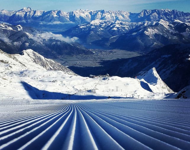
After five days of low temperatures and light to (occasionally) moderate snowfall, the Alps are – at last – looking wintry. In places, Mother Nature has dropped 15-20cm of the white stuff. In others it’s no more than a dusting, but the crucial difference is that, in the higher resorts, the snow-cannons have been able to run at full whack, and they’ve made a big difference to the skiing outlook for the next few days.
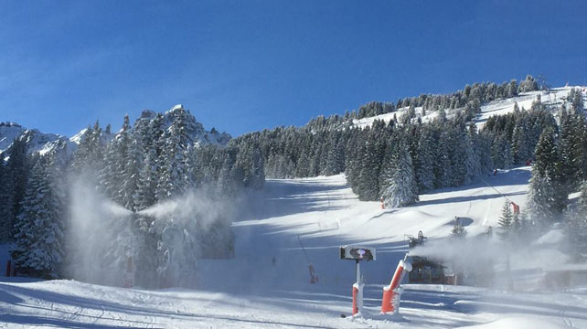
Pictured below is La Croisette in the middle of Courchevel 1850, the hub of the resort’s lift system. It was taken yesterday and it’s a good illustration of how quickly the snow cannons have made good the shortage of cover. In fact, on Tuesday, the resort was able to open its signature descent – the Combe de la Saulire – as well as the connecting Verdons piste, all the way back into the resort. More pistes are scheduled to open at the weekend – although by no means the whole of the ski area.
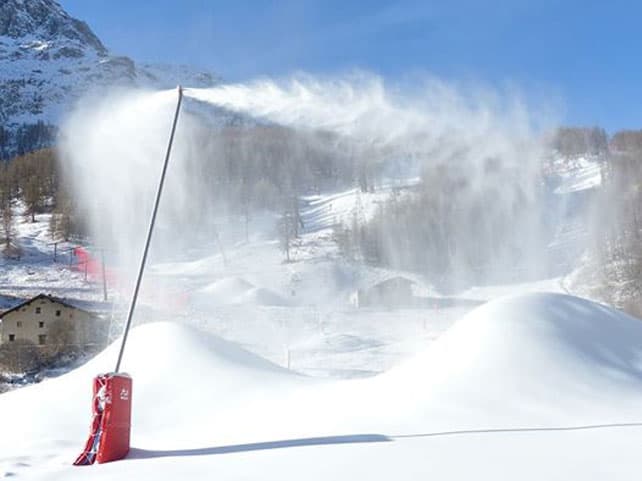
Val d’Isere has made progress opening up its skiing, too: 25% of its pistes are now skiable, thanks to opening of the Solaise earlier this week. John Yates-Smith’s photo, below, will give you an idea of how hard the snow cannons are working in the resort.
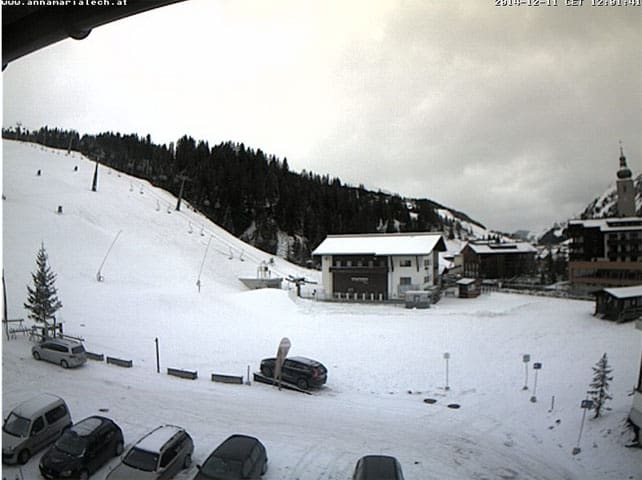
Meanwhile, in Austria, St Anton and Lech-Zurs, which had to postpone their opening day last weekend, will also be opening a small number of pistes and lifts at the weekend, as will the Skiwelt. In the Italian Dolomites, a small number of pistes are already open, after last weekend’s postponement of the start of the season..
Does that mean winter is back on track? Not yet. The weather gets, at most, two cheers from Welove2ski this week. Yes, the mountains are looking white, but the cover is thin, and we need another week of cold weather or – better still – a proper blizzard, to get the resorts shipshape for the busy Christmas and New Year period. It’s worth noting, for example, that this week Flaine put back its opening day to December 20, despite the cold snap.
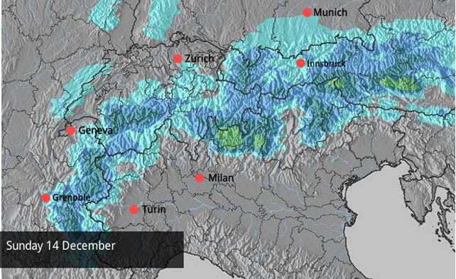
Problem is, in the short term, neither an extended freeze nor heavy snow look certain. At the beginning of the week, forecasters were talking about a big storm in the western and southern Alps on Saturday, but as you’ll see from our snow forecast, that possibility has now evaporated. There is some hope of moderate snowfall on Sunday: but before then, we will have to endure a jump in temperatures and a return of the ever-unpopular Foehn wind. This is due to pick up tomorrow, and continue into Saturday, and will send the snowline scurrying back uphill for a time. For a time, the freezing point will be back up to 2000m.
Hopefully, the expected snow on Sunday will repair the damage. According to French forecaster, Meteo Chamonix, it should fall down to 500m, which is pretty low, even in December.
However, it’s worth noting that the mid-range forecasts are currently predicting a resurgence of the troublesome area of high pressure over the Azores. There’s a possibility we’ll get a dose of mild and sunny weather: so if you are thinking about a last-minute Christmas trip, you need to aim high. Pick a resort with plenty of skiing above 2000m: at altitude, there’ll be plenty of skiing on-piste, even if powder is in short supply.
Here’s a quick survey of recent photos from the cold snap, starting with fresh snow in Morzine on December 9 (pictured, below) – courtesy of Alpine Elements. It was good to see snow down at village level here, but it’s not yet certain it will be enough to open the pistes into town. Currently, the only definite plan is to open some of the slopes in neighbouring Avoriaz.
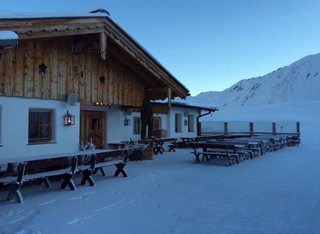
Pictured below was the Hohe Mut Alm above Obergurgl yesterday morning. Obergurgl’s upper slopes are in good nick at the moment, with over 90cm bedded down, on piste.
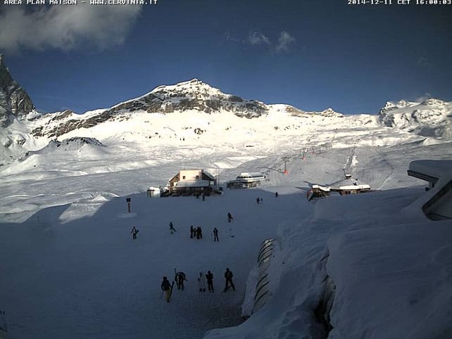
Meanwhile, below is a webcam shot from high-altitude Cervinia this afternoon. As everyone knows, Cervinia had loads of snow in mid-November, and managed to hold onto a fair amount during the ensuing thaw. Currently, mid-mountain, the cover is 150cm deep.
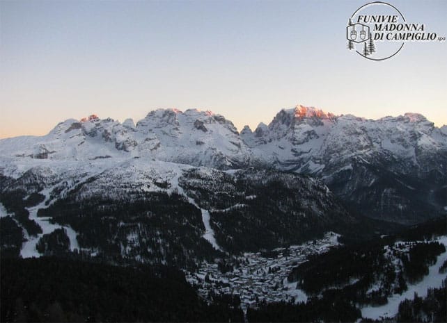
Pictured below is a late-afternoon shot from Madonna di Campiglio, which seems to have snagged far more than its fair share of snow so far this winter. The cover is still very thin on the lower slopes but at 2250m, it’s a very respectable 115cm deep, and more pistes are due to open this weekend.
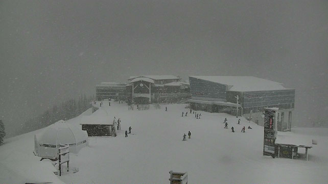
Finally, pictured below, is how the pistes were looking on the Kitzsteinhorn glacier, yesterday, above Kaprun. 15 pistes area currently open for skiing here.
Surf’s up in California
Skiers on America’s west coast will be buzzing today as a meaty storm moves in from the Pacific and hits the Sierra Nevada. Open Snow forecaster Bryan Allegretto thinks it could bring 30-90cm of snow in the mountains around Lake Tahoe, with another storm due in on Monday, and further snow likely on Friday December 19. What’s more, there will – finally – be a significant drop in temperature, and as much as 30cm of the white stuff is expected down on the shores of the lake. Last week saw heavy snow in parts of the Tahoe region, but it was pretty wet and heavy, and was followed by sharp thaw. The coming storm looks different: colder and more powerful. If it’s followed by more snow next week skiers can expect a spectacular Christmas in resorts such as Heavenly, Kirkwood, Squaw and Northstar.
There will be snow this weekend in Utah and Colorado too
It’s two weeks since the big November cycle of storms came to an end over Utah and Colorado, and since then the weather’s been pretty mild. This frustrating spell of weather should come to an end this weekend when the storm in California moves inland. It’ll lose some of its power as it goes but at the moment snow forecasters in Utah are predicting up to a foot of snow in the mountains east of Salt Lake City (home to resorts such as Snowbird and Canyons) and maybe 15cm in the resorts of Colorado. More of the white stuff is expected on next week, as well as lower temperatures, although we can expect the totals to be in lower than in California.
Up in Wyoming, Jackson Hole should see snow at the weekend as well – plus a welcome drop in temperature. It’s been warm there this week: with temperatures at the bottom of the lifts well above freezing.
Whistler is getting its next dose of snow right now
| France: see our main report. Temperatures dropped last Friday, and the snow cannons have been working hard in many resorts, helped along by light-to-moderate snowfall. However, we can’t talk about winter having roared into life – some resorts are still postponing their opening days, and those that have started are only offering a fraction of their total number of pistes. The best policy at the moment is to aim high – and don’t expect to ski much in the way of powder. Among those resorts currently open are Tignes, Val Thorens, Val d’Isere, Les Deux Alpes and Alpe d’Huez. Serre Chevalier is confident it will be opening for the season on Saturday, too. | |
| Switzerland: there was light snow across much of Switzerland at the weekend, and a little more in the last few days, too. Laax, south of Zurich, did quite well from the latest sprinkling, and is today reporting 30cm of snow mid-mountain, and 125cm on its glacier. There’s also good skiing up high above Zermatt and Saas-Fee, which were walloped by some big snowstorms in mid-November. Other ski areas currently open include Engelberg, Les Diablerets, Verbier, Davos, and St Moritz. In St Moritz, both Corvatsch and Corviglia are open, with a total of 54 pistes to ski. The snow there is up to 91cm deep on the higher slopes, but thinner lower down. | |
| Austria: there’s been light snow across much of Austria, and a noticeable drop in temperatures. Snow cannons are working hard to make up the shortfall of natural snow, with rather more success in the higher resorts than lower down. Currently, Ischgl has some of the most extensive skiing on offer, with 79km of pistes open, but you can also ski at high-altitude Obergurgl, and this weekend will see pistes open at Lech, St Anton and the Skiwelt. Let’s not forget the glaciers, too. Skiing is currently on offer on the Hintertux, Stubai, Molltal, Pitztal, Kaunertal, Rettenbach and Kitzsteinhorn glaciers. | |
| Italy: early-season conditions have been superb above Cervinia, especially above 2500m. Above Champoluc and Gressoney in the Monterosa ski area a handful of lifts and pistes are also open, and there’s good snow on the Groste sector of Madonna di Campiglio. Pistes are opening up around the Sella Massif too, in Selva and Canazei. Meanwhile at Passo Tonale, nine pistes are open today. | |
| Andorra: the Grandvalira ski area got going after a week’s delay on Saturday – and had a very timely 40cm of snow on its upper slopes to help the season along. Currently, 151km of pistes are skiable. Vallnord got going at the weekend too. | |
| Western USA: see our main report. November turned into a memorable month in the American Rockies with the snowstorms coming in waves. As a result, many resorts were in great shape at the start of the season. That early promise has faded a bit over the last fortnight – thanks to two weeks of unseasonably mild weather. However, it looks as though colder weather, and a little fresh snow, will return at the weekend. Meanwhile, in California, heavy snow is expected over the next couple of days. In Vail, Colorado, the settled cover is 48cm deep on the upper slopes. In Snowbird, Utah, it’s around 74cm deep. Further north, Jackson Hole in Wyoming claims a metre of snow is bedded down, mid-mountain. | |
| Western Canada: Whistler should get a decent top-up of snow over the next couple of days – around 30cm, although there may still be rain on the lower slopes. Meanwhile, in Banff National Park, Lake Louise reports settled cover 78cm deep on the mid-mountain pistes. After a frigid start to December, the weather there is much milder, with a daytime high today of +1C. |


Add Comment