


With less than a week to go to the start of the busy Christmas period, the Alps are still waiting for the first proper dump of winter. We’ve seen autumn storms, high-altitude blizzards, and – ten days ago – a cold snap which allowed the snow cannons to run. But what we haven’t seen is moderate-to-heavy snow which has fallen from top to bottom in the resorts, or a decent freeze which has lasted more than five or six days. As a result, the slopes in many of the lower ski areas are still green. Higher-up, pistes are open, but even at 2300m the snow on them is – in most places – man-made, with only a dusting of Mother Nature’s stuff on either side.
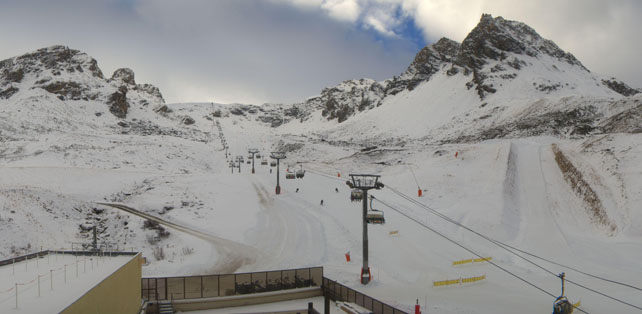
It’s only once you get up above 2500m that the natural cover is substantial, and even up here there are variations. Much the deepest cover is to be found on the high ridge that separates Italy and Switzerland, above the Aosta Valley – and most of that is made up of snow which fell in mid-November. Pictured below, for example, is the scene 2555m above Cervinia today. You’d never know, looking at this shot, that almost everywhere else in the Alps there’s been a snow drought.
For much of the last fortnight, high pressure over the Azores has blocked the advance of weather fronts from the north-west, and the latest frustration has come from the return of milder air at the end of last week. This has raised the daytime freezing point to 2000m, and slowed the work of the snow-making teams considerably.
Is there any relief in sight? Possibly: but only for the higher resorts. One of the features of the recent weather has been how hard it is to predict. But it does look as though a snowstorm will arrive on Wednesday night from the north west, with a second band of precipitation on Thursday. Here’s our current snow forecast for the Alps for Wednesday.
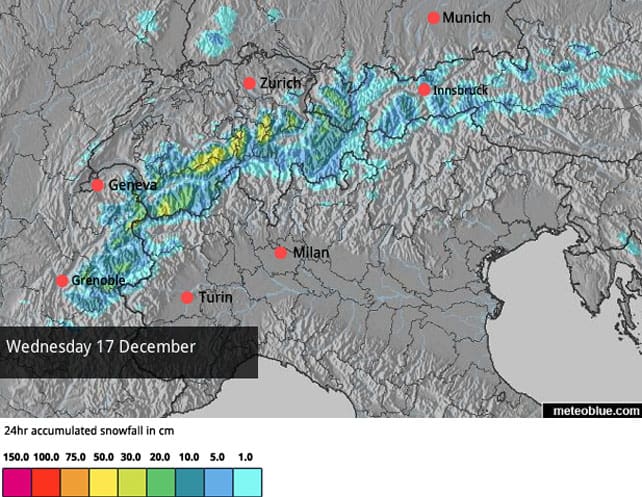
You’ll see more snow in the forecast for Thursday, too.
Looks good, doesn’t it? But one feature of this weather – if it comes – will be the relatively mild air that accompanies it. French forecaster Meteo Chamonix reckons the snowline will sink, briefly, to 1200m in the western Alps, then rise rapidly. So the snow lower down will turn to rain. Then, when the sun comes out, the freezing point could jump to 2700m for a time. So the only real beneficiaries will be the high-altitude resorts.
Here’s a quick survey of the higher webcams this morning.
Pictured, below, is Ischgl, in Austria. Much of the skiing here is between 2500 and 2800m, and the resort has made superhuman efforts with the snow cannons in recent weeks to supplement Mother Nature’s meagre contribution. It has a very respectable 117km of pistes open.
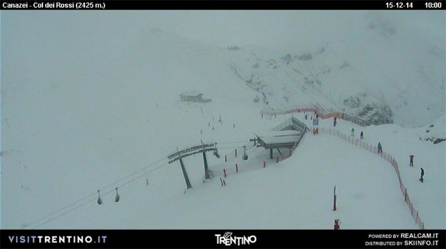
Pictured below is Canazei, in the Italian Dolomites, where there’s light snowfall today. As with most resorts in the Dolomites less than half the pistes are currently open here and the snow is 15-30cm deep.
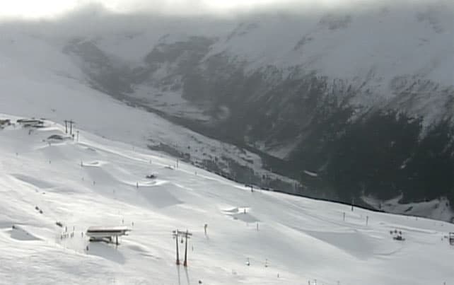
Below, is the Jakobshorn above Davos in Switzerland today. On piste, the snow here is up to 65cm deep here, on the upper slopes, but only 15 pistes in the resort are currently open.
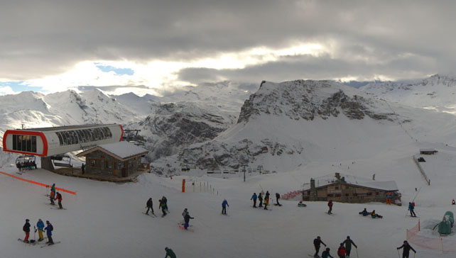
Pictured below is the top of the Bellevarde in Val d’Isere, where – thanks to a big snow-making effort last week, 42% of pistes are now open. Snow depths are around 25cm deep, on-piste.
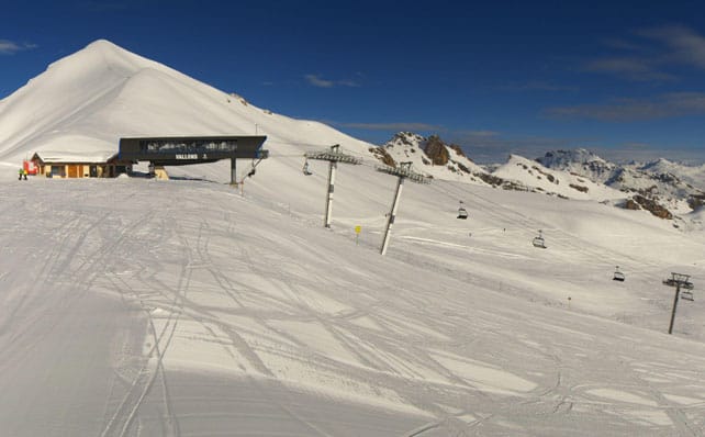
Finally, this is the top of the Cucumelle piste in Serre Chevalier. Serre Chevalier has better snow than most, up top. There, the cover is up to a metre deep. But – in common with many resorts – it’s thin or non-existent lower down.
In the Pyrenees, conditions are better
There’s been more snow in the Pyrenees than the Alps, lately. Currently, in the Grand Valira ski area – home to both Soldeu and Pas de la Casa there’s 20-90cm of snow on the pistes, and 177km of piste are open. It is however, likely to warm up later in the week.
Snow returns to the western US
In California, hopes were high for a big storm at the end of last week, but it didn’t turn out to be as meaty as expected, and snowfall totals varied wildly. In the Lake Tahoe area, Kirkwood notched up 48cm in the last week, Northstar 25cm and Heavenly just 8cm. More snow is expected over the next three days, but again, it looks as though it will be less than first thought, and it will be followed by a dry, sunny spell. So, suddenly, the run-it to Christmas looks less amazing here than it did in the middle of last week.
Here’s the latest video from Northstar, shot on Saturday.
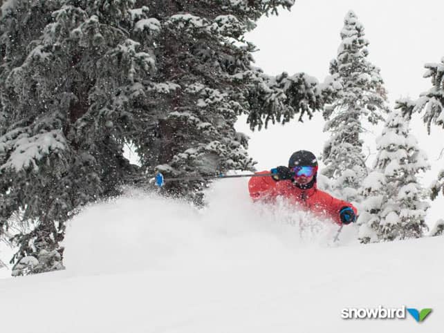
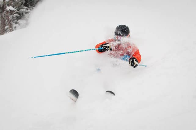
Last week’s storm did move inland, however, and produced some decent accumulations in Utah and Colorado. In Utah, Snowbird claimed 35cm of fresh snow yesterday…
Meanwhile, in Colorado, Breckenridge was reporting 30cm of fresh snow this morning, Telluride 38cm, Vail 41cm, and Winter Park 48cm. Local forecaster Joel Gratz was too excited about the conditions to write a full report this morning: he’s gone skiing instead. But he did say more light snow was expected midweek, with a possible shift to colder weather on the cards next week.
Up in Canada, Whistler has seen 61cm new snow on its upper slopes in the last seven days, and published this video on Friday.
| France: see our main report. It’s poor start to the season. Most of the skiing below about 2500m is on man-made snow, and even in the higher resorts by no means all the pistes are open. Lower down, below about 1700m, things are looking very sketchy at the moment, with very little in the way of natural cover, and snow-making teams battling against another mild spell. The midweek forecast is looking promising for higher resorts, but not for the low-altitude ones. Among those resorts currently open are Tignes, Val Thorens, Val d’Isere, Les Deux Alpes, Alpe d’Huez, Serre Chevalier and Les Arcs. | |
| Switzerland: as in France, it’s been a disappointing start to the season in Switzerland, although there are a few places where the snow is deep – notably Andermatt, where there’s up to 290cm of snow on the Gemsstock, and as well as Zermatt and Saas-Fee, which both had lots of snow on the higher slopes in November. Other ski areas currently open include Engelberg, Laax, Les Diablerets, Verbier, Davos, and St Moritz. In St Moritz, both Corvatsch and Corviglia are open, with a total of 26 pistes to ski. The snow there is up to 88cm deep on the higher slopes, but – in common with the whole of the Alps, the lower slopes have little or now snow. | |
| Austria: the return of mild weather has been a blow to the lower resorts of Austria. Currently, Ischgl has some of the most extensive skiing on offer, with 117km of pistes open, and there’s also good skiing on the higher pistes in Obergurgl. Lech and St Anton are also open in the Arlberg, but with a limited number of pistes on offer. Don’t forget you can also ski up on the glaciers, including the Hintertux, the Stubai, the Molltal, the Pitztal, the Kaunertal, and the Kitzsteinhorn. | |
| Italy: early-season conditions have been very good above Cervinia, especially above 2500m. Above Champoluc and Gressoney in the Monterosa there’s also good skiing on the higher pistes, and there’s deep snow on the Groste sector of Madonna di Campiglio in the Brenta Dolomites, too. Nearby, at Passo Tonale, 15 pistes are open today. Generally, however, the Italian resorts have been suffering from the same mild weather as those further north. Aim high if you plan to ski there in the near future. | |
| Andorra: the Grandvalira ski area got going after a week’s delay on December 6, and thanks to snowfall since then 177km of pistes are now skiable. | |
| Western USA: see our main report. November turned into a memorable month in the American Rockies with the snowstorms coming in waves. As a result, many resorts were in great shape at the start of the season. That early promise faded a bit in early December, but the snow returned last week, along with a welcome drop in temperature. Currently, in Vail, Colorado, the settled cover is 81cm deep on the upper slopes. In Snowbird, Utah, it’s around 99cm deep. Further north, Jackson Hole in Wyoming claims 106cm snow is bedded down, mid-mountain. | |
| Western Canada: Whistler is in much better shape this week thanks to 61cm of snow on its upper slopes in the last seven days. Meanwhile, in Banff National Park, Lake Louise reports settled cover 79cm deep on the mid-mountain pistes. Despite sunny weather, top temperature shouldn’t exceed minus 6C. |


Despite the Daily Telegraph telling us that Val d’Isere has 0cm at resort level, the nursery slopes are fully operational and clients who returned yesterday all reported conditions are MUCH better than expected or report in the British press!