


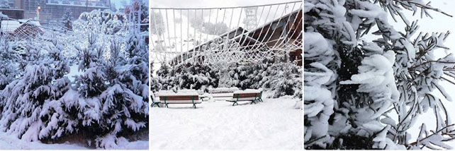
Jump to my December 20 update, because there has been a proper dump overnight, south of Grenoble, and in the Aosta valley.
Hallelujah. It’s just started snowing!
I’ve been sitting here, in Meribel, waiting to start the Snow Report, and like everyone else in the Alps, I’ve been staring at the sky, willing the first flakes to fall from the flat grey clouds above us.
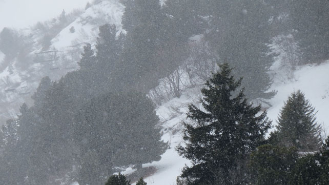
And now, just after midday, it’s started. It’s not exactly blowing a blizzard though, and the worry in Meribel is that there it won’t be more than a dusting. Currently, our snow forecast for the Alps is showing up to 50cm falling in places, but it’s going to be very localised, and Meribel seems to be on the edge of it. Here it is, located on the today’s map.
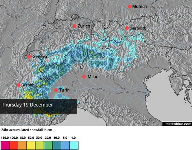
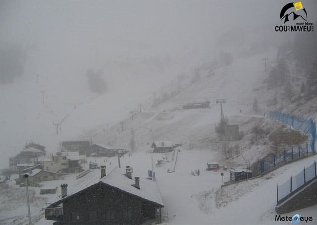
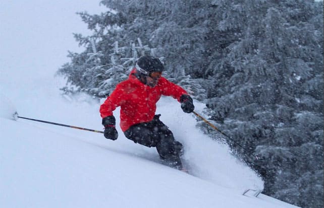
The Italian side of Mont Blanc is one of the places expecting heavier snow – and as you’ll see from the webcam below, the white stuff does seem full-blooded there.
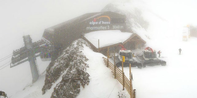
The resorts south of Grenoble should do fairly well, too. Alpe d’Huez is one of them – and here you can see snow falling at lunchtime today at the top of the Pic Blanc.
Sadly, it seems like Austria and most of Switzerland will only get a dusting, at best.
We’ll have to wait and see what the rest of the day (and night) brings. But at the moment, I don’t think this weather front is going to make a significant change to conditions in the Alps as we approach the first weekend of the Christmas and New Year rush (with a few localised exceptions in Italy and south of Grenoble in France). The last really heavy snow was back in heady days of November – and since then, the weather in the Alps has been predominantly sunny and mild. Above about 1800m the cover is okay, given the time of year – although it’s hard-packed (except on the highest runs, where you’ll still find a softer, grippier surface). Lower down, however, the pistes are thin and threadbare. Most off-piste routes are far to rocky to be skied. If you’re heading out this weekend, don’t panic, you will be skiing: but it is a far cry from how things were before Christmas last year.
Still, let’s not forget that the weather suddenly turned mild over Christmas in 2012. By contrast, there’s growing consensus amongst the mid-range weather charts that there will be a bout of colder, snowier weather over Christmas Day and Boxing Day in 2013 – bookended between periods of sunshine. Fingers crossed we get it.
The snow is deeper in the Pyrenees
There’s the chance of a little fresh snow in the Pyrenees over the next 24 hours – and there snow depths are generally deeper than in the Alps at the moment. In Baquiera-Beret for example, they’re claiming 115-165cm of cover on the slopes. Grandvalira in Andorra has 80-160cm. By contrast, here in Meribel there’s 25-78cm of snow on-piste.
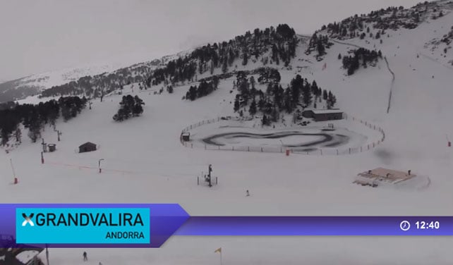
Here’s how it was looking above Soldeu today.
Fresh snow is expected in the western resorts of Canada and the US
In the American Rockies, the weather has been pretty quiet since the big dumps of early December. That was good news for the organisers of the Dew Tour in Breckenridge last weekend – because you can’t run a world-class freestyle event in a blizzard.
Here’s a video recap of the event.
Needless to say, the region’s many powder-skiing addicts have been less amused. Now, at last, change is in the air, and snow is expected. In Colorado, local snow guru Joel Gratz is forecasting light snow today and moderate accumulations at the weekend. In Utah, Evan Thayer thinks the weather system could stall over the Wasatch Mountains today, giving 15-30cms to resorts such as Snowbird and the Canyons.
Further north, in the Canadian Rockies, the weather has already changed – with signficant effect. In Banff National Park, Lake Louise is reporting a 34cm in the last two days, and 60cm in the last week.
Hey, Canada! Send us some of your white stuff, will you?
December 20 upate
Oh me of little faith! Yesterday, I doubted our snow forecast for the Alps when it predicted heavy snow south of Grenoble.
But look what happened in Serre Chevalier overnight…
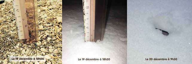
The resort suffered in the long mild spell in early December, and had to postpone it’s opening day for a week. But the Snow Gods took pity – and they’ve just dumped 35cm of snow overnight. It won’t be enough to open up the off-piste routes, but it’s going to do wonders for the quality of the pistes.
Here’s what confronted the Inghams reps this morning in the resort.
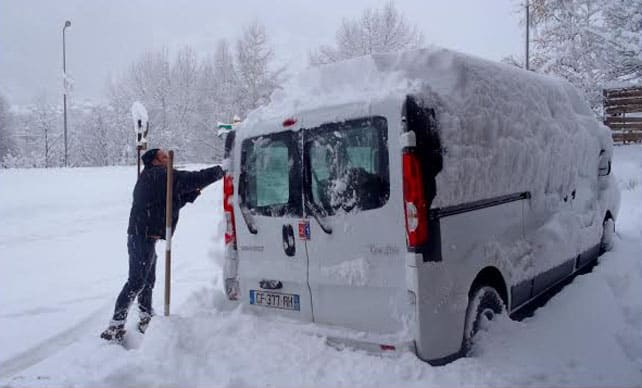
Les Deux Alpes had a dump too, as did Alpe d’Huez (which reports 20-25cm this morning).
Italy’s Aosta Valley did well from the storm. Cervinia, on the Italy side of the Matterhorn, is claiming a whopping 45cm of fresh snow this morning as a result of the overnight storm. Meanwhile, in Champoluc, part of the Monterosa area…
However, it is worth stressing that the snowfall has been localised. In the eastern Alps there’s only been a dusting (although there may be more overnight, with the Tirol in Austria expecting 5-10cm in places). Even in Meribel where I am now, the snow hasn’t been nearly so heavy as Serre Chevalier. I’ve just been skiing in the fog, on soft, humid snow – and once the skies clear and the pressure rises the pistes are going to dry out a bit, and – at altitude at least – there’s going to be a noticeable improvement in the quality of the skiing. There could well be 10cm of fresh cover here by the end of today.
What’s more, it does now look as though more widespread snow is due into the Alps on Christmas Day and Boxing Day. It’s still too early to be absolutely sure. But it looks promising!
| France: see our main report. At altitude, the cover on-piste is respectable for the time of year. But lower down the sunshine and mild temperatures have thinned the cover considerably, and the pistes are icy first thing and at the end of the day. Today’s fresh snow looks patchy, but some resorts south of Grenoble, such as Les Deux Alpes, may get enough to substantially refresh their pistes. Most big-name resorts in the country are now open, including Val d’Isere, where the settled cover is 40-73cm deep, Val Thorens (60-100cm), Meribel (25-78cm), Les Deux Alpes (15-170cm) and Alpe d’Huez (20-150cm). However, Serre Chevalier has postponed its opening day until December 21 in order to preserve the cover for Christmas. Hopefully it will receive at least a moderate top-up today. | |
| Switzerland: Conditions in Switzerland are similar to those in France. More snow is needed to fresh up the pistes, and fill in the off-piste terrain. Sadly, only light snowfall is expected in most places from the latest snowfalls. In Laax the settled cover is 10-70cm deep, in Verbier it’s 18-100cm deep and in St Moritz it’s 20-23cm deep. | |
| Austria: Austria saw moderate snowfall on December 6 and 7 and there was a dusting on Saturday in places, but the mild weather has thinned the cover in most places, and off-piste the snowpack is below average for the time of year. Only a dusting of snow is expected over the next couple of days. Given the conditions, high-altitude Obergurgl is a good bet right now, as are the glacier skiing areas such as the Hintertux, and the Kitzsteinhorn. | |
| Italy: The Aosta valley and other areas in the western Italian Alps should do fairly well from the snow today. In Cervinia, for example, the fresh snow is starting to accumulate, and will refresh pistes which haven’t had a top up since November 21. The mid-mountain cover is now reported to be only 20cm deep. In Madonna di Campiglio in the Brenta Dolomites it’s starting to snow too. Here, the cover is 10-50cm deep. Above Canazei in the main Dolomiti Superski area it’s 10-70cm. | |
| Andorra: Thanks to heavy snow in November, the Pyrenees got off to a cracking start to the season, and in Andorra both the Grandvalira and Vallnord ski areas are open. As in the Alpes, there’s been a long period of sunshine too, but some snow is expected today to refresh the pistes. Grandvalira reports 90-160cm of settled snow, on-piste. | |
| Western USA: The weather’s been mostly sunny and dry in the American west since December 8. But snow depths are still good for the time year. Breckenridge has 81cm packed down, mid-mountain, Snowbird 86cm, and Jackson Hole 81cm. More snow is expected over the next five days – and there’s the chance of snow on December 24 and 25, too. | |
| Western Canada: In Banff National Park, Lake Louise reports a whopping 60cm of snow in the last week – and is the place I’d most like to be skiing today. Further west, Whistler hasn’t had as much snow as forecast in recent days – 15cm in the last week in all. More is expected. The mid-mountain cover is 83cm deep. |


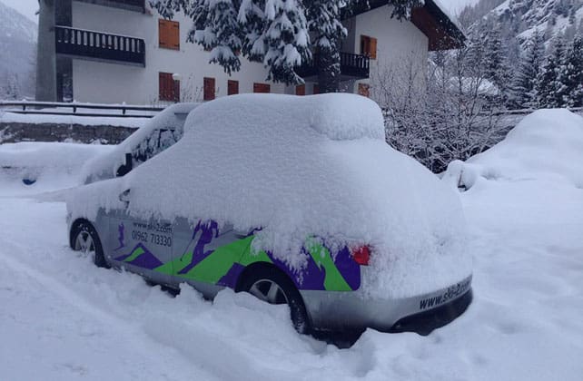
Here’s the latest snow report – as the white stuff falls in Meribel. Everyone pray for a heavier-than-expected dump! https://t.co/PPNFBKHf1p
“@welove2ski: the latest snow report – as the white stuff falls in Meribel. pray for a heavier-than-expected dump! https://t.co/r6zNIsO5Wv”
Yeah Baby! Yesterday’s forecast was spot on for the southern French resorts and the Aosta Valley. PROPER SNOW. https://t.co/pCYocKm3w3