


Merry Christmas, Snowfiends! May your satsumas be sweet and juicy, and your mince pies thickly strewn.
And if you’re in the Alps at the moment, may your lift system offer plenty of skiing above 2000m – where the snowpack is very deep for the time of year.
There are three main points to make this Christmas Eve. First is that the weather’s turned mild for Christmas. It’s likely to stay that way, especially in the western Alps, until the weekend at least.
Temperatures jumped on Friday and Saturday, fell back a bit yesterday, and will rise again tomorrow. In the French Alps, for example, the daytime freezing point will be at 2000m today, before rising to 2800m tomorrow and 3000m on Boxing Day. As a result, the snow will be affected by the thaw on all but the highest, shadiest slopes.
At least the skies will be clear and bright. Sunshine will be the watchword for Christmas and the days to follow. That’ll mean conditions will be spring-like in many places: with a daytime cycle of overnight freezing and daytime melting. If you want to get the best of it, you’ll need to employ spring-skiing tactics.
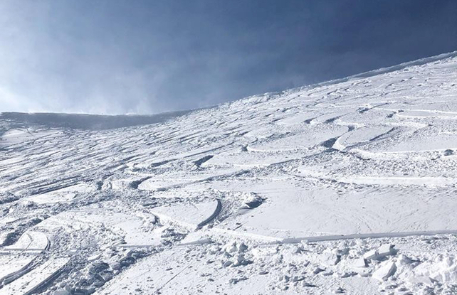
The second point to make about current conditions is that – above 2000m – the snow is deep for the time of year. There have been frequent snowfalls in recent weeks, and there’s another one at the moment, which is particularly intense in Switzerland and Austria.
It’s been accompanied by strong winds too, and here the avalanche warning at 4/5 in many places. As the Tirol’s excellent avalanche service says this morning: “for the time being, it is inadvisable to engage in backcountry touring and other off-piste activities outside marked and open pistes.”
In St Anton the snow is currently 160cm deep on the Valluga, at the top of the ski area. In Samnaun in Switzerland (which shares its ski area with Ischgl) the mid-mountain depth is 160cm, and in Val d’Isere in France there’s 180cm above 3000m. Here the avalanche risk is currently 3/5.
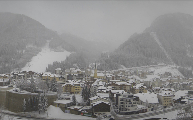
By contrast, the mild temperatures – mixed, at times, with rain – have hit the valley runs in the lower resorts. In the Portes du Soleil for example, fewer than half the pistes are open today.
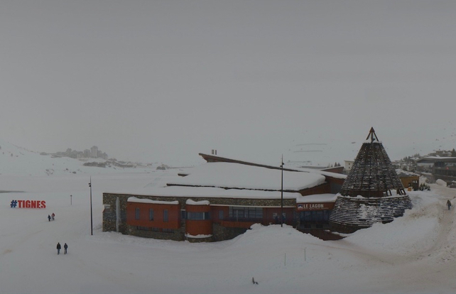
The third point is that Italian resorts – aside from those closest to northern frontiers – have had much less snow in the run-up to Christmas, and snow-depths are generally thinner. One striking exception at the moment is high-altitude Cervinia, on the border with Switzerland. Here, the mid-mountain snow depth is 165cm.
At the moment, the mid-range forecast is for high pressure to build over the course of the week. A week of mild and sunny piste-skiing lies ahead for most: with the chance of powder for those in the high-altitude resorts, who hire a guide – and pay close attention to avalanche warnings.
If you’re after more wintry conditions for a last-minute trip, you might want to consider North America. Breckenridge in Colorado, for example, reports four metres of snow so far this season, and 60cm in the last week. Tomorrow, the temperature on the lower slopes might hit +1C, but for the rest of the week it’ll be chilly with the chance of snow showers. Jackson Hole and Whistler are among the other North American resorts off to a flying start this winter.


Add Comment