


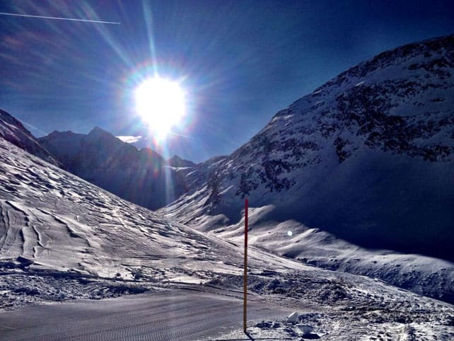
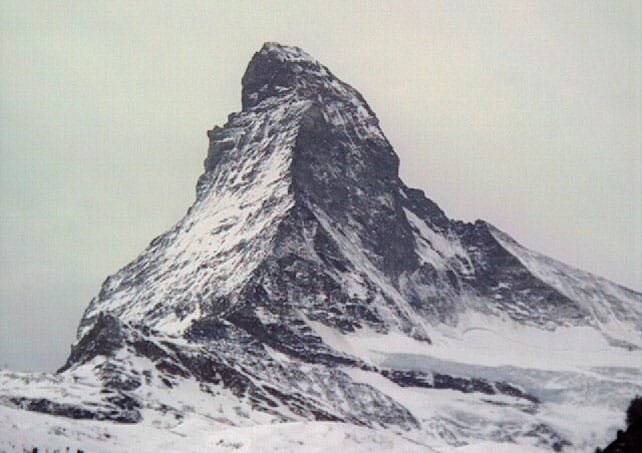
Oh, to have been in St Anton yesterday…
As regular followers of our Snow Report will know, there was fresh snow in the eastern Alps on Friday and Saturday: and on Sunday it was followed by sunshine. It was also the opening weekend of the Arlberg resorts – St Anton, Lech-Zurs and Warth-Schrocken – and the 20cm of snow that fell was a great curtain-raiser for the start of the ski season.
Check out the video they shot yesterday morning and see for yourself.
The Arlberg wasn’t the only place to get snow. South of Zurich, in Switzerland, there was 5-15cm, and up to half a metre in parts of the Salzburgerland further east in Austria.
And now? Well, as I said, the sun’s out, and it’s still cold – today at least. We’re not talking about conditions to match those at the start of December 2012: but still, there’s top-to-bottom skiing in almost every resort. St Anton reports 25-65cm of settled snow, on-piste, the Skiwelt has 30-55cm and Saalbach 35-75cm. None can match the depths in high-altitude Obergurgl though, where the snow is 75-165cm deep.
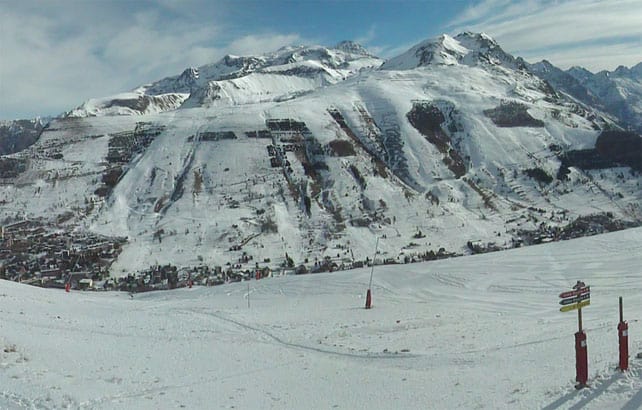
Here’s how it was looking in Obergurgl yesterday.
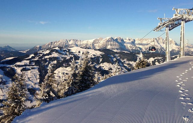
Pictured, below, is the view in the Skiwelt ski area this morning.
Sadly, the French Alps, western Switzerland and most Italian resorts missed out on the snow, and the sun has shone more or less uninterrupted. Yes, I know it sounds weird to be complaining about sunshine in December: but the fact is the wonderful snowstorms of November are now a fading memory. Although the cover is still pretty good on-piste, given the date, we need a couple more dumps to give the pre-Christmas period some fizz.
There’s no sign of fresh snow coming anytime soon, either. It looks as though the high pressure now sitting over western Europe will persist until the beginning of next week at least, and temperatures are set to rise again, too. French forecaster Meteo Chamonix predicts the afternoon freezing point will be up to 3300m tomorrow, which means a daily cycle of thawing and overnight re-freezing will set in. Expect hard-packed pistes on all but the highest and shadiest slopes each morning – and a crusty surface to off-piste snow.
It’s too soon to say yet when the high pressure will break down. There are some hints in the mid-range weather charts that it could happen just in time for Christmas, but it’s much too early to be sure. So if you’re planning a last-minute dash to the slopes, check out our guide to the best resorts for early-season skiing, and aim high to be sure of the best conditions.
Oh yes, and if you are skiing this week, it might be the time to have a crack at a terrain park. Just like Candide Thovex did in Val Thorens at the weekend…
Here’s a quick taste of the weather in the west today. There’s a bit of high-altitude cloud around in places, but it’ll burn off this afternoon.
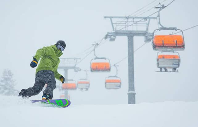
Meanwhile, in the Rockies, there’s been more snow
Anyone who saw Friday’s snow report will know that last week saw fresh snow in the American Rockies. In fact, up to 60cm of the white stuff fell in places.
The weekend saw another dump: which favoured Utah and southern Colorado, but brought at least a dusting to most Rocky-Mountain resorts. Breckenridge reported 5cm of fresh snow, Vail 10cm and Aspen 22cm. In Breckenridge today a high today of minus 14C is expected.
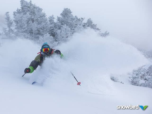
Snowbird in Utah did particularly well, reporting 33cm in just two days. Given how frigid the weather was, this was classic blower powder too…
Meanwhile the Canyons in Utah clocked up another 18cm, bringing its seven-day total to 60cm.
There’s been heavy snow in California too
The Lake Tahoe resorts have just notched up their biggest storm since last Christmas: with 50-100cm recorded in the last week.
On Saturday, Heavenly, above South Lake Tahoe, recorded a mind-boggling 74cm in one day – a reminder that when it snows in California, it really snows. Here’s the video…
And here’s a snatch of rather luscious video from Kirkwood yesterday:
After a threadbare start to the season in California, this is going to set the trails up nicely for Christmas – although according to local forecaster Bryan Allegretto the region is expecting a dry and sunny spell now for up to two weeks. Eek! Sounds like the Alps…
| France:See main report. Cover is respectable for the time of year, but it’s a shame the French Alps won’t see any new snow for at least a week. The mild temperatures expected this week will be a pain too – affecting snow cover on sunny pistes right to the top of many resorts. Most of the big-name resorts in the country are now open, including Val d’Isere, where the settled cover is 40-80cm deep, Val Thorens (65-105cm), Meribel (30-100cm), Les Deux Alpes (15-170cm) and Alpe d’Huez (20-150cm). | |
| Switzerland: The eastern end of Switzerland had a light-to-moderate top-up of snow on Friday and Saturday. Elsewhere it was dry – and will remain that way for the forseeable future. In Laax the settled cover is 15-70cm deep, in Verbier it’s 20-90cm deep and in St Moritz it’s 20-25cm deep. | |
| Austria: See our main report. Austria is the pick of the Alpine nations for skiing right now – thanks to the fresh snow at the weekend. However, the general warming trend will reach here too – so ski as high as possible to be sure of good conditions right through the week. Obergurgl is a good bet right now, as are the glacier skiing areas such as the Hintertux, and the Kitzsteinhorn. | |
| Italy: The weather has been sunny across much of the Italian Alps for some time now. In Cervinia, the last snow fell on November 21, but the mid-mountain cover is still 145cm deep. In Madonna di Campiglio in the Brenta Dolomites, the cover is 35-60cm deep, and above Canazei in the main Dolomiti Superski area it’s 10-70cm. | |
| Andorra: Thanks to heavy snow in November, the Pyrenees got off to a cracking start to the season, and in Andorra both the Grandvalira and Vallnord ski areas are open. Grandvalira reports 100-170cm of settled snow, on-piste. Temperatures today are expected to reach a balmy +7C on the slopes. | |
| Western USA: See our main report: it’s been a frigid weekend in the American Rockies and in California, but there’s been plenty of snow about to keep the powder hounds happy. Now, a sunny and mild spell is expected, which is due to last until the beginning of next week. Snow depths are good for the time year. Breckenridge has 86cm packed down, mid-mountain, Snowbird 96cm, and Jackson Hole 86cm. | |
| Western Canada: the resorts of the Canadian Rockies missed out on the snow further south – though it has been even colder than in the US. In Banff National Park, for example, Lake Louise reports just 1cm of snow in the last week. But the temperature today is -16C. Further west in Whistler has had just 3cm of snow in the last week and is expecting a high today on the upper slopes of -11C. Fresh snow is expected in Whistler from Wednesday onwards. |


Oh to have been in St Anton, yesterday. Or, Utah. Or California… Check out our latest snow report for details https://t.co/vpXxsMX1vL