


There was heavy snow in the parts of the south-western Alps at the weekend – but it wasn’t as widespread or as prolonged as expected.
Now, the outlook for the coming week is dry, sunny and increasingly mild, with the chance of snow next weekend.
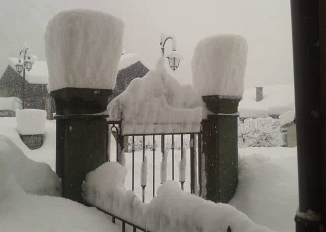
Meanwhile, close to the Italian border in both France and Switzerland there was a decent top-up, too. Serre Chevalier in France had about 10cm, and there was 20cm in Saas-Fee. Further east in the Italian Dolomites, Canazei got a 5cm top up, as did much of the rest of the French Alps.
Here’s how Serre Chevalier was looking on Saturday. The cover here is now 43-155cm deep, on-=piste.
All the same, I can’t help feeling a little disappointed this morning. For a while, the forecast was for a much more intense and widespread storm, and away from the Aosta Valley, Lombardy and Piedmont, its effect will be short-lived in such a busy week as this. Aside from Italy, it won’t have had much of an impact on conditions off-piste, either – which had become extremely variable by the end of last week, mixing sun-baked crust on many south-facing slopes, with a hard-wind-blow surface higher up, and – occasionally – some sheltered patches of powder.
Still, I shouldn’t be complaining. Since January there have been several significant snowy episodes across the Alps, and on-piste, the cover is good almost everywhere: although it will be hard first thing in the morning on the lower slopes, before the sun warms it up.
Here are the main highlights of the recent spell of wintry weather.
*A big storm over the central-southern Alps on January 18.
*30cm of fresh snow in Austria on January 27
*the “storm of the season”, which hit France on January 29
*Piedmont and the Aosta Valley’s snowstorm of February 5-6
*Austria’s blizzard on February 9
*Moderate to heavy snowfall across Piedmont, the Aosta Valley, and parts of Lombardy and Trentino on February 14 (see above).
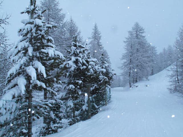
Here’s a quick squizz at the morning webcams to give you an idea of how the Alps are looking this morning, starting with Val d’Isere in France, where the snow is currently 87-153cm deep.
Meanwhile, here’s the scene in Les Arcs, seen from the far side of the Vanoise Express cable car, where they have 95-150cm of cover.
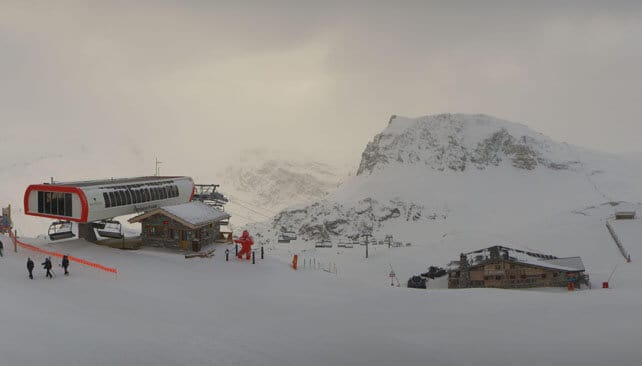
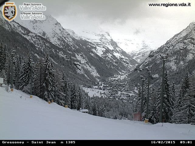
Pictured below is Gressoney in the Aosta Valley, where the snow is 80-230cm deep.
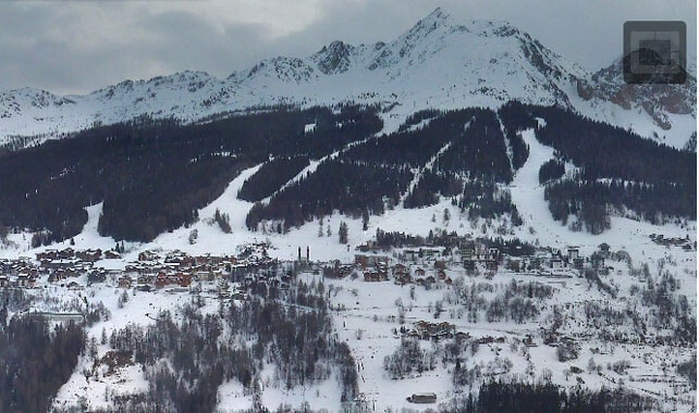
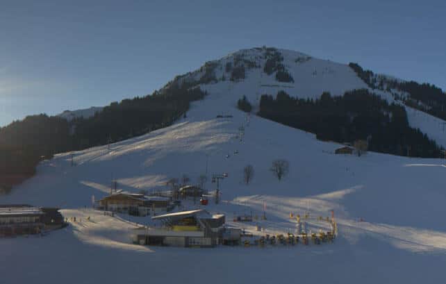
Below is Soll in the Skiwelt, where the snow is 80-100cm deep.
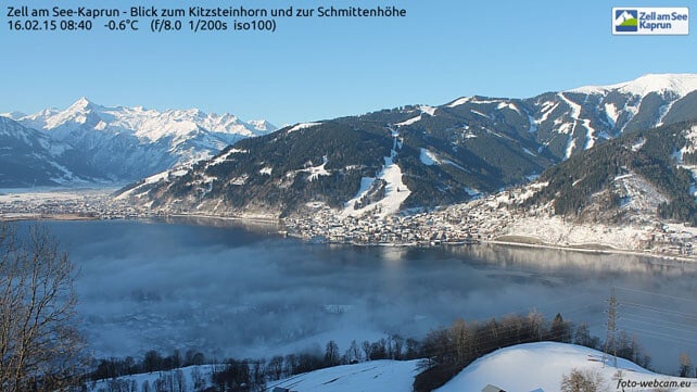
And this is Zell am See in the Salzburgerland, where they’ve got up to 111cm of snow on the Schmitten, immediately above town, and up to 270cm on the Kitzsteinhorn glacier.
In the short term, the forecast is for snow to clear from the western end of the Italian Alps tonight, while the sun shines elsewhere. It’ll be cool but not cold to start with, and then increasingly mild as the week progresses. There’s the chance of snow at the weekend, probably on Sunday. But it’s not certain yet.
In Beaver Creek, the World Championships finished with a little snow

There’s been some memorable racing at the World Championships in Beaver Creek – and some unusually mild temperatures too. But at last winter is beginning to reassert itself, with cooler air and some light snowfall. There’s the chance of more significant snowfall across the American Rockies next weekend, although this isn’t yet a certainty.
| France: across most of the French Alps there was light snowfall on Saturday: 2-5cm was typical of the amount that fell. Closer to the Italian border there was more, but nothing to match the quantities that fell in parts of the Aosta Valley. Now the forecast is for sunshine and rising temperatures, and with plenty of cover on-piste conditions will be very good for piste-skiing families. Powder hounds will be less happy, as off-piste the snow is showing signs of wear and tear – from a mix of high winds and mild sunshine. Fingers crossed the snow comes next weekend to freshen everything up.
Currently,Avoriaz has some of the deepest snow in the French Alps, and reports 180-270cm of cover. Meanwhile, in high-altitude Val Thorens there’s 100-155cm packed down on its pistes. |
|
| Switzerland: a few resorts near the Italian border, such as Zermatt and Saas-Fee, had decent snow at the weekend, but generally there was only a dusting. Still, as in France, conditions are good for piste-skiing families this half-term week: although the lower runs will be hard first thing and will need a bit sun to soften them up. Currently Verbier has 34-170cm of cover on its pistes, Laax in the east reports snow depths of 50-270cm, and St Moritz in the south has 51-133cm. | |
| Austria: Austria missed out on the weekend snow, but still has decent cover, top-to-bottom, in its resorts, thanks to the snowy spell in late January and early February. However, the lower pistes did suffer a bit in last week’s thaw, and will be hard again now the weather’s cooled off. Give the sun a chance to warm them up before you ski them. Currently, in the Arlberg, Lech reports cover 85-150cm deep, and in the northern Tirol the Skiwelt has 80-100cm on its pistes. Meanwhile, in the east, Schladming reports 80-140cm of cover, on-piste. | |
| Italy: there was heavy snow across the western half of the Italian Alps at the weekend, to add to the dump of February 5 and 6. This is where you’ll find the best snow in the Alps right now – in resorts such as Madesimo, Champoluc and Courmayeur. Currently, a href=”https://welove2ski.com/cervinia” target=”_blank”>Cervinia has 75-300cm of cover, on piste. Meanwhile, in the Dolomites, Canazei reports on-piste cover 20-115cm deep. | |
| Andorra: Andorra is expecting some snow this week. Currently, the Grandvalira ski area reports settled cover, on-piste, of 100-170cm. | |
| Western USA: the snow currently falling in Colorado is lighter than expected – much to the dismay of local skiers, who haven’t been enjoying the prolonged spring-like spell. It’ll be followed by more sunshine, too; although there is the chance of more substantial snowfall next weekend. Currently, Jackson Hole in Wyoming reports 193cm of settled snow, mid-mountain. In Utah, Snowbird in Utah has 167cm of mid-mountain cover, and in Vail, the settled snowpack is up to 109cm deep, mid-mountain. | |
| Western Canada: in common with the western USA, western Canada has had a prolonged mild spell, and it looks set to continue this week. Currently, Whistler reports 11cm of fresh snow over the last seven days, and 144cm of settled, mid-mountain snow. The pistes are hard-packed. Inland, Lake Louise in Banff National Park reported 6cm of new snow and settled mid-mountain cover of 130cm. Top temperature today will be 0C. Contrast that with Tremblant, in Quebec, where top temperature today will be -18C. |


Add Comment