


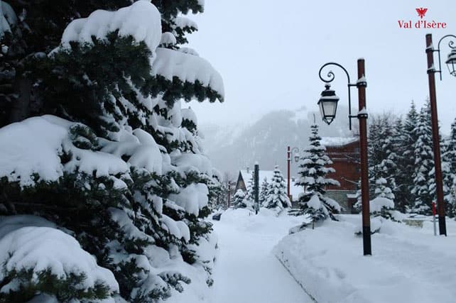
The storm of the season is still going. It started on Wednesday night in the north-western Alps, and so far (according to MeteoFrance) it’s dropped 1.3-1.6m of snow on the Chablais (home to Avoriaz and the Portes du Soleil), 1.2-1.5m on the Month Blanc massif above Chamonix, 60-80cm in the Haute Tarentaise (home to Val d’Isere and Tignes) and over a metre on the Grandes Rousses massif (home of Alpe d’Huez and Vaujany).
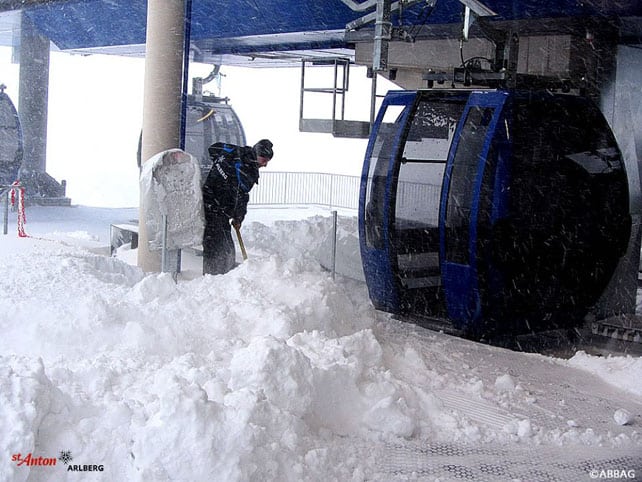
The French Alps have seen the heaviest falls, there’s been plenty of snow across the northern Alps, and in Italy’s Aosta Valley too. In St Anton, in the Austrian Arlberg, for example, St Anton reports 300cm of snow on the Valluga this morning, and 70cm in town. Verbier, in western Switzerland, has 58-210cm of settled cover, and Courchevel in the Three Valleys of France has 113cm-180cm. In Avoriaz, which has really been walloped over the last four days, the cover is 200-250cm deep.
It’s cold, too. Top temperature today in Les Arcs is expected to be -6C this afternoon, at resort level. Up on the Grands Montets above Chamonix it’ll be -18C. At village level in Lech, in the Arlberg, it’ll be -6C today.
Here’s today’s video snow report from Chamonix.
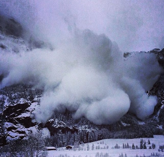
Note the no-nonsense advice about where to ski: “stay on the pistes”. Across the north-western Alps the avalanche risk is almost universally 4/5, and pictured below is a reminder why – published in Engelberg, last Thursday by the Ski Lodge Engelberg. “An avalanche of giant proportions took off (naturally, not triggered) above Galtiberg and went all the way to the valley 2000m further down,” they reported. “It went right over the tracks where people were skiing only hours before it happened.”
Meanwhile, just before the storm broke in Chamonix, Stuart McDonald of the Avalanche Academy recorded a very useful guide as to why the snowpack was unstable, and likely to get even more dangerous as the fresh snow piled up.
Sadly, despite the many warnings, there have been a string of avalanche fatalities across the Alps in recent days. One slide on the Piz Vilan in Switzerland over the weekend has killed five people. Please please please be careful out there. It’s not worth risking your life for a few powder turns.
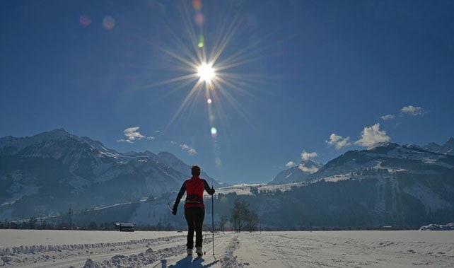
Here’s a survey of the latest Facebook and webcam shots, starting with a taste of how beautiful the Alps are looking right now, whenever the clouds lift. It was taken in the valley between Zell am See and Kaprun on Saturday. Note that it’s snowing again here today.
Pictured below was Alpe d’Huez, which was hammered by snow yesterday and has 128-200cm of cover on its pistes.
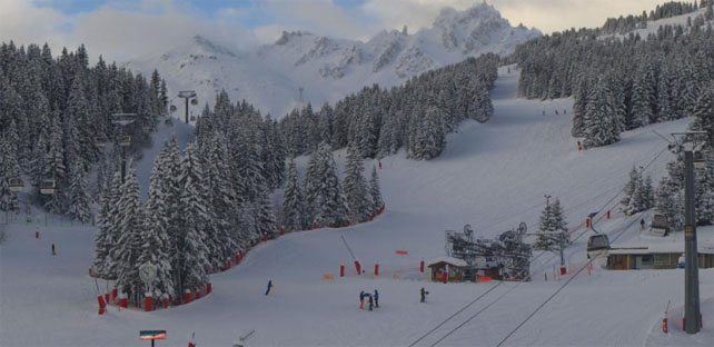
Pictured below was La Croisette in Courchevel 1850 this morning, where the temperature is -9C.
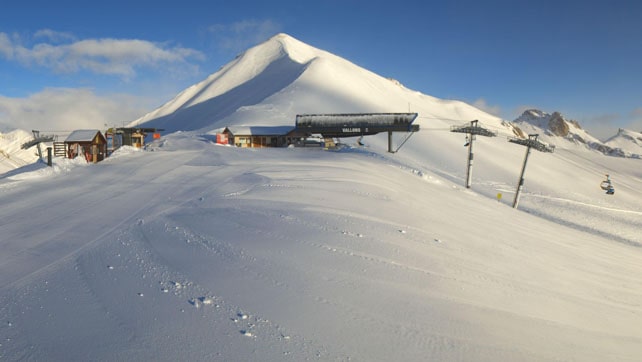
Below is how it was looking at the top of Serre Chevalier this morning, with up to 150cm of settled snow on the pistes.
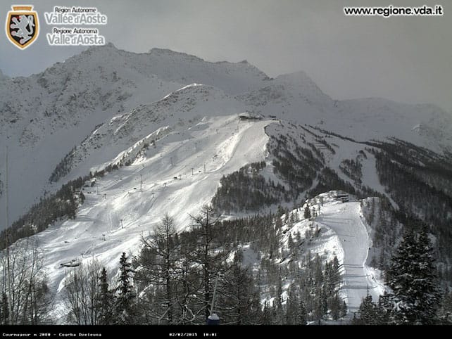
Pictured below was Courmayeur in Italy’s Aosta Valley earlier today. Here, the snow is 50-130cm deep.
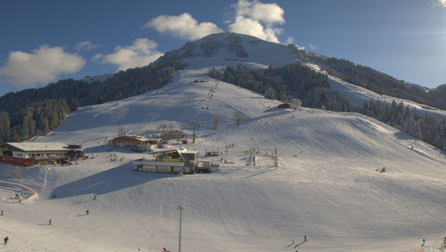
Below is how it’s looking at the moment above Soll, in Austria’s Skiwelt, where it was snowing heavily this morning. Here, the snow is 75-95cm deep, on-piste.
What’s Coming Next?
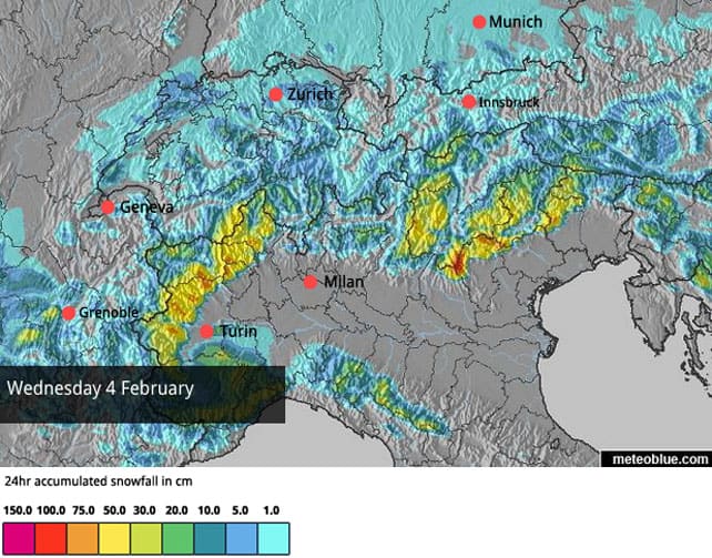
The action has shifted east today, into eastern Switzerland and Austria, where 10-20cm of snow is on the cards for most resorts. Then it’s Italy’s turn, which is great news, because so far most resorts there have missed out on the new snow. Wednesday’s snow map in particular looks promising.
After that, we should expect to see the snow easing off and, by Saturday, clear skies over the Alps. At this point the forecasts lose their consensus. Some predict another storm cycle on Monday, February 9. Others reckon the cold fronts will miss all but the very eastern end of the Alps, and there’ll be an extended spell of high pressure and sunshine. If that happens, temperatures will rise significantly, and even though it won’t be as warm as in early January, I’d still counsel aiming for a resort with skiing above 2000m to be on the safe side if you’re planning a trip.
There’s been heavy snow in the Pyrenees, too
The Pyrenees have seen heavy snow over the last three or four days too: in the Grandvalira ski area, shared by Soldeu and Pas de la Casa, the snow depth on the lower pistes has doubled to 100cm since our last snow report. Up top, it’s now 160cm deep.
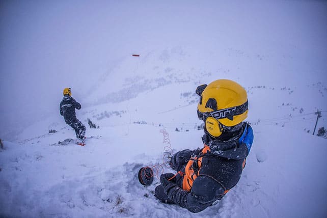
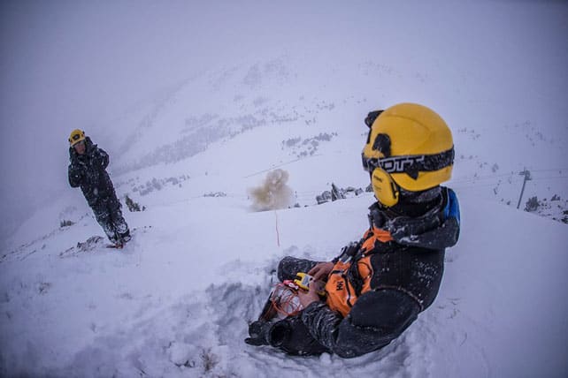
Yesterday, the Grandvalira posted some neat photos of its avalanche-safety teams at work…
Meanwhile, in Colorado, the World Championships start to today
Today sees the start of the Alpine World Ski Championships in Vail and Beaver Creek, and here’s a little taste of the stoke that’s building up on the other side of the Atlantic.
Beaver Creek, which is home to the Birds of Prey and Raptor courses, saw a welcome drop in temperatures over the weekend, after a mild spell last week. The ladies are the first out of the gates, with Downhill training today…
| France: see our main report. The French Alps have had a lot of snow since Wednesday night, and the shaky start to the ski season is now well behind us. It’s cold too, and whenever skies clear, the skiing will be superb, at all altitudes. Nevertheless, it’s still worth booking a resort with lots of skiing above 2000m if you haven’t yet planned your trip. Some mid-range forecasts are predicting an extended spell of sunny weather from next weekend. It’s not a certainty yet, but if temperatures rise you want to be well above the cycle of daily melting/overnight refreezing that could set in on the lower slopes. Currently in high-altitude Tignes there’s 103-170cm of cover, on-piste, and the snow is fresh and soft. Meanwhile, in Meribel, there’s 87-175cm of cover, on-piste. | |
| Switzerland: in western Switzerland, the situation is very similar to France. Heavy snow has fallen, and the avalanche risk is high. In the east, the new snow isn’t quite so deep, but conditions on piste are still excellent. The only area that’s missed out on the big storm so far is the south-east, in resorts such as St Moritz: however, there was heavy snow there two weeks ago, and more is likely to fall on Wednesday. Currently Zermatt has 20-210cm of cover on its pistes, Laax in the east reports snow depths of 50-270cm, and St Moritz in the south has 50-137cm. | |
| Austria: Austria hasn’t had as much snow as France, but all the same many resorts have notched up 50cm in the last week. Currently, in the Arlberg, Lech reports cover 110-180cm deep, and in the northern Tirol the Skiwelt has 75-95cm on its pistes. Meanwhile, in the east, Zell am See reports 118cm of settled snow on the Schmitten, immediately above town, and 270cm on the Kitzsteinhorn. | |
| Italy: most Italian resorts have missed out on the snow that’s fallen since Wednesday night. However, there have been exceptions, in the Aosta Valley in particular. The Dolomites had a dusting of snow on Thursday too. What’s more the forecast is for heavy snow across the southern half of the Alps on Wednesday, so it looks as though everyone will get a top-up at least. Some resorts could see 50cm. Currently, Cervinia has 155cm of snow packed down, mid-mountain, Madesimo has 170-430cm of cover, on pistes, and Canazei in the Dolomites 15-115cm. | |
| Andorra: Andorra has seen heavy snow over the last three days, increasing the settled cover on the lower pistes in the Grandvalira ski area from 50 to 100cm since our last snow report. Higher up, the cover is now 150cm deep. | |
| Western USA: the mild weather has backed off the Rockies for a bit, but it looks set to return at the end of the week when skies clear. Before then, light to moderate snowfall is expected in northern Colorado and in Wyoming and Montana. Currently Jackson Hole in Wyoming reports 15cm of fresh, and a mid-mountain snowpack that’s 180cm deep. Meanwhile, in Utah, Snowbird in Utah has 162cm of mid-mountain cover, and reports a light dusting of fresh snow today. In Vail, the settled snowpack is 104cm deep, mid-mountain. | |
| Western Canada: conditions in Whistler have improved a bit. It’s had 13cm of snow in the last week, and the mid-mountain snowpack is 133cm deep: the surface of the pistes is described as “soft-packed”. There should be another dusting over the next three days, before heavier snow sets in on Thursday – although temperatures are likely to rise at the same time. Inland, in Banff National Park, Lake Louise reports 3cm of snow overnight and mid-mountain cover of 113cm. Top temperature today will be -2C. |


Add Comment