


Thanks very much, Snow Gods. In the Alps, almost every resort has had a top-up since half-term, and in France and parts of Switzerland it’s snowed twice since Saturday. The forecast looks promising, too.
Meanwhile, parts of the Pyrenees and the American Rockies what been walloped by powerful storms. Some resorts have clocked up nearly a metre of fresh snow as a result.
This is just what the doctor ordered. After the mild and sunny weather last week (which was perfect for easy-skiing, half-term family holidays), the Alps have had the fresh snow and cool temperatures required to recharge the pistes and add powder to the backcountry.
The heaviest falls were on Saturday across the south-western and south-central Alps, when some Italian resorts clocked up half a metre of snow (see our Monday snow report for that). In France and Switzerland, there was 10-30cm, and a dusting in most parts of Austria.
There was a second dose of snow on Tuesday and Wednesday, which brought another 15-25cm to the French Alps, as well as western Switzerland, and 10-40cm across eastern Switzerland and Austria. Tuesday’s snow dipped into the eastern core of the Italian Dolomites as well, dropping 10-35cm across the region.
Yesterday, the skies began to clear, and conditions were – for the most part – gorgeous.
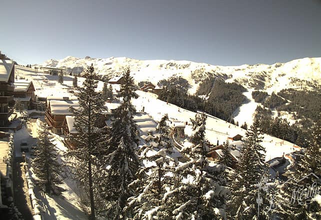
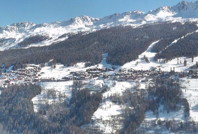
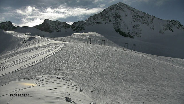
Pictured above is how it was looking in Avoriaz yesterday. The resort has the highest snowfall average in France and always does well from storms that come in from the north-west. It’s had about half a metre of fresh snow since Saturday.
Meanwhile, this was the Kitzsteinhorn, near Zell am See yesterday, where they reckoned to have 40cm of fresh snow on Tuesday night and Wednesday morning.
It’s another beautifully sunny day today, and the freezing point is going to stay fairly low (1200m in France, 1300m in Austria). Nevertheless the sun is gaining strength now, as we hurtle towards the equinox, so even above that level you’ll find the snow on south-facing slopes getting a little wet and heavy.
Off piste, the avalanche risk is still considerable (3/5) in many places, and there’s a huge variety of snow to be skied: everything from melt-freeze crust to deep powder is on the menu. By far the best policy is to hire a guide who can lead you safely to the good stuff.
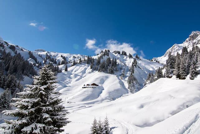
Here’s a brief survey of the today’s webcams, starting with Meribel, where the snow is currently 95-155cm deep, on piste.
Pictured, below, is Les Arcs, seen from the far side of the Vanoise Express cable car. In Les Arcs, the snow is currently 93-155cm deep, on piste.
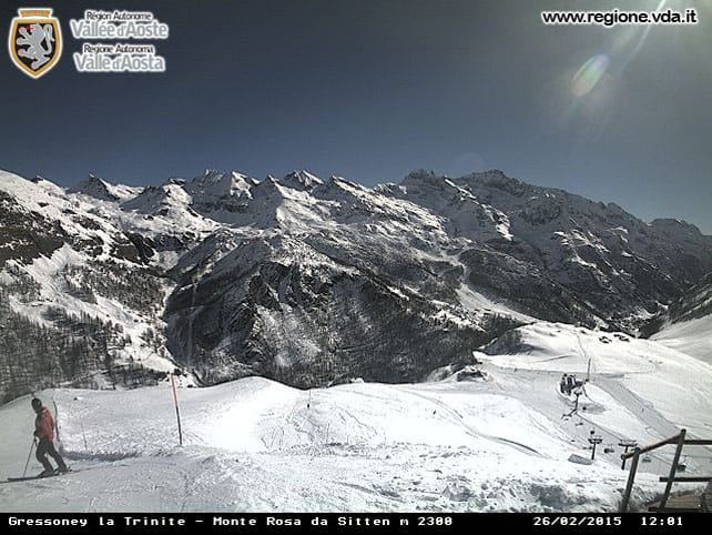
Pictured below is Gressoney in the Aosta Valley – part of the Monterosa ski area. The cover here is 105-225cm deep.
Below is little Madesimo in Lombardy, which had half a metre of snow at the weekend. Here the snow is 200-480cm deep.
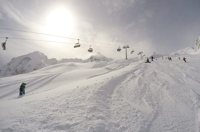
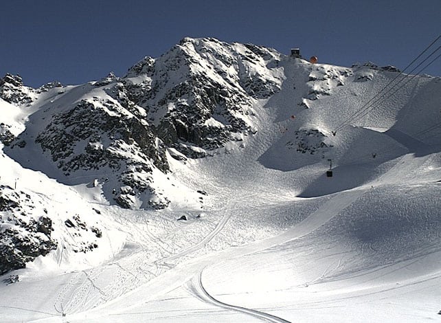
Pictured below is the magnificent mogul field on the north face of the Mont Fort, above Verbier. On piste, the snow here is 60-190cm deep.
Pictured below is the Stubai Glacier, south of Innsbruck, where the snow is up to 210cm deep, on-piste.
There’s more snow in the forecast
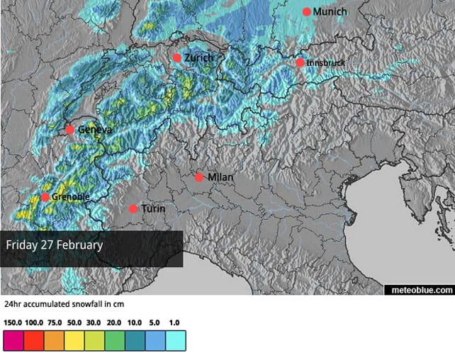
More snow is due into the French and Swiss Alps on Friday, as you’ll see from our latest snow forecast. It’s likely to be quite chilly, too.
After that, we’re expecting sunshine at the weekend, a mild day on Sunday and then…well, this is by no means certain, but it could get quite wintry for a while at the end of next week. All the same, if you’re planning a last-minute March skiing trip, I’d still factor in plenty of altitude to your plans, in case mild spring weather takes hold.
It’s been snowing hard in the Pyrenees
It’s been snowing hard in the Pyrenees, although temperatures have risen, and it’s rather wet and heavy today on the lower slopes. Baqueira-Beret in Spain reports 60-90cm of new snow in the last 24 hours and 280-410 of settled cover.
This is how it was looking in the Grandvalira ski area in Andorra yesterday, where the cover is now 150-230cm deep.
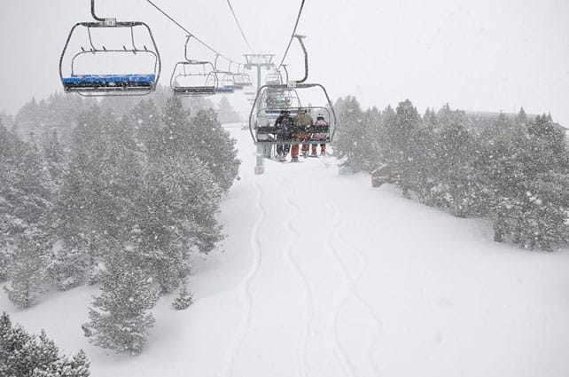
There’s been heavy snow in parts of the Rockies, too
Telluride, in southern California has just had a 75cm snowstorm. Here’s how it was looking before the skies cleared,
According to local snow guru, Joel Gratz, southern Colorado could see another 50-100cm storm next weekend…
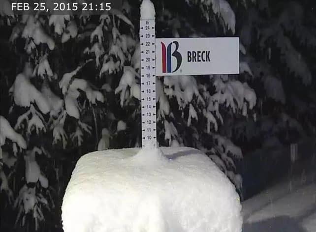
There’s been fresh snow elsewhere in Colorado, too. Pictured above was the snow stake in Breckenridge last night, showing 20cm of fresh, ready for the morning. Vail has had almost as much. They too are expecting snow at the weekend, though probably 25-30cm rather than half a metre. It should snow in Utah, too. All of which is raaaather exciting as I’ll be skiing in the Canyons and Breckenridge next week…
| France: the French Alps had another top-up of snow on Tuesday, to add to the 10-40cm that fell on Saturday. Most resorts got somewhere between 15 and 25cm. There was some rain below 1600m beforehand, and the snow on the lower and sunnier slopes will be getting wet and heavy today as the sun warms them up. But for the most part, conditions are superb right now. Snow depths are healthy all over region, which is a far cry from the situation in mid-January. South of Grenoble, for example, Serre Chevalier reports 40-140cm of cover on its pistes. Meanwhile, in high-altitude Val Thorens in the Three Valleys, there’s 130-205cm packed down on the pistes. | |
| Switzerland: on Tuesday, there was 10-25cm of snow in the northern, eastern and western resorts of Switzerland. In the south, 5-10cm was more normal. This fell on top of the 10-20cm most resorts recorded at the weekend, and as a result, the cover is in pretty good nick at the moment almost everywhere. Currently Verbier has 60-190cm of cover on its pistes, Laax in the east reports snow depths of 40-260cm, and St Moritz in the south has 63-144cm. | |
| Austria: Austria missed out on most of the weekend snow, but saw 10-40cm on Tuesday. That will have pepped up the pistes nicely, although the lower slopes are likely to be suffering a bit in the sunshine today. Currently, in the Arlberg, Lech reports cover 95-165cm deep, and in the northern Tirol the Skiwelt has 50-70cm on its pistes. Meanwhile, in the east, Schladming reports 80-140cm of cover, on-piste. | |
| Italy: the western half of the Italian Alps missed out Tuesday’s snowfall. But thanks to three significant dumps there since February 5, conditions are very good, all the same. Currently, Cervinia, high above the Aosta Valley, has 60-310cm of cover, on piste. Meanwhile, further east in the Dolomites, Canazei reports on-piste cover 40-125cm deep, thanks to fresh snow on Tuesday. | |
| Andorra: it’s been snowing hard in the Grandvalira ski area, but it’s mild today and the cover is wet and heavy. Currently settled snow depths range from 150-230cm, and temperatures should be dropping back tomorrow. | |
| Western USA: see our main report. The resorts of southern Colorado and southern Utah have the best conditions at the moment, thanks to a big dump at the start of the week. Elsewhere the snowfall has been either light or moderate. In Vail, there’s been 23cm of snow overnight and 53cm in the last week. Jackson Hole in Wyoming reports a dusting of snow in the last couple of days and 190cm of settled cover, mid-mountain. In northern Utah, Snowbird had fresh snow at the weekend and reports a settled snowpack of 178cm. More snow is expected across the region in the next few days. | |
| Western Canada: after a long mild spell in western Canada, the weather’s cooling down. At Lake Louise in Banff National Park, a top temperature of -8C is expected today. Currently, the mid-mountain snowpack is 124cm deep. Meanwhile, in Whistler there’s been a 3cm dusting of snow overnight and the settled snowpack is 145cm deep. Conditions are described as hard-packed. In the east, the long cold spell continues. Top temperature in Tremblant today will be -15C. |


Telluride, in southern California
*southern Colorado
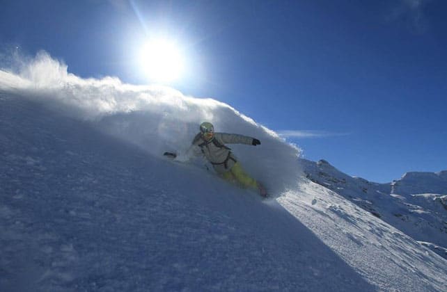
Great top photo by Kat Glover