


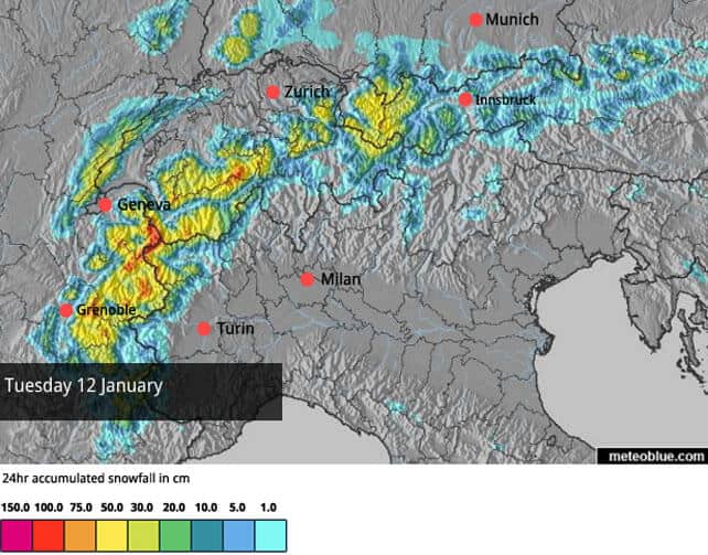
An unwelcome spell of mild, wet weather is coming to an end in the north-western Alps today. Temperatures are dropping and heavy snow is expected down to 800m this evening and tomorrow.
Here’s tomorrow’s snow forecast.
The forecast tells two stories. The first is the welcome return of snow to the lower resorts. The weather warmed up on Thursday afternoon last week – and for a time, on Friday and Saturday, it was raining up to 2000m in the French resorts.
It’s washed away a lot of the snow on the lower runs. In the valley at Morzine, for example, the slopes are green again, and at village level in Les Gets (set at 1200m), the snow is getting patchy away from the pistes. Both are part of the Portes du Soleil, and there’s still good skiing higher up. Nevertheless, the return to wintry conditions will be a huge relief.
Meanwhile, at altitude, it’s too much snow, not too little, that’s the problem. The snow has continued to fall over the weekend, and now another dump is on the way. Well over a metre of new snow is on the cards by the time skies clear on Wednesday. Strong winds are also expected today, and the snow will be falling on a snowpack that’s already unstable. The avalanche risk in many resorts is already 4/5, which rules out off-piste skiing altogether – and for a while it could get worse.
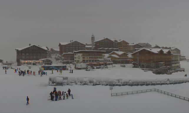
Here’s how it’s looking in Tignes today, where the snow is currently 85-155cm deep at altitude.
It’s not only the French Alps that will see significant snowfall over the next two days. Northern and western resorts in Switzerland will also see heavy snow, as will the Arlberg resorts in Austria. In western Switzerland, the avalanche risk is now at 4/5, and the situation can only deteriorate further as the storm gathers strength. Further east, into Austria, it’s 3/5 but likely to rise to 4/5 today.
For a time, there’ll also be heavy snow in the Engadin valley in south-eastern Switzerland (home of St Moritz), and the Italian Dolomites. Although it won’t be as prolonged as in the north, it will be very welcome, especially in the Dolomites. Here, resorts have been almost entirely dependent on their snow cannons for cover so far this season.
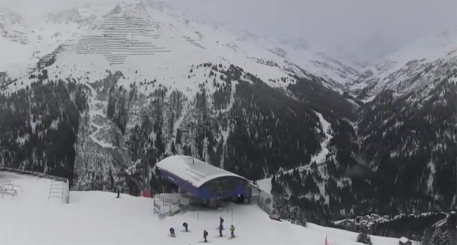
Here’s how it’s looking in St Anton am Arlberg this morning.
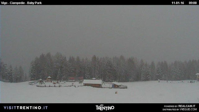
And this is the scene in Catinaccio, between Canazei and Moena in the Dolomites.
So in the short term, the outlook is a very wintry one – and there’s likely to be another dose of heavy snow at the end of the week too. But if you’re planning a trip in the near future I’d play it safe and aim for a resort with plenty of skiing above 2000m. It’s been an exceptionally mild winter so far, and the mid-range weather models are currently predicting a return to warmer weather at the end of next week.
I’ll be back with a full Snow Report on Thursday.


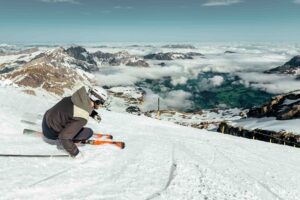
The powder was excellent on the upper, gentler slopes of Val d’Isère this morning, and it has been for a week or so. The traditional itineraries may be inaccessible, but plenty of people have been enjoying brilliant skiing from the lifts. See Wayne Watson’s report: https://www.alpineexperience.com/waynes-daily-diary/