


There’s been a long spell of cool and spectacularly weather in the Alps – with the occasional snowy interlude, notably last week in Italy.
But now the pattern is beginning to shift. There was snow in Austria yesterday, and from tomorrow a westerly, Atlantic airstream is going dominate the whole region. The weather will be much more changeable as a result. In the western Alps especially, it’ll be noticeably warmer when the sun shines, but these periods of warmth will alternate with colder spells which bring snow down to 1000m at times.
The next snowy spell is likely between Friday evening and Saturday morning, and will bring light to moderate snowfall across the northern Alps. Another snowy weather front is due on Sunday or Monday and will favour the western Alps.
Here’s Welove2ski’s snow forecast for Saturday (which shows the snow due to fall in the early hours of the morning).
In between times, temperatures will be yo-yoing about all over the place. In the French Alps, the daytime freezing point is likely to be at 1800m on Friday, 3000m on Saturday afternoon and back down to 1500m on Sunday.
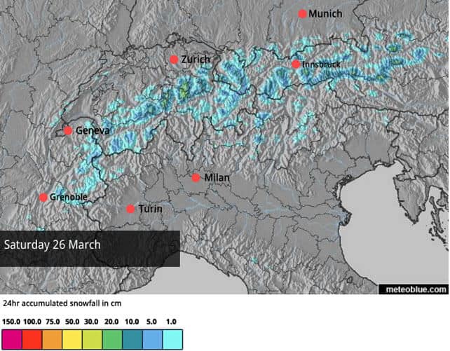
Then on Wednesday there is the chance of significant snowfall across much of the region. It’s certainly suggested by the latest run of maps from the European Centre for Mid-Range Weather Forecasting (ECMWF). But it’s too soon to be sure of it – and not all the mid-range models agree. It’ll be interesting to see whether it stays in the forecast over the weekend.
Here’s Wednesday’s ECMWF weather map from Meteociel.

So there’s going to be a little bit of everything over the Easter holiday. The sharpest contrast in conditions will be in the west, and it will stay cooler for longer in Austria. Across the Italian Alps it’s likely to be sunnier than in the northern Alps, with much less snow.
Skiing conditions will change almost constantly, too. There’ll be the occasional white-out, followed by dazzling spring sunshine, and more wind than we’ve seen for a while. There is still soft, wintry snow out there to be skied: I found quite a lot of it above St Anton, Lech and Zurs earlier this week, but you have to stick to the north-facing slopes to find it, and increasingly, as temperatures rise, you’ll have to ski at higher altitudes.
Lower down, and on slopes that get a lot of sun, you’ll find hard-packed “icy” conditions first thing in the morning, and – when the sun shines – slush from late morning onwards. As ever, the trick will be to ski the snow just as it begins to soften. If you’re out on an overcast day when there’s a little snow in the air, you’ll find the hard-packed surface will endure for longer, because it won’t be warming up so quickly.
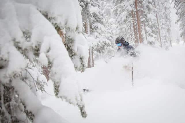
Off-piste, there’s almost no powder left unless you’re prepared to hike/go ski-touring to find it. There may be a few spots in Austria as a result of yesterday’s snow (see below), and after the Friday night and Sunday/Monday snow there may be enough on sheltered spots to give you a few powdery turns as well. But the best hope for powder junkies is the hoped-for snowstorm next Wednesday. Those who like skiing just-melted corn snow may have more luck in the short term, provided they hire a guide to show them the way, and pick one of the sunny days to go hunting for it.
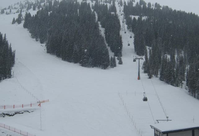
Here’s a quick survey of the morning webcams, starting in Austria. Yesterday it had its own private snowstorm. It wasn’t heavy, but some parts of the Tirol had notched up 10-15cm by the end of it, and there are still some snow showers about, as you can see from the photo of Hochfugen in the Zillertal, at the start of the feature. Up high, on north-facing pistes, that’ll be enough to provide a soft, wintry surface to ski on this morning. Lower down, the new snow will be scraped off by passing skiers quite quickly to reveal a hard-packed underlayer.
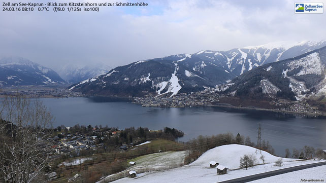
Here’s how it’s looking in Zell Am See in the Salzburgerland today – which shows the line to which the new snow settled nicely.
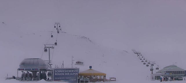
Pictured below is high-altitude Obergurgl, which really comes into its own at this time of year. The snow here is 24-168cm deep.
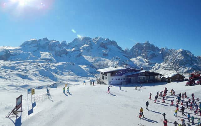
Below are the magnificent Brenta Dolomites in Italy, seen from Madonna di Campiglio. Here, the snow is 95-180cm deep, on-piste.
These are the slopes above Verbier in Switzerland, where the snow is 30-230cm deep.
Pictured below, is the top of Serre Chevalier in France this morning, all groomed and ready to go. The snow here is 20-145cm deep.
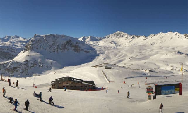
This is Val d’Isere, where there’s 143-238cm of settled snow.
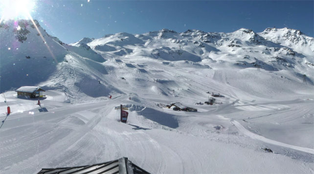
And finally, here’s high-altitude Val Thorens, where the snow is 160-280cm deep.
Meanwhile, in North America…
Many resorts in the American west have just had a decent dump of snow. The storm hit the west coast first, and on Monday and Tuesday the resorts around Lake Tahoe in California got an early 22-42cm Easter present. In Utah, Tuesday was snow day: Park City had nearly 30cm and Snowbird 45cm.
The storm then moved into Colorado and intensified on Wednesday. Telluride and Steamboat did particularly well: by Wednesday afternoon, Steamboat reported 37cm of fresn snow.
Here’s how it looked in Heavenly, California on Tuesday.
This was Snowbird on Tuesday, when the snow was still falling …
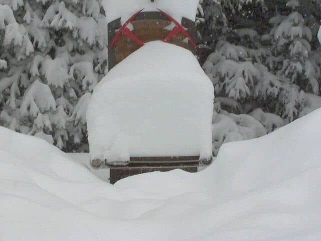
And this is how Telluride’s snow stake looked on Wednesday morning…
If you’re heading out to the mountains this weekend, have a great trip, and to all Snowfiends..,
Happy Easter
Don’t forget to eat at least four hot cross buns for breakfast tomorrow.
| France: it’s nearly three weeks since the last big round of storms in the north-western Alps, and there’s been plenty of sunshine since then. However, cool winds have kept the snow in remarkably good condition for the time of the year, and you’ll still find wintry snow on shady, north-facing slopes. Elsewhere, spring conditions predominate, and the slush is likely to get slushier between the weather fronts during the course of the next few days. For the most consistent conditions, stay high, on north-facing slopes, or use spring-skiing tactics. Currently, Chamonix reports up to 300cm of settled snow on the Grands Montets, and Tignes 143-238cm. | |
| Switzerland: conditions across Switzerland are similar to the northern resorts of France: it’s been sunny and cool, but the weather is about to get more changeable. The snow is generally much deeper in the north and west than the south and east. Currently, Engelberg reports 30-380cm of settled cover on its pistes. In the south-east, St Moritz has 51-113cm. | |
| Austria: see main report. Austria had its own private snowstorm yesterday and there are still a few snow showers about. It’s enough to fresh up the pistes nicely on north-facing slopes, above about 2000m. Lower down, and on south, east and west facing slopes, you’ll find a hard-packed surface not far beneath the new snow. In the Arlberg, Lech reports 105-185cm of settled snow. Meanwhile, the Skiwelt has 50-60cm of cover. Watch out for the return of spring conditions when the sun comes out again. | |
| Italy: the sun’s been blazing across Italy for much of the last week, and spring conditions predominate. Timing is of the essence if you want to get the best from the pistes, so ski them just as the snow turns from hard to soft in the morning sunshine. In the Dolomites, Canazei reports 50-140cm of cover. In the west, Champoluc in the Aosta Valley has 40-130cm of settled snow on its pistes. | |
| Andorra: in Andorra, Pas de la Casa has 80-130cm of cover packed down, on-piste. | |
| Western USA: see our main report. The week got off to a snowy start in the resorts of the American west. There should be some more snow on Friday/Saturday, too. In Colorado, Breckenridge reports 180cm of mid-mountain snow, in Utah Snowbird has 274cm, and in California Heavenly has 236cm. | |
| Western Canada: in Whistler the mid-mountain snowpack is a very healthy 327cm deep. After a short dry spell, it’s been cold and snowy, with light accumulations of powder. In Banff National Park, Lake Louise reports a mid-mountain snowpack of 118cm. |


Add Comment