


After last week’s wonderfully wintry interlude, spring has returned to the Alps. Sunshine and mild temperatures are the order of the day – although the weather won’t be quite as warm or as settled as it was during the thaw of early March.
In France, the freezing point is expected to hit 2500m today and tomorrow, and 2900m on Wednesday. In Austria, it’s likely to hover around the 2800m mark all week. There are likely to be a few clouds about too: in France local forecasters Meteo Chamonix are predicting isolated showers at the end of each day, which may turn stormy by the end of the week as the pressure starts to drop.
It looks as though the weather will break down at the end of the week. The Pyrenees will be affected first, on Thursday, before wet weather hits the Alps on Saturday. However, it will stay mild – so the precipitation is likely to fall as rain in the lower resorts.
Despite the warm weather, you can still find soft, cold snow on north-facing slopes – especially above 2500m. However, any snow that gets a lot of sun will be melting during the day and refreezing at night. So you want to ski it just as the sun begins to soften its surface each morning. Catch it at just the right moment, and this spring snow is a joy to ski. But let the sun shine on it too long and you’ll be wallowing in a soupy mess. Off-piste, this heavy snow also becomes dangerous as the day progresses, as slopes begin to shrug off their cover in the form of wet-snow avalanches. So a guide is essential if you want to leave the safety of the groomed and way-marked pistes.
For piste skiers, mastering these conditions is much more straightforward. Start on the east-facing slopes in the morning and let the sun warm them up for maybe 20 minutes before you attack them. Ski them no more than a couple of times, and then move on – following the sun around the ski area until you’re facing west. By lunchtime the snow will be heavy even here, so it’s time to knock off for a long break on a sun terrace. You’ll have earned it!
Don’t forget to check out our feature on the best resorts for spring skiing if you’re planning a late-season trip. And in the meantime, here’s a brief survey of the day’s webcam shots.
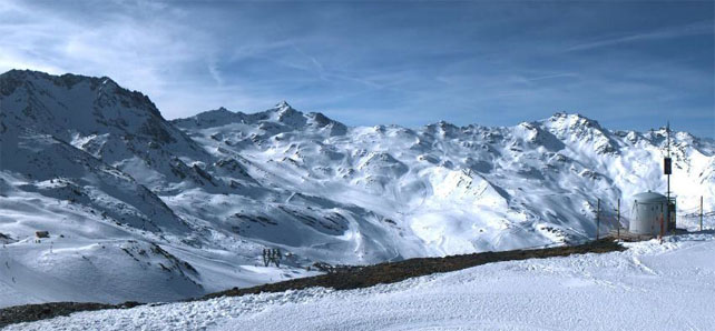
Pictured below is the glacier above Les Deux Alpes today, high above the effects of the current thaw. Up here, the snow is 220cm deep.
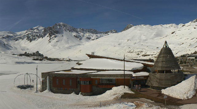
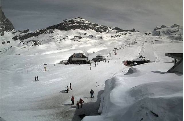
Pictured, below, is high-altitude Tignes, where the snow is currently 91-210cm deep on-piste, depending on altitude.
Meanwhile, this is the view towards Val Thorens, from the ridge that separates it from Meribel. The snow here is 120-230cm deep, on-piste.
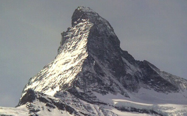
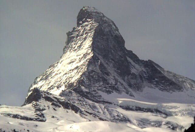
Pictured, below, is high-altitude Cervinia in Italy, which shares its ski area with Zermatt. Here the snow is 80-320cm deep.
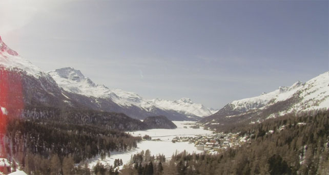
Below is St Moritz, where the snow is currently 105-203cm deep, on-piste.
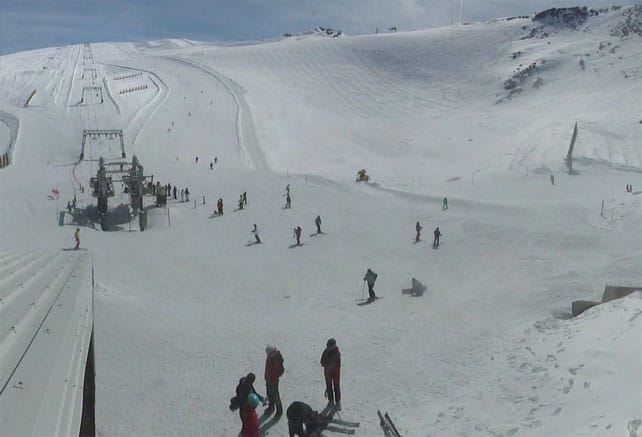
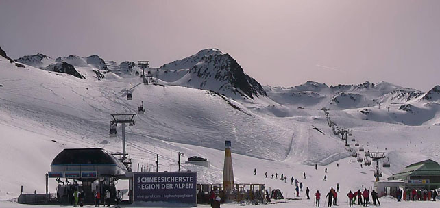
Finally, pictured below is Obergurgl in Austria, where the snow is 39-124cm deep, on-piste.
Lots of powder across the Pond
The contrast between conditions in the Alps and the western US at the moment, is, is – well, it’s annoying, frankly. Resorts in California, Utah, Wyoming and Colorado are all being walloped by the white stuff.
In the Tahoe resorts of California, for example, there was fresh snow last week, fresh snow on Sunday, and there’s more to come over the next couple of days.
Pictured, below, is the scene in Heavenly yesterday, which picked up 30cm of snow from the overnight storm.
Meanwhile, pictured below is the scene in the The Canyons in Utah on Friday. Another storm rolled through the region yesterday afternoon, dropping up to 27cm of lovely Utah snow across the Salt Lake City ski areas. Yet more snow is due in later today…
Meanwhile, below was how it was looking in Jackson Hole, Wyoming, on Saturday. Yesterday, the resort reported 30cm of fresh snow from the latest storm – and there’s been more snow since then.
Finally, in case you haven’t seen it already, here is the mouthwatering powder video posted by Breckenridge in Colorado on Friday. More snow was expected in Colorado yesterday afternoon, with another dump forecast for Tuesday.
| France: see our main report. There’s still plenty of good skiing to be had in the high-altitude resorts, provided you stick to north-facing slopes, or else adopt the spring-skiing tactics described above. Fingers crossed the change in the weather at the weekend brings another wintery interlude like the one we saw last week. Currently, Val d’Isere reports 91-161cm of settled snow on its pistes. On the Grands Montets above Chamonix the snow report records 120-290cm of cover, on-piste. | |
| Switzerland: as in France, spring has returned to the Swiss Alps, and you need to aim high, and stay on north-facing slopes to find wintry snow. Failing that, spring-skiing tactics will deliver a good morning on the slopes. Currently, in Saas-Fee the cover is 76-348cm deep, on piste. Meanwhile, little Andermatt reports cover 74-400cm deep on its slopes, and Verbier 30-176cm. | |
| Austria: Austria did well from the snow on March 22 and 23: but the current thaw has undone much of the good work at lower altitudes. You have to aim high to get decent skiing now. Currently Nassfeld in Carinthia reports 20-310cm of settled snow, on-piste, St Anton 30-130cm, and Obergurgl 39-124cm. | |
| Italy: the weather has warmed up quickly in the Italian resorts, and the lower pistes are thinning fast in the warm sunshine. However, at altitude there’s still plenty of snow. Currently, in the Aosta Valley, Cervinia has 80-320cm of settled snow on its pistes, and Canazei in the Dolomites 50-220cm. | |
| Andorra: the Pyrenees had fresh snow last week, but spring-like conditions have returned to the region for the time being, before the weather gets more unsettled at the end of the week. Currently, Soldeu in the Grandvalira ski area reports 70-200cm of settled snow on its pistes. | |
| Western USA: here, the first few days of April should be as good for powderhounds as the last few days of March. Snow, snow and yet more snow, is the forecast. Currently, Jackson Hole in Wyoming, reports a settled mid-mountain snowpack of 270cm. In Colorado, Breckenridge in Colorado has reported its fifth snowiest season ever, and a mid-mountain snowpack of 241cm. In Utah, The Canyons reports a settled snowpack of 175cm. | |
| Western Canada: there’s been fresh Whistler: 26cm in the last couple of days, boosting the mid-mountain snowpack 288cm deep. Inland, there’s been more. Fernie, has had 36cm in the last two days, and now has a whopping 414cm of cover mid-mountain. In Revelstoke the mid-mountain cover currently measures 277cm. |


Add Comment