


Another snowstorm is sweeping over the Alps. It’s a fitting end to an extraordinary month, which has left the high-altitude resorts and glaciers with (for the most part) excellent early-season conditions.
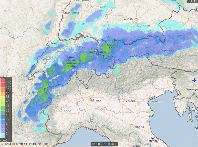
See below for Meteoblue’s 24-hour snow forecast to 1am on Saturday morning. Moderate falls of 30cm or more are expected across much of the north-western Alps, from the Tarentaise in France to the Arlberg in Austria.
Some areas will have more. Meteofrance is for example, predicting 40cm of snow over the next two days above Chamonix.
However, it’s worth noting that below about 1300m it’ll be raining. This will add to the woes of low-lying resorts, whose preparations for the start of winter were put on hold by a mild and stormy spell that rocked the region at the weekend. In fact, down at 1000m, the slopes are green again in many areas.
Fortunately, on Sunday, temperatures will drop sharply, and it will snow right down to the valley floors. It won’t necessarily be heavy, but it will give resorts the chance to run their snow cannons and build up their reserves.
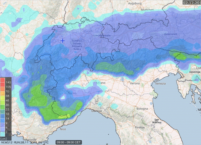
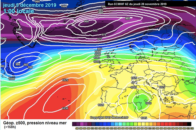
Here’s the 24hr snow forecast to 9am on December 2. Note the intensity of the storm in the southern French Alps.
Up high, the new snow will be a great curtain-raiser for the start of the mainstream ski season this weekend. Ischgl in the Austrian Tirol opened today, St Anton and Lech-Zürs open tomorrow, and Val d’Isère gets going on Saturday.
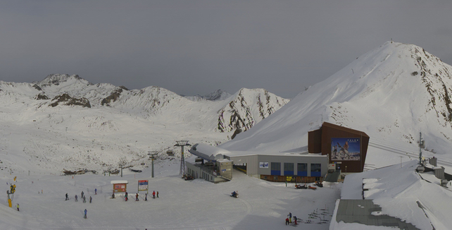
Here’s how it was looking in Ischgl this lunchtime. Snow depths here are currently around 45cm, on-piste.
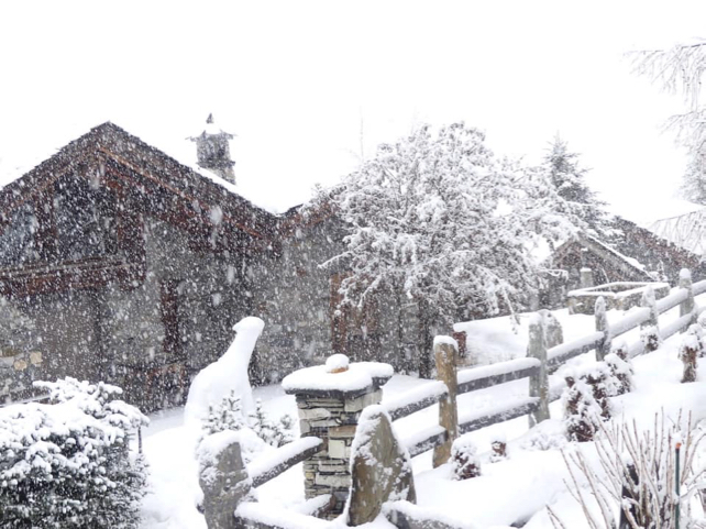
And this was the scene in Val d’Isère yesterday afternoon. The snow here is 50-150cm deep.
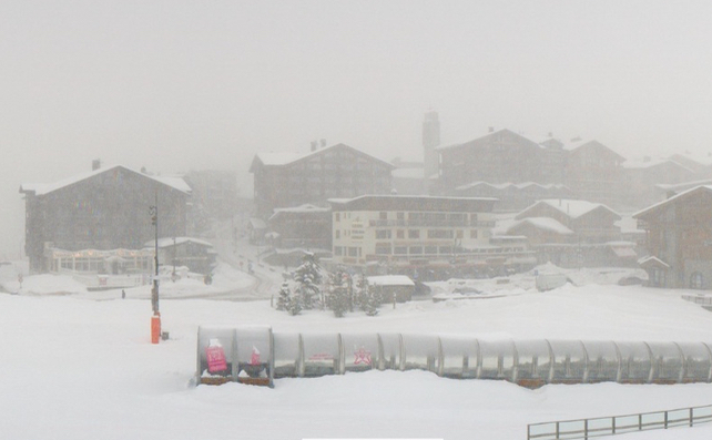
And here’s how it was looking at Tignes, next door to Val d’Isère, this morning.
Tignes is already open open, of course, and will link up with Val on Saturday. New slopes will also open above Zermatt and Cervinia, to create a total of 210km of skiable pistes – currently the largest extent of skiing available in the Alps.
The glacier ski areas are open too, such as Hintertux and the Stubai, as well as the high-altitude resorts of Obergurgl and Val Thorens.
In Obergurgl, snow depths are currently 85-170cm deep, despite the mild spell at the weekend. These are exceptional depths for late November.
Please bear in mind, however, that the weather has been wild over the last week, with high winds and rain mixed in with spells of snow. The snow quality is very variable as a result: and exposed slopes have been scoured by stormy winds. If you’re planning to ski off-piste, pay attention to local avalanche reports and hire a guide to be extra safe.
Bear in mind also that mid-range forecasts are suggesting we could get another mild spell in the middle of next week. So once again I’ll repeat the early-season watchwords. Aim high. You need to build altitude into your plans to be sure of a high-quality skiing surface.


Add Comment