Snow report 23 January
In today’s report we catch up on conditions across Europe, North America and Asia with things looking up across the Alps; historic snowfall in the Southern States of the US; and continued powder turns in Japan.
Where’s the snow going to land next? We’ve scoured the internet to give you the best recommendations.
Now on with the snow!
Snow Report
Our ‘on the spot’ reporters have been enjoying improved conditions across the European Alps.
Bringing you the latest snow updates, Ken Smith from Progression Ski reports the return of powder in Val d’Isère and shares vital tips for heading off-piste during the incoming storm cycle.
Mark Handford, from Snowdonia Adventures reporting from Serre Chevalier, has swapped Snowdonia for the fresh snow in Serre Chevalier, and Phil Brown from Impulse Racing delivers a snowy report straight from Pila in Italy’s Aosta Valley.
Watch now…
The Southern States of the US saw historic snowfall the past two days with up to 35cm falling in Alabama, Florida, Louisiana, and Texas!
View this post on Instagram
The snow tap has stayed on across Japan with big accumulations on Honshu and the Northern island of Hokkaido.
View this post on Instagram
World Snow Forecast For The Next 3-4 Days
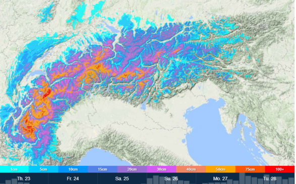
The Austria resorts will see a mix of weather through Saturday with freezing levels reaching 3,100m and freeze thaw conditions at all levels. From Saturday evening a new – and welcome – storm system will move in bringing sub zero temperatures above 950m and 10-15cm of snowfall.
France sees the return of snowfall across most its resorts with 5-10cm forecast today and a further 15-20cm over the weekend.
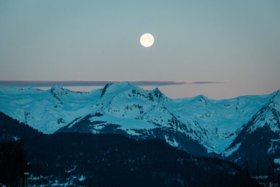
It will be a similar situation in Italy and Switzerland, with Madesimo, Italy expecting 30-35cm and Corvatsch Diavolezza Lagalb, Switzerland 25-30cm.
After a period of warm temperatures and freeze thaw conditions Andorra and the French & Spanish Pyrenees will see a return to sub zero temperatures and 10-15cm of new snow through Monday.
It will be a similar situation in Central and Eastern Europe with 5-10cm forecast over the weekend.
Further east the Georgian and Turkish resorts will see temperatures dropping below -10 C and 5-10cm of new snow.
The Nordic countries of Finland and Sweden will see continued cold temperatures and the chance of 10-15cm through Monday. Are, Sweden could see 15-20cm.
A big storm system is sweeping across the Norwegian resorts with 20-40cm forecast through Monday. Myrkdalen could see 1m and Roldal 1.5m!
The Alberta and British Columbia resorts of Canada will see cloudy skies and cold temperatures with light snow flurries.
Temperatures will remain cold on the East Coast with Tremblant expecting 20-25cm of new snow.
Most of the western US resorts will see continued below zero temperatures and 5-10cm of new snow. Alta, Utah could see 15-20cm through Monday.
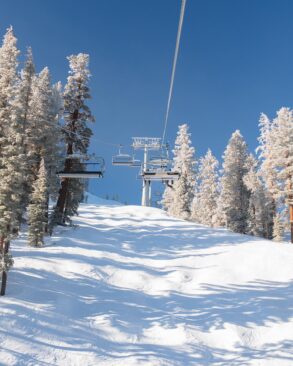
The West Coast resorts of California, Oregon and Washington will see a drop in temperatures and 5-10cm of new snow. Mammoth, California could see 15-20cm.
The snow continues to fall at Alyeska, Alaska with 40-45cm of new snow forecast through Monday.
Temperatures will remain cold on the East Coast with sunshine and 5-10cm of snow forecast.
The resorts on Japan’s main island of Honshu and the northern island of Hokkaido will see a brief respite from the ‘Japanuary’ storms with 10-15cm forecast through Monday.
Where To Ski
If you can drop everything and book a last minute trip then head north to Norway for what looks to be be a powder filled weekend.
The European Alps will see much improved conditions on and off piste in the second half of the week but please take heed of avalanche advisories as the new snow tries to bond with the hard, established snow underneath.
The Japanese resorts continue to off the most consistent conditions across the ski world, with almost daily replenishment of dry, light snowfall.




Add Comment