


Snow Report Monday 17 February 2025
In today’s report we have location reports from Val d’Isere, Courmayeur and the Portes du Soleil, following last weeks snow as well as highlights from Italy and the USA. Plus even more powder days in Asia are being reported.
Where will the snow fall next? We’ve done the research to bring you the top recommendations.
Let’s get to the snow!
Snow Report
Our ‘on the snow’ reporters have been enjoying great conditions across the European Alps.
Val D’Isere & Tignes Snow Report, France
Ken Smith from Progression Ski reports sunshine and powder in Val D’Isere and Tignes.
Ken Smith has lived and worked in Val d’Isere for 30 seasons and is the owner of Progression Ski and Snowboard School and Alpine Exclusive accommodation agency.
Courmayeur Snow Report, Italy
Phil Brown sent us this report from Courmayeur, Italy which is in great shape heading into the February Half Term holidays.
Click here to book lessons with Phil and his team.
Champery & Les Crosets Snow Report, Switzerland
Dave Burrows from Snow Pro Ski School reports sunshine and powder in Champery & Les Crosets.
Click here to book English lessons in Switzerland with Snowpros.
Villars Snow Report, Switzerland
Dave’s colleague Mike reports similar conditions in Villars.
Further south it’s been otherworldly on Mount Etna
Mount Etna Snow Report, Italy
View this post on Instagram
Different country, same smile. Luke is back from Japan and managed to score a 45cm (18″) ‘Country Club’ day at Snowbird, Utah, USA on his return.
Snowbird Snow Report, Utah, USA
View this post on Instagram
World Snow Forecast For The Next 3-4 Days
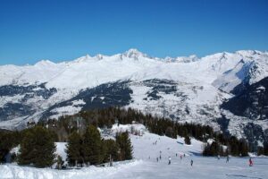
The Alpine resorts of Austria, France, Italy and Switzerland will see sunny skies for the February Half Term holidays with the freezing level rising to 2,000m and t-shirt weather at village level.
Andorra and the French & Spanish Pyrenees will see freeze thaw conditions and a combination of sunshine and cloudy skies.
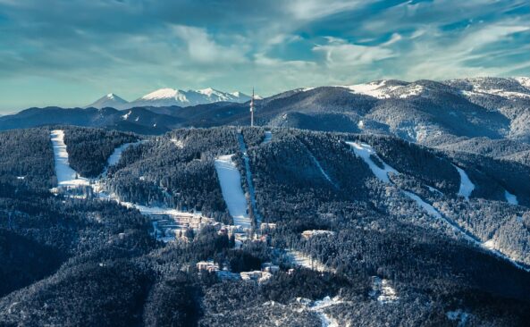
Central and Eastern Europe will see below freezing temperatures and clear skies. Borovets, Bulgaria is expecting 15-20cm of new snow.
Further east the Georgian and Turkish resorts will see temperatures between -5C and -10 C with 15-20cm forecast for Gudauri. Uludag, Turkey is forecast to receive 25-30cm.
The Nordic countries of Finland, Norway and Sweden will see continued cold temperatures and cloudy skies with Narvik, Norway expecting 25-30cm.
The Alberta and British Columbia resorts of Canada will see sunshine and a sprinkling of new snow.
Temperatures will remain cold on the East Coast with 5-10cm forecast for Tremblant, Quebec.
Most of the western US resorts will see below freezing temperatures and 10-15cm of new snow. Vail, Colorado could see 20-25cm.
The West Coast resorts of California will see as break in the storm with clear skies and sunshine.
Further north the Oregon and Washington resorts will see colder temperatures and 30-35cm forecast through Thursday. Timberline, Oregon could see 45-50cm.
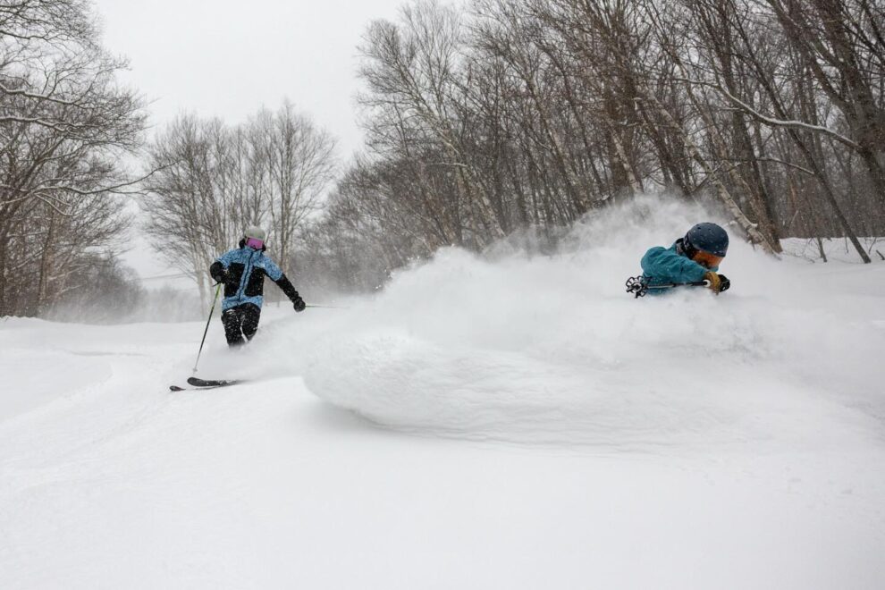
After a very snowy weekend on the East Coast a further 5-10cm is forecast. Jay Peak, Vermont could see 15-20cm.
The resorts on Japan’s main island of Honshu and the northern island of Hokkaido continue to get pounded with snow with another 65-75cm forecast through Thursday. Happo One in the Hakuba Valley could see 1m!
Further north Kiroro is forecast to receive 70-75cm.
Where To Ski
There’ll be great skiing all across Europe but for powder head to Borovets, Bulgaria.
Northern Norway will be quieter that the Alps, and Narvik continues to be the resort of choice.
Have the time to head further afield?
Then head West to the Rockies of Colorado and the volcanoes of Oregon or East to Japan where conditions are still deep & light.


Add Comment