


Snow Report – Thursday 20 February 2025
In today’s report we catch up on conditions across Europe, North America and Asia with snow in Turkiye, the United States, and Japan.
Where’s the snow going to land next? We’ve scoured the internet to give you the best recommendations.
Now on with the snow!
Snow Report
Our ‘on the snow’ reporters have been enjoying great conditions across the European Alps.
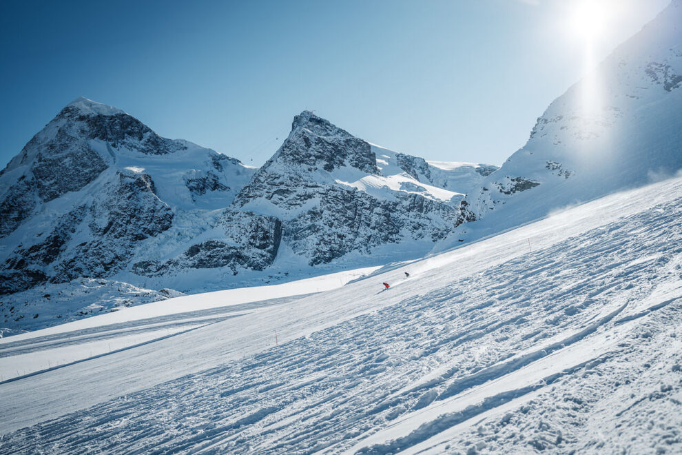
Kronplatz Snow Report, Italy
Dickie Fincher sent us this report from Kronplatz, Italy which is in great shape under sunny skies.
Further East, a major snow storm has swept across Turkiye bringing 20-40cm of new snow. Even Istanbul is getting in on the act.
Uludag Snow Report, Turkiye
View this post on Instagram
The East Coast of the United States has been enjoying fantastic conditions this February with cold temperatures and regular snowfall. Just a couple of hours out of New York City the turns are deep.
New York Backcountry Snow Report, NY, USA
View this post on Instagram
And out West, Jackson Hole, Wyoming continues to deliver fresh snow and deep turns.
Jackson Hole Snow Report, Wyoming, USA
View this post on Instagram
World Snow Forecast For The Next 3-4 Days

The Alpine resorts of Austria, France, Italy and Switzerland will see sunny skies leading into the second half of the February Half Term holidays with the freezing level rising to 3,000m and freeze thaw conditions at most levels.
Andorra and the French & Spanish Pyrenees will see a storm rolling through from tomorrow evening with 10-15cm forecast. Baqueira Beret, Spain could see 20-25cm.

Central and Eastern Europe will see below freezing temperatures and clear skies.
Further east the Georgian and Turkish resorts will see temperatures between -5C and -10 C with 10-15cm forecast. Uludag, Turkey is forecast to receive 20-25cm.
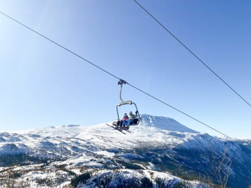
The Nordic countries of Finland and Sweden will see the freezing level rise to 2,00m bringing freeze thaw conditions, 5-10cm of snow at the higher elevations and rain at village level.
Norway will remain cold with 10-15cm forecast through Monday. Gaustablikk is expecting 20-25cm.
The Alberta and British Columbia resorts of Canada will see sunshine and 10-15cm of new snow. Revelstoke, BC could see 20-25cm, with Whistler Blackcomb forecast to receive 50-55cm.
Temperatures will remain cold on the East Coast with 5-10cm forecast for Tremblant, Quebec.
Most of the western US resorts will see below freezing temperatures and 10-15cm of new snow. Schweitzer, Idaho could see 30-35cm.
The West Coast resorts of California will see clear skies, sunshine and freeze thaw conditions through Monday.
Further north the Oregon and Washington resorts will see the freezing level rise to 2,600m with snow above that level and rain below. Timberline, Oregon could see 20-25cm and Crystal Mountain, Washington forecast to receive 50-55cm.

Temperatures remain cold on the East Coast with a further 5-10cm forecast. Jay Peak, Vermont could see 10-15cm.
The resorts on Japan’s main island of Honshu and the northern island of Hokkaido continue to get pounded with snow with another 30-40cm forecast through Monday. Gala Yuzawa on Honshu could see up to 1m, with Kiroro expecting 45-50cm.
Where To Ski
There’ll be great skiing all across Europe but for new snow head East to Georgia and Turkiye or South to Baqueira Beret, Spain.
Gaustablikk, Norway will have the best conditions in the Nordic countries.
Have the time to head further afield?
Then head West to Idaho, Wyoming and Washington State in the United States and Whistler Blackcomb in British Columbia, Canada.


Add Comment