


Snow Report, Monday 24 February 2025
In today’s report we catch up on conditions across Europe, North America and Asia with big snowfall in Turkiye, the United States, and Japan.
Where’s the snow going to land next? We’ve scoured the internet to give you the best recommendations.
Now on with the snow!
Snow Report
The big news in skiing over the weekend was Mikaela Shiffrin’s 100th World Cup victory when she topped the podium after winning the slalom at Sestriere, Italy.
She is the first skier, male or female, to reach triple digits in World Cup race victories. A feat that could quite possibly never be equaled, let alone surpassed, and which cements her status as the Greatest Ski Racer Of All Time.
And she’s not stopping any time soon! Recently back from injury she’s hungry for more success this season.
View this post on Instagram
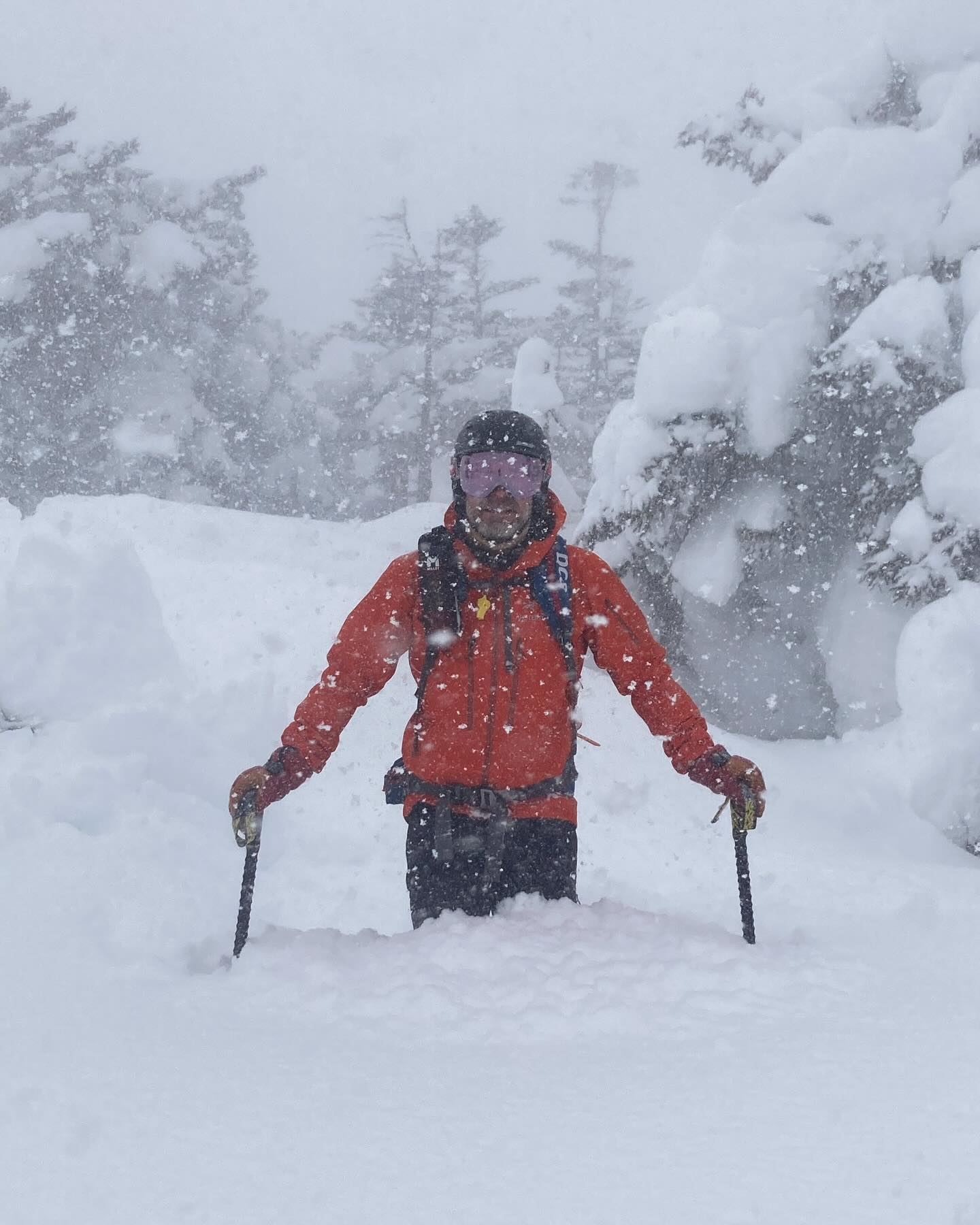
Further East, a major snow storm has swept across Turkiye bringing huge disruption to Istanbul; deep snow at the resorts in the West; and season’s best conditions in the mountains on the Black Sea Coast.
Turkish Backcountry Snow Report, Turkiye
View this post on Instagram
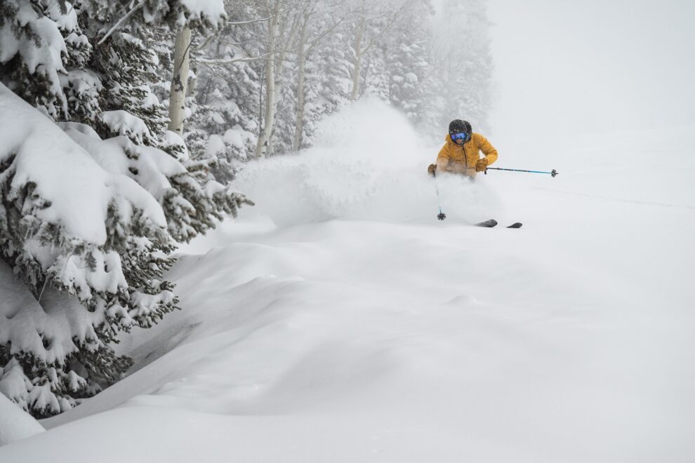
In the Western United States Jackson Hole continues to deliver fresh snow and deep turns.
Jackson Hole Snow Report, Wyoming, USA
View this post on Instagram
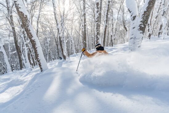
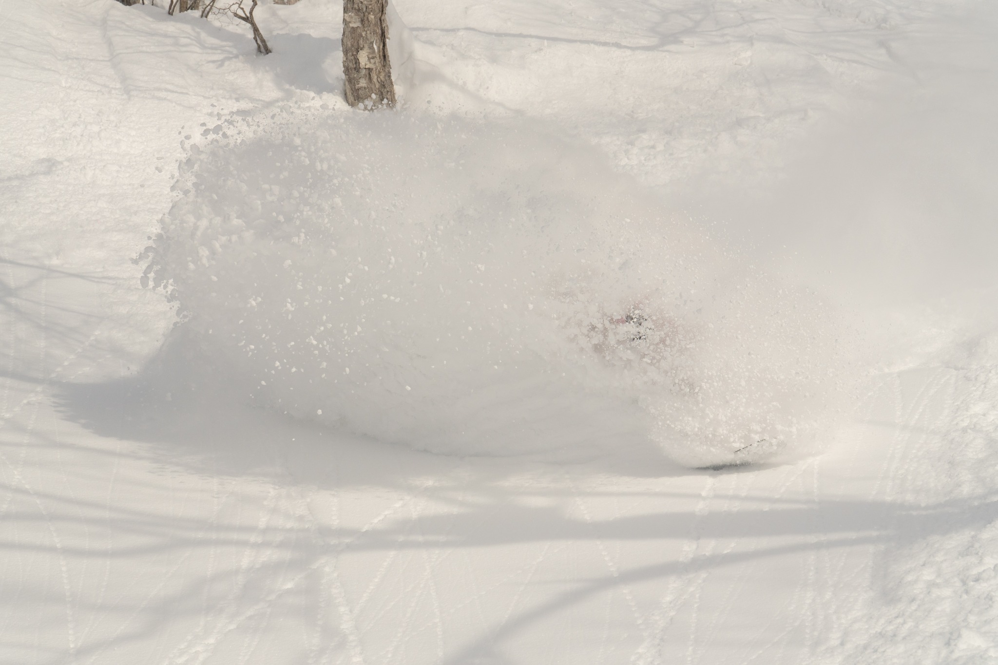
The snow keeps piling up at the resorts on Honshu – the main island of Japan – with lift closures and lift collisions. Be careful out there!
Honshu Snow Report, Japan
View this post on Instagram
View this post on Instagram
World Snow Forecast For The Next 3-4 Days
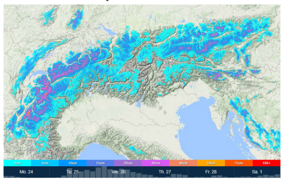
The Alpine resorts of Austria, France, Italy and Switzerland will see a storm moving in from tomorrow evening bringing a welcome 10-20cm of new snow and colder temperatures to most resorts.
It will be a similar situation in Andorra and the French & Spanish Pyrenees with 5-15cm forecast.
Central and Eastern Europe will see below freezing temperatures and 5-10cm of new snow. Krvavec, Slovenia could see 25-30cm.
Further east the Georgian resorts will see temperatures between -5C and -10 C with 15-25cm forecast. Goderdzi, Georgia is forecast to receive 70-75cm.
The Nordic countries of Finland, Norway and Sweden will see freeze thaw conditions and the chance of 5-10cm of new snow at higher elevations. Myrkdalen, Norway is expecting 15-20cm.
The Alberta and British Columbia resorts of Canada will see mixed conditions and 5-10cm of new snow. Whitewater, BC could see 15-20cm.
Temperatures will remain cold on the East Coast with 5-10cm forecast for Tremblant, Quebec.
Most of the western US resorts will see mixed conditions with freeze thaw conditions below mid mountain and the chance of 5-10cm of new snow above that.
The West Coast resorts of California will continue to see clear skies, sunshine, and freeze thaw conditions through Thursday.
Further north the Oregon and Washington resorts will see a major storm front moving through with 20-25cm forecast. Crystal Mountain, Washington could see 60-65cm.
Temperatures remain cold on the East Coast with a further 5-10cm forecast.
There’s a brief respite from the storms for the resorts on Japan’s main island of Honshu and the northern island of Hokkaido with 10-20cm forecast through Thursday. Asahidake, Hokkaido is expecting 35-40cm.
Where To Ski
There will be great skiing all across the Alps during the second week of the Half Term holidays but for new snow head East to Krvavec, Slovenia and Goderdzi, Georgia.
Myrkdalen, Norway will have the best conditions in the Nordic countries.
Have the time to head further afield?
Then head West to Washington State in the United States to ski the resorts near Seattle and Crystal Mountain in the shadow of Mt Rainier.


Add Comment