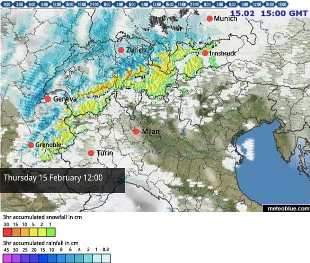
Yuck. It’s been a soggy day in the Alps, with rain up to 2300m in France, and up to about 1500m this afternoon in Austria.
We did know it was coming. The forecast was spot on about the sudden shift from frigid to mild. But all the same, it’s a shame to see the recent, settled spell of wintry weather come to an end.
Fortunately, the thaw won’t last too long, and it will only bite hard in the west. In the east, it’s cooler, with the daytime freezing point expected to bobble around the 1600m mark in Austria for the next few days, compared with 2300m in France. On Saturday, temperatures will start to drop back in France too – and there’s a good chance of a proper chill settling over the region at the end of the weekend, accompanied by snow.
In the meantime, however, it will be murky and wet for another day across much of the northern Alps, and half-terming families may find themselves retreating to the nearest swimming pool once ski school is over tomorrow. In Italy, by contrast, the skies will be clearer, as they were today.
Another feature of the milder weather is the increasing avalanche risk, as the top layer of snow gets wet and heavy, and grows increasingly unstable. The avalanche forecasters at Meteofrance France and the Tirol’s service are warning of spontaneous releases in areas where it’s been raining. The also warn of poorly-bonded layers of snow above the level of the rain as well. Generally, across the north the risk will be at 3/5, which is considerable. Caution is needed if you’re hunting powder.
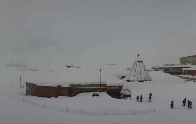
Here’s how it was looking today in Tignes. Not vintage half-term conditions, but there’s a reminder here of how deep the cover is in the French Alps, in the wake of the January storms, and further top-ups over recent weeks.
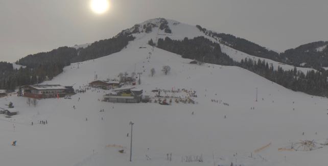
This was the Skiwelt in Austria earlier today, before the clouds came down and things got murky.
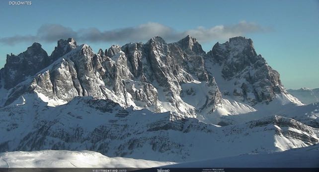
And this, by way of striking contrast, was how the Pale di San Martino looked this afternoon, near Moena in the Italian Dolomites. Sometimes, being on the drier side of the Alps has distinct advantages…
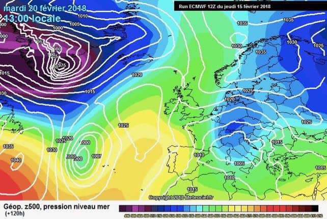
Finally, here’s the ECMWF’s forecast for Tuesday, February 20 on meteociel.fr, showing that useful finger of cold air poking into the Alps. Let’s hope it comes.




Add Comment