


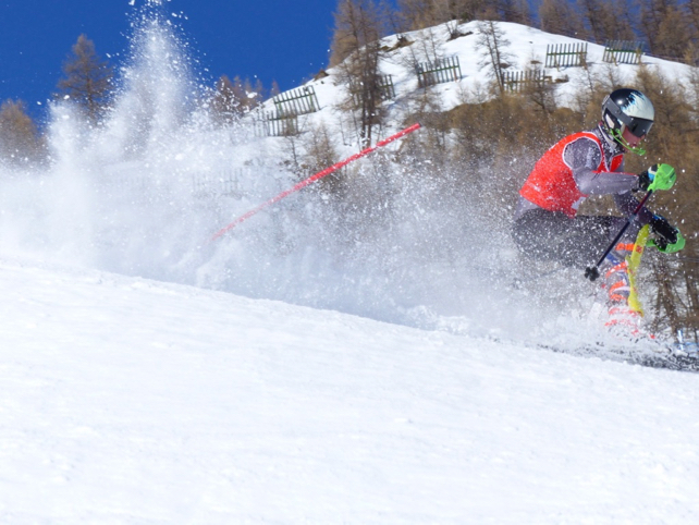
“As the wonderful weather enters its third week, we’re running out of things to photograph,” so said John Yates-Smith of Val d’Isere specialist YSE in his daily post earlier today.
Still, he didn’t do badly with his latest shot of a French skier on the Face de Bellevarde, taken yesterday afternoon.
He does however have a point about the sunshine. The whole of western and central Europe has been basking in an extended spell of cloudless and unusually warm weather, and the Alps have been no exception.
This week, it’s warmer than ever. In Austria’s Arlberg, for example, the forecast for Lech predicts daytime highs of +11C at village level on Wednesday.
Meanwhile, in the French Alps, the daytime freezing point has been above 3000m since Friday, and will stay at that level until Friday. Here too, Wednesday is likely to be the warmest day.
So far, so Easter (or should that be May?). But what’s surprised me about the current warmth is how well the snow cover has held up. You can see in the shot of Val d’Isere, above, that the surface of the snow on the east-facing Face is a little soft in the sunshine. But it’s not a slush pit.
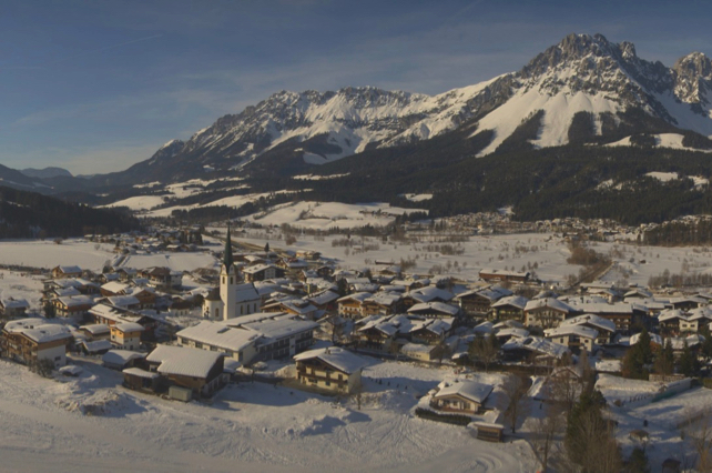
Meanwhile this photo of Ellemau – one of the resorts below the Skiwelt’s plateau – shows how snowy the valleys are looking.
That said, skiers still need to take the warmth into account when they ski – especially on sunny slopes. Above Val d’Isere, for example, MeteoFrance’s avalanche report states that the snow on south-facing slopes is now “profoundly humidified” up to an altitude 2800m at least, and to 2400m on southwest-facing slopes. There are daily wet-snow avalanches on these slopes too.
On cooler, shadier mountainsides, the thaw’s effect isn’t so pronounced – but all the same, off-pisters are likely to find a testing mix of conditions on most descents. It’s best to hire a guide to help you navigate them, so you don’t spend half your day grinding through breakable crust.
Meanwhile, anyone skiing on-piste needs to read our guide to skiing spring snow, and follow the sun around the resort as it softens the cover after each night’s refreeze.
Bear in mind, by the way, that the snow is thinner on the Italian side of the mountains, and off-piste the snowline is unseasonably high. This may change next week, however, as wintry conditions return to the Alps. Currently, according to the ECMWF, both the northern and southern Alps should benefit.
Here’s Meteociel’s ECMWF chart for next Tuesday, March 5. It’s much too soon to be sure of this forecast: but still, it suggests we’re not done with winter just yet.


Add Comment