


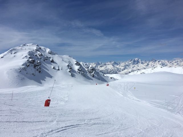
“Where is everybody?” asked my fellow editor, Felice Hardy, when she sent this photo from the French resort of Montgenevre, south of Grenoble. “I thought it was the start of the Easter holidays?”
Elsewhere, the slopes have been busier, but at the western end of the Milky Way ski area, the slopes were “almost completely empty” this morning. The snow was in remarkably soft and grippy, too, given it’s the end of March – and in the sunshine, skiing it was sheer bliss.
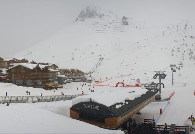
Further north, the skies were not so clear. Here’s how it looked in high-altitude Tignes this afternoon.
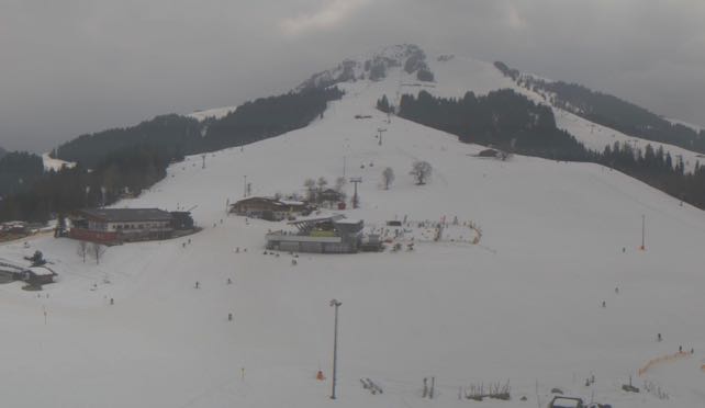
It’s been murky in the Austrian Tirol, too – these were the slopes above Soll in the Skiwelt at lunchtime.
Across the northern half of the Alps, the cloudy theme is going to continue for much of the week, as a series of weather fronts crosses the region. Initially, they’ll be riding in on a westerly airflow, which will keep temperatures respectable for the time of year. The dividing line between rain and snow will bobble between 1200 and 1800m as a result, with Wednesday and Thursday milder than tomorrow.
Here’s tomorrow’s snow forecast.
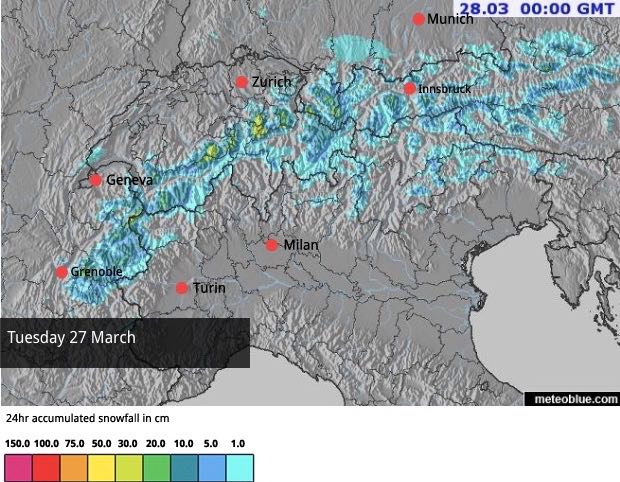
Wednesday’s forecast suggests that the snow will be heavier but also more limited in extent (because it’ll be warmer).
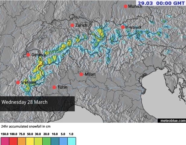
Skies are likely to be clearer in the Italian Alps than in the northern half of the region, and Austria will be drier than France.
Then, at the end of the week the wind will swing into the south-west as a more powerful low-pressure system muscles into the southern Alps from the Gulf of Genoa – before moving into central Europe. Temperatures will rise on Saturday, and there’s likely to be heavy rain lower down and heavy snow higher up. Currently it looks as though the Italian Dolomites, followed by the Austrian Alps, will see the heaviest precipitation: but it’s too soon to be certain of this.
So we’re looking at a very changeable week of weather; and one that’s going to be warmer as we approach Easter. The beginning of next week looks mild too – not outrageously so, but after the cold snaps of the early spring, it’ll be quite a change. As ever at this time of year, the best conditions will be in the higher resorts.
But wherever skiers are based, they’ll have to be ready for all kinds of snow – from wet heavy stuff on the valley runs to fresh powder higher up. Sunshine will intermittent, at best. Meanwhile off-pisters will need to follow local avalanche risk assessments closely. After a mild day last Saturday, the snowpack has consolidated, but the fresh snow (and rain) forecast for the week ahead is likely to increase the dangers.
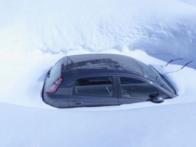
Here’s one sign of the change, from Val d’Isere earlier today, courtesy of John Yates-Smith of YSE. “Cars are slowly reappearing from the snow,” he says “This one has a way to go, though: the snow all around is at least six feet deep, and we don’t think it will be going anywhere before May…”


Add Comment