This week’s snow report was going to be about how we all needed to calm down after the snow in the Alps at the end of August.
After all, there are still three months until the ski season fires up properly in the Alps. And as experienced snow-watchers know, temperatures are likely to yo-yo about all over the place before then. Last week’s heatwave reminded us all of that. It burned off nearly every snowflake that fell ten days ago, and has degraded the cover on the glaciers once more.
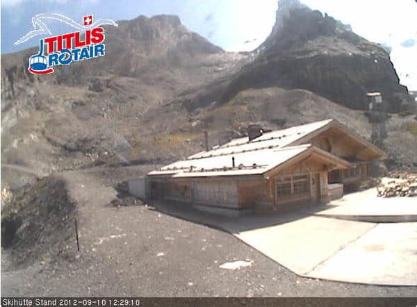
Here’s a graphic demonstration of the power of the September sun. Below is the Stand ski hut above Engelberg last week.
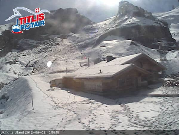
And here’s the same view this morning. It might as well be mid-July up there.
BUT…look what’s coming next.
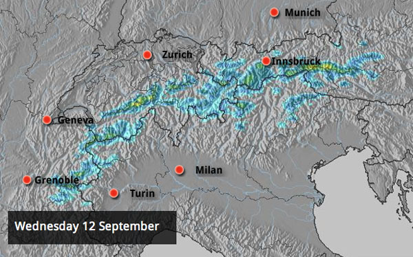
Up to 30cm of snow is expected at altitude, while heavy rain douses the lower slopes. The snow is likely to fall even more heavily on Thursday, especially over the Zillertal, the East Tirol and parts of the Salzburgerland.
Will it stick around this time? Certainly not – except on the highest, north-facing slopes. This is September, and the forecast is for warmer weather to return by the weekend.
But all the same, it’s an encouraging sign – for the start of the season at least. We notice that some mid-range forecasts are suggesting an even colder snap at the end of September: and if a pattern of chilly, turbulent weather establishes itself, then we could (I emphasise, could) see snow starting to accumulate at altitude in the autumn. Don’t book a November skiing trip just yet. But it’ll be worth keeping a close eye on developments over the next six weeks.
Meanwhile, on the other side of the Atlantic, all talk is of the developing El Niño. Last week, America’s Climate Prediction Centre (CPC) downgraded its prognosis slightly – saying that it is likely to be a weak event, and will set in a little later than expected, this month.
El Niño is a Pacific-Ocean climate anomaly set off by rising sea temperatures, and it can have an effect on snowfall in Canada and the USA – just like its sister, La Niña. Broadly speaking, El Niño often produces milder winters in the Pacific Northwest and northern Rockies, and much wetter ones in California and the southern Rockies. The strength of the event does however affect its impact – especially in the eastern US (read this good AccuWeather summary for more).
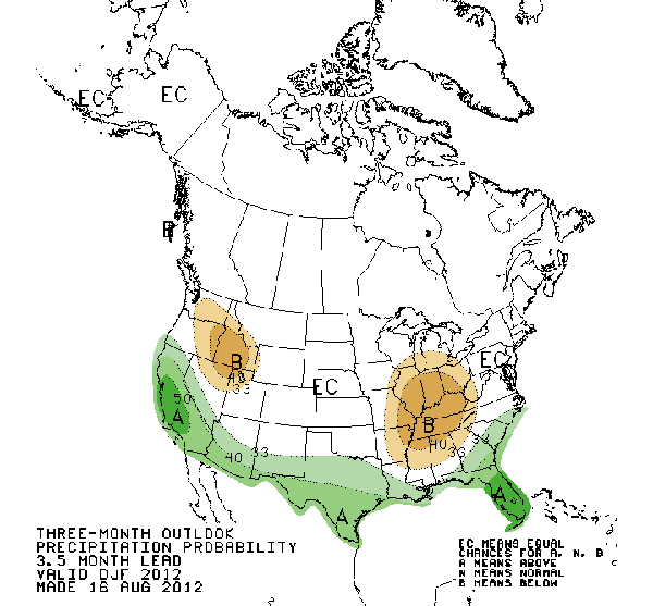
Below is the current precipitation prediction from the CPC for December, January and February. Note that it was made in August and may change later this month – but at the moment, Californian skiers must be pretty excited. All of the state’s ski resorts should get more precipitation than usual – which at altitude means more snow.
And what of the southern hemisphere? It’s getting harder and hearder to concentrate on the other side of the planet, to be honest – but we were delighted to hear last week about British skier James Woods’ win at the first FIS World Cup Slopestyle event in Ushuaia, Argentina (see the video of his run here). Well done Woodsy, and please please please can you do that again??
Snow-wise, in the South American resorts, it’s been a so-so winter. There was a good start, a disappointing middle, then a couple of really useful dumps at the end of August. Most recently, a modest 15cm dump on September 6 has refreshed the slopes. Here’s how it was looking on Saturday in Valle Nevado in Chile.
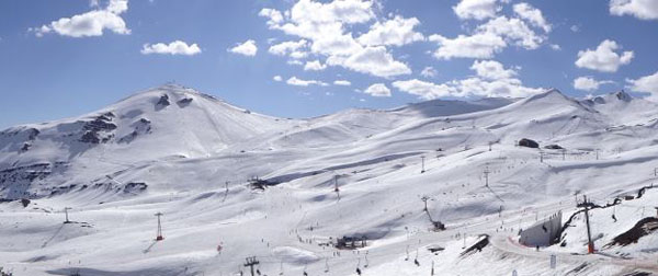
By the way, Valle Nevado was the setting last week for the Swatch Skier’s Cup – a freeskiing competition between a combined North and South American team, and the best of the Europeans. The Americans won – but both teams contributed to the rather lovely backcountry slopestyle highlights video, below.
Meanwhile in Australia, the fantastic conditions of recent weeks in Perisher, New South Wales, have soured somewhat, thanks to gale-force winds and – on occasion – driving rain. But in the midst of all the wild weather up to 40cm of snow fell on the higher slopes. Conditions now are spring-like with the snow softening quickly during the day and refreezing overnight, and the cover is up to 186cm deep.
Here’s today’s video snow report.
Finally, in the south Island of New Zealand, conditions are stormy. Mount Hutt, near Christchurch was closed today because of gale force winds, and The Remarkables, near Queenstown, was expecting to do the same. Both resorts have had fresh snow however – The Remarkables’ snow report records 20cm yesterday and a settled snow base of 60-90cm. Mount Hutt had 15cm on Saturday, and reports cover up to two metres deep.
| France: The glaciers above Les Deux Alpes and Tignes, are currently closed. | |
| Switzerland: Four pistes were open today for summer skiing above Saas-Fee and five pistes above Zermatt. Thanks to the hot weather this week, The cover on the glaciers is thinning again. It’s down to 109cm above Saas-Fee. | |
| Austria: The brilliant September sunshine has spoilt the snow that fell on August 31 and September 1 on Austria’s glaciers. On the Hintertux glacier, for example, the cover is down to 50cm from 65cm last week. However, heavy snow is expected up there on Wednesday and Thursday, which will more than repair the damage. | |
| Italy: Glacier skiing will resume above Val Senales later this month – if conditions are good enough. | |
| Andorra: Andorra’s ski areas are closed. | |
| Western USA: All the mainstream resorts in the US are now closed for skiing. However, there is skiing (and a terrain park) on offer at Timberline Lodge on Mount Hood in Oregon. | |
| Western Canada: The glacier above Whistler is now closed. |


Add Comment