


There’s been a repeat performance of last week’s snowstorm in the south-western Alps. Slightly less snow has fallen: but it hasn’t been quite so warm in the immediate aftermath. Those who were lucky enough to ski it in the immediate aftermath have had a rare old time.
Here’s how it looked above Champoluc in the Monterosa ski area this morning. The area reported 50cm of fresh snow on April 1 and 2.
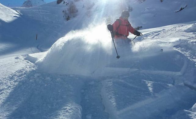
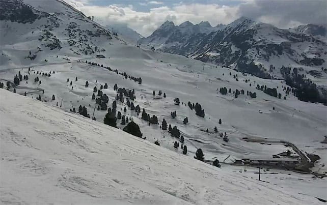
This was the Solaise, above Val d’Isere, yesterday.
Pictured below is Montgenevre yesterday, at the western end of the Milky Way ski area. Children’s racing had to be cancelled because there was too much snow on the course.
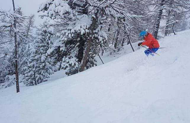
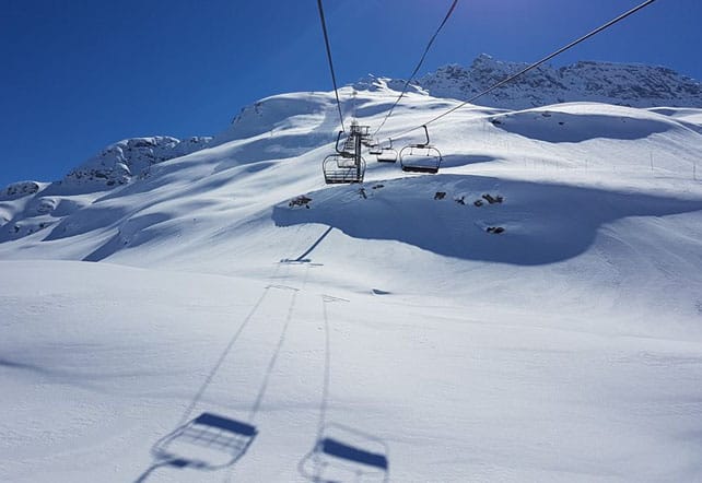
And this is how it looked at little Bonneval-sur-Arc, near Val Cenis, this morning.
Bonneval is one of my favourite small ski villages, and when it’s like this it can feel like your own private ski resort. I have happy memories of a morning skiing snow very similar to this…
What’s striking about this storm is how localised it was. At the southern end of the Haute-Tarentaise (home to Val d’Isere and Tignes) there was 40cm of new snow at the weekend. On the other side of the Col de l’Iseran, in the Maurienne Valley (home to Val Cenis and Bonneval), there was 40-80cm. Meanwhile, Serre Chevalier, further south, had around 15cm of snow. Chamonix, to the north, had just a couple of centimetres.
So while some lucky resorts reported fabulous conditions this morning, the vast majority have been scratching their heads and wondering what all the fuss is about.
We also have to remember that this is April, and as soon as the sun comes out fresh snow starts to moisten and grow heavy. Generally speaking, it’s now cooler this week than last, but with the daytime freezing point at the 2500m mark, even the high-altitude resorts will be suffering. You’ll need to be skiing close to 3000m if you want to find snow unaffected by the thawing process. Otherwise, despite the fresh dump, you’ll need to adopt spring-skiing tactics.
Meanwhile, in the eastern Alps, resorts with most or all of their skiing below 2000m have suffered from this year’s long, mild spring. Austria’s Skiwelt has already closed, and the Ski Juwel is offering only a few skiable pistes today. But at least the big melt-off will slow down in the second half of this week, when a cold front hits Austria from the north, and – for one day at least – the daytime freezing point will be down to 1700m. Nevertheless, this is still the time of year to be skiing high-altitude resorts. Spring temperatures have a habit of bouncing back quickly.
Here’s how it was looking in Kuhtai, Austria today.
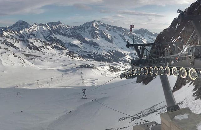
And this was the Stubai glacier yesterday.
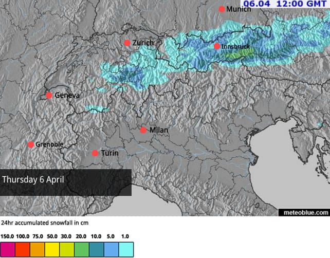
Here’s our latest snow forecast for Thursday, April 6.
Meanwhile, in North America…
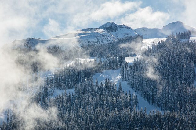
In western Canada, the weather is pausing for breath after a magnificent March – which saw Whistler clock up 320cm of snow in a month. The snow starts again midweek, and there could be another 50cm of fresh on the slopes by Saturday night. Here’s how it looked yesterday, as the sun came out.
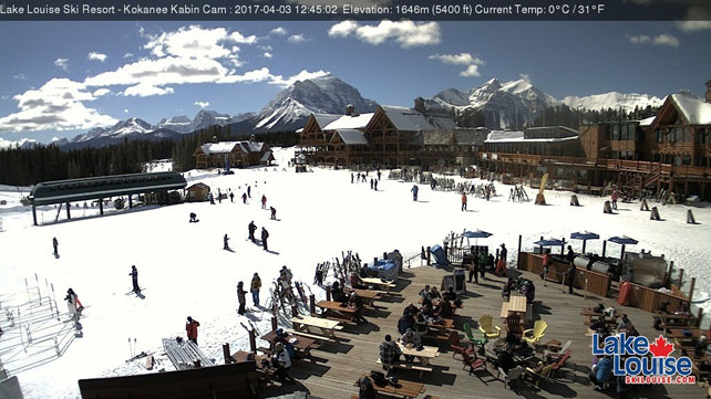
Inland, Lake Louise had a good March, too – although the snow didn’t fall here in anything like the same quantities as in Whistler. The latest storm brought 20cm of snow at the start of the weekend, and the high today will only touch +1C. That sounds like a recipe for excellent end-of-season skiing to me…
South of the border, there was light snowfall on Sunday across many resorts in the American Rockies, and more snow is expected on Tuesday and Wednesday in Colorado. At the end of the week a significant weather front hits California and then moves inland. Everyone is hoping for a powder day this weekend.
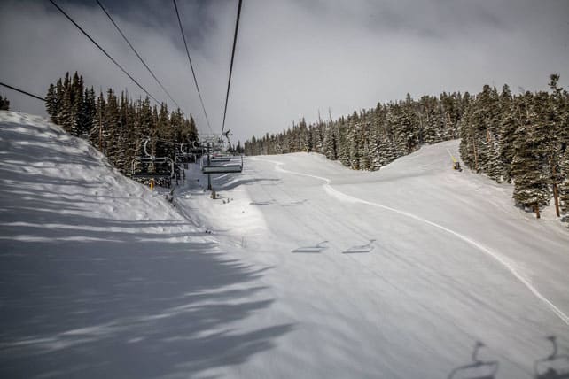
Here’s how it looked in Breckenridge, Colorado with around 10cm of new snow on the slopes this morning.


Add Comment