Well, here’s a surprise. The high pressure currently dominating the Alpine weather is about to slip south for a day – letting in some colder air and bit of snow. We’re not expecting a proper dump, and the snow is likely to fall only in the north-eastern Alps. But it’ll be very welcome in Austria and the resorts of eastern Switzerland.
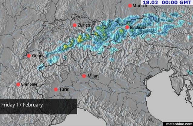
Here’s tomorrow’s snow forecast. As you’ll see, 5-20cm is expected across the Tirol and the Vorarlberg in Austria, with maybe 30cm on the peaks in the Arlberg (home to St Anton and Lech), as well as a few spots in Switzerland. There may be a few flakes in the west, but generally, they’re only expecting clouds.
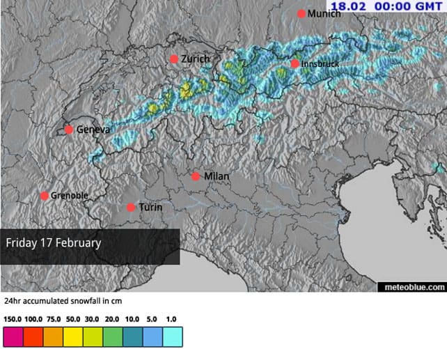
Just as important will be the drop in temperatures. It’s already bit cooler than it was at the beginning of the week – when the daytime freezing point was nudging 2500m. But tomorrow, it should drop to 1300m in Austria and 1500-1700m in the French Alps.
This will slow the effects of the thaw which has taken hold in recent days. Its main effect has been to create a spring-like cycle of daytime melting and overnight refreezing on many pistes below 2300m, especially those facing south.
But in the lower resorts, down at the 1000m level, the impact is more marked. The pistes are still in reasonable nick: but increasingly, they’re ribbons of white against the grass. Which is never a good look in a resort in mid-February.
Off-piste, the risk today is generally 2/5 at altitude in the eastern Alps – where the snow cover is rather thin for the time of year. In the western Alps, especially in the French resorts, the cover is generally deeper, thanks to the heavy snow that fell between February 2 and 6. Here, the avalanche risk tends to be 3/5 – with the fatal avalanche accident in Tignes on Monday standing as a stark reminder of the dangers.
Looking ahead, tomorrow’s weather front will be followed by more sunshine, although it will be cooler. Then, for the end of next week, some of the mid-range models are suggesting a more wintry turn. The one below is from the ECMWF.
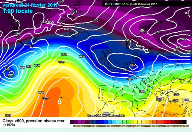
February 24 is eight days away, so this has to be taken with several pinches of salt. But still. Fingers crossed…
As for conditions right now – well, here are a couple of webcams to give you a sense of how magnificent the Alps are looking today.
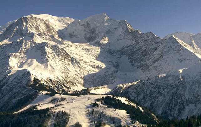
Here’s Mont Blanc, seen from Les Houches, above the Chamonix valley. In the ski areas along the valley there’s currently 75-200cm of snow bedded down, on-piste.
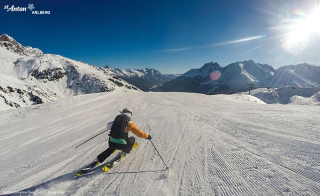
This was St Anton in Austria earlier today. The snow here is 60-135cm deep, on piste.
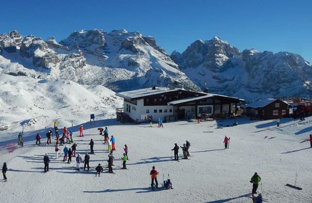
Here’s the view of the Brenta Dolomites from Madonna di Campiglio in Italy. The snow here is 50-90cm deep, on-piste.
Finally, here are the shadows of Wayne and Gill Watson, leading a group of ski tourers to the Col des Fours above Val d’Isere yesterday. (On-piste, Val d’Isere has 91-185cm of cover.
Meanwhile, in North America…
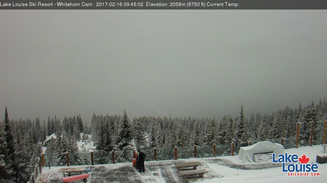
It’s been mild almost everywhere in the mountains of western Canada and the US. Even in Lake Louise, the mercury is expected to hit +4C today. Some snow is expected on the top half of the mountain. Here’s how it looked there this morning.
Generally, temperatures are expected to drop back in Canada over the next couple of days: but south of the border, it will stay quite mild. Two snowy passages are expected – one that will focus on southern California and the southern Rockies and another, starting on Sunday, which is likely to bring heavy snow to northern California and the Pacific Northwest, before moving into the Canadian Rockies. 60-150cm are expected in the Tahoe resorts next week.
And finally…
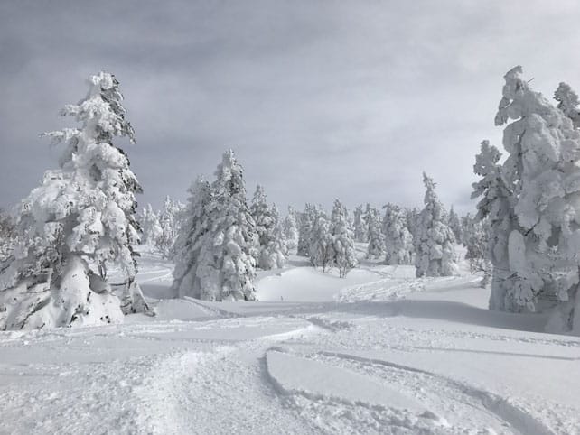
We’ve had some photos in from Richard Lumb of Kaluma Travel, who is currently on a “research trip” in Japan. Sitting at my desk, with my legs going slightly numb, I find them strangely upsetting. I can’t think why…





Add Comment