


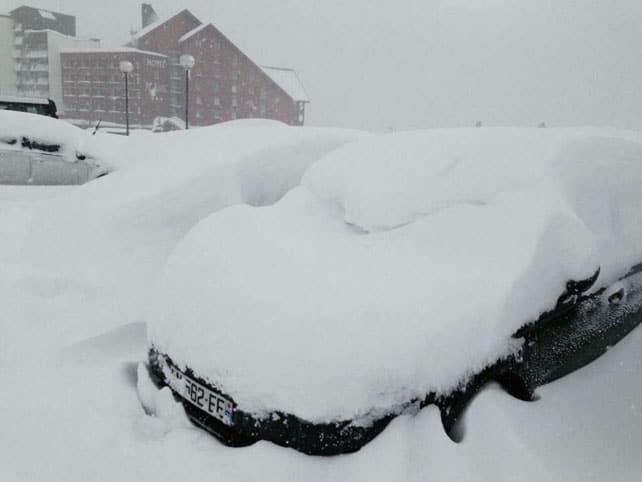
A busy four-day spell of weather has left nearly 80cm of fresh snow in parts of the western Alps. The French resorts in particular have done well – but there’s been snow right across the region, including the Italian Dolomites.
Some of deepest accumulations are in the Chamonix valley – where, according to Meteofrance, 75cm of the white stuff fell between Thursday and Sunday night. Alpe d’Huez, south of Grenoble, also racked up 75cm, with about 70cm in the Three Valleys and 60cm in Val d’Isere. All these resorts got more snow today. It hasn’t been so heavy, but it’s likely to have brought the five-day total to 80cm in places.
The snow has settled at low altitudes, too: there’s snow down to village level in Morzine again, for example, even on south-facing slopes. Higher up, the off-piste avalanche risk is generally 3/5 – down from a very dangerous 4/5 yesterday, but still significant.
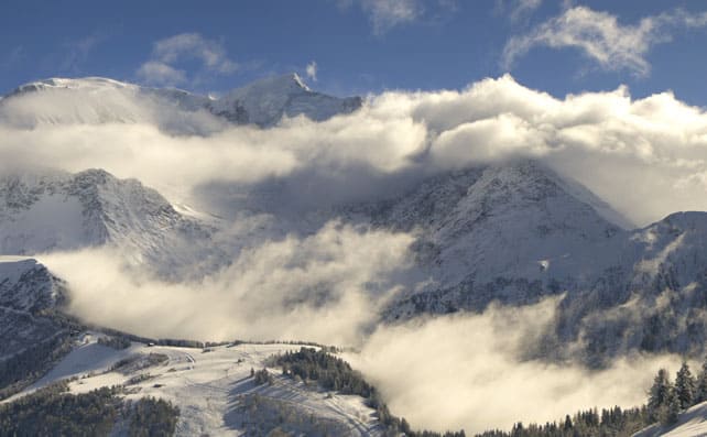
This was how the Mont Blanc massif looked this afternoon as the clouds began to lift in the Chamonix Valley.
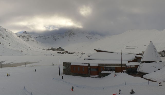
Here’s how it was looking in Tignes this afternoon – the resort shares its ski area with Val d’Isere.
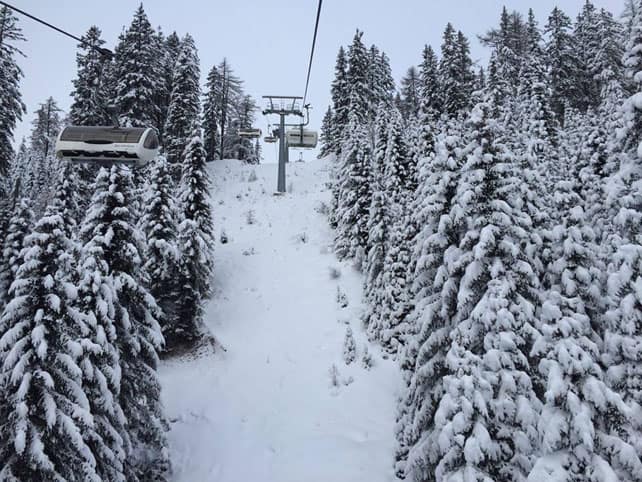
And this was Serre Chevalier earlier today. 45-65cm of snow has fallen here in recent days.
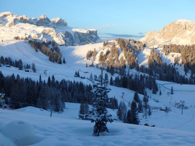
Parts of western Switzerland also saw 50-60cm of fresh snow, and it’s been snowing heavily in some Italian resorts, too: this morning, Madonna di Campiglio in the Brenta Dolomites reported 50-70cm of snow across its slopes.
This was Madonna di Campiglio yesterday.
One of our editors, Peter Hardy, was skiing in San Cassiano in the Dolomites at the weekend, and reports that “the new cover is very welcome. But what is quite remarkable is that the skiing was already superb. Thanks to some extraordinary snowmaking and expert grooming, over 1000km of pistes in and around the Sella Ronda have a pebble-free base of half a metre of man-made stuff. The new cover is simply icing on the cake.”
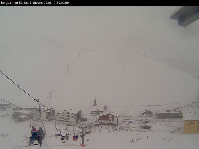
Austria generally had less than France from this sequence of storms, but it was snowing overnight and continued today, with up to 30cm expected in 24 hours.
Here’s how it looked in Kuhtai this afternoon (the resort is again the host of the Channel 4’s The Jump).
And this was the snow in Alpbach this morning.
A little more of the white stuff to come
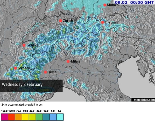
The really heavy snow is now at an end, but we’re not quite done with the white stuff just yet – as you can see from the February 8 snow forecast, below.
In the west, the daytime freezing point will be at 1000m on Wednesday. In Austria it’s likely to be at 1500m. Thereafter, drier and progressively milder weather is on the cards.
Meanwhile, in North America…
.
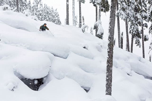
The situation is mixed in the resorts of the western Canada and the US. There’s been snow in many areas, and in Canada the white stuff has been mixed with low temperatures. Yesterday, for example, Whistler reported 64cm of snow in 48hrs, and is expecting a high of just -13C on its slopes today. So the powder will be staying soft and fluffy for a while yet. Another dump is expected there on Thursday.
Here’s how it was amongst the trees yesterday.
There’s been snow south of the border too – and a lot more is expected over the coming week. But here, the temperature will also be rising sharply. In the resorts of Lake Tahoe for example, snow on Sunday night will be followed by howling winds (up to 90mph on the peaks) and heavy rain – up to 9,000m for a time (which is above the top lift at Squaw). Fortunately, a cold front will bring snow again on Thursday night.
There’ll be heavy snow inland as well: parts of Utah could see 90cm at altitude, and parts of Colorado 60cm, but it will be mild, too. In Colorado, most resorts are high enough to avoid the rain (except at village level), but even so the snow will be unusually wet and heavy for the Rockies.
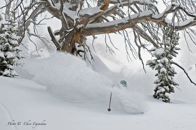
Up in Wyoming, there’ll be a mild spell, though it probably won’t be so pronounced as in Colorado and Utah. Up here, Jackson Hole reported 53cm in 48hrs yesterday. Here’s the great Tommy Moe on Saturday…


Add Comment