


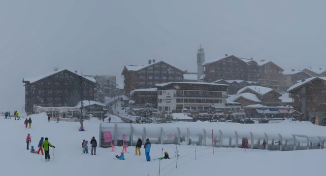
It’s been snowing again across the northern Alps.
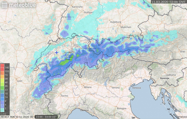
In France, the forecasters at Meteo Chamonix expect 25-30cm of the white stuff over Chamonix, and 15-20cm over Val d’Isere and Tignes by the time skies clear tonight. Note that this is at an altitude of 2200m or above: because lower down rising temperatures have brought rain as the storm has developed.
Meanwhile, in Austria’s Tirol, 20-30cm is expected – and maybe more in St Anton. However, rain will be falling below 2000m at the end of the storm.
Here’s Meteoblue’s 24hr snow forecast to 3am tomorrow morning.
Then, we can expect sunshine and spring-like warmth. Both tomorrow and Thursday, the daytime freezing point in France is expected to be at 3000m.
As a result, anyone who wants a crack at the latest delivery of powder will need to be quick – before the March sun gets to the snow and makes it dense and heavy. They’ll also need to take account of the considerable avalanche risk. The danger level is up currently at 3/5 across much of the northen Alps. What’s more, the sunnier mountain faces will shed their loads of fresh snow tomorrow as they warm up, so the situation will become more volatile for a while before the new cover settles. It’s best – as always – to hire a guide.
That said, tomorrow morning will be gorgeous at altitude, once the sun comes out. Piste skiers should start early to get the best of the “winter” conditions and then switch to spring-skiing tactics as the weather warms up. Even Val d’Isere is expecting a daytime high of +10C tomorrow. So stay as high as you can.
The northern Alps are due another top-up on Thursday night. To start with, the precipitation could fall as rain up to 2600m. But it will get colder as the storm progresses, and the snow is expected to settle down to 1700m overnight.
After a cloudy weekend, and fairly cool temperatures, the mid-range forecasts suggest a more sustained period of mild sunshine next week. With excellent cover across the northern Alps, a balmy week of piste skiing awaits. It’s just a shame so few people will be out there to enjoy it…


Add Comment