


It’s the best day of the season so far across much of the north-eastern Alps. Temperatures are low, the sky’s clear, and there’s fresh, soft snow on the slopes right down to valley level.
This photograph from the Skiwelt in Austria sums the situation up nicely.
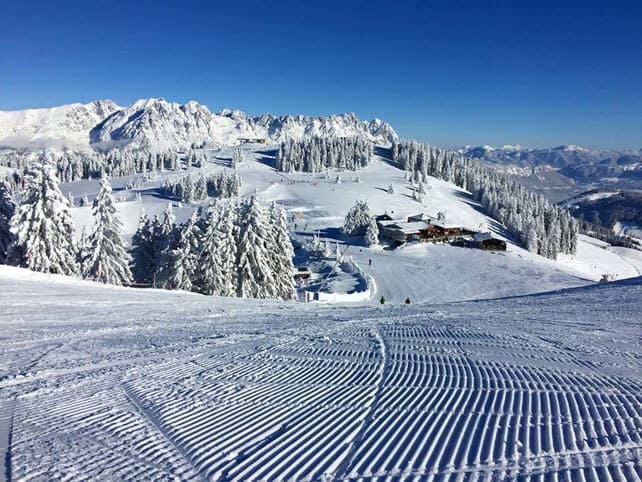
Like many of Austria’s ski areas, the Skiwelt missed out on much of the heavy snow that fell in first half of January in France and Switzerland. But late last week, the weather patterns shifted slightly, and it got the snow it needed. Now the cover is 50cm on the valley runs and 70cm higher up. Top temperature today at village level today was -8C.
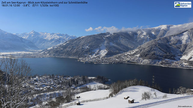
Meanwhile, further east, in Zell am See, there’s excellent top-to-bottom cover, too (although you’ll notice that despite the cold, the lake hasn’t frozen over yet).
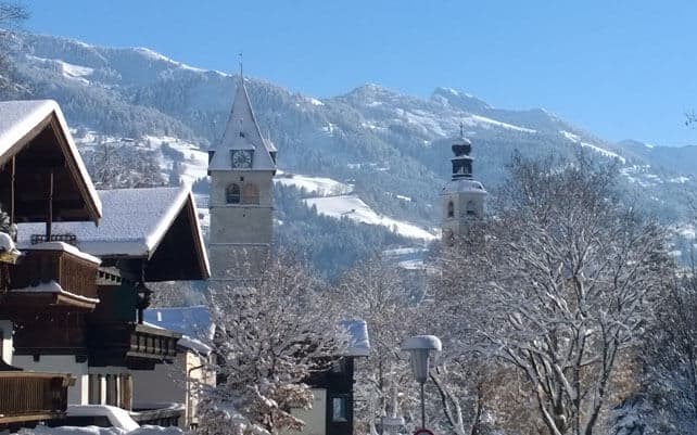
Here’s how it was looking in Kitzbuhel this morning. Perfect timing for the coming Hahnenkamm weekend…
And this is the scene in St Anton am Arlberg earlier this afternoon.
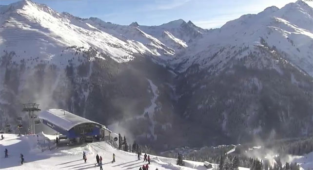
The Arlberg has caught a lot more snow than most Austrian ski regions lately, and in St Anton, the snow is 75-165cm deep on the pistes. The avalanche risk stood at 4/5 this morning. Elsewhere in the Tirol, the risk stands at 3/5, which is still considerable. “Slab avalanches continue to be easily triggerable, even by minimum additional loading,” says today’s avalanche bulletin.
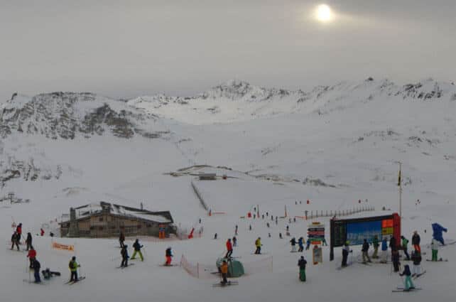
Further west, there’s generally more snow, which is no surprise given how unsettled the weather has been over the last 17 days. The scene is utterly transformed from the threadbare conditions endured over Christmas and New Year. Here too, the avalanche risk is still 3/5.
Pictured below is how it’s looking in Val d’Isere this afternoon, where the cover is 103-190cm deep. Top temperature at 2000m today was -8C.
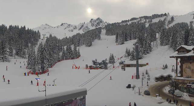
Here’s the scene in Courchevel, which has also had loads of snow in the last fortnight. The cover here is 109-193cm deep.
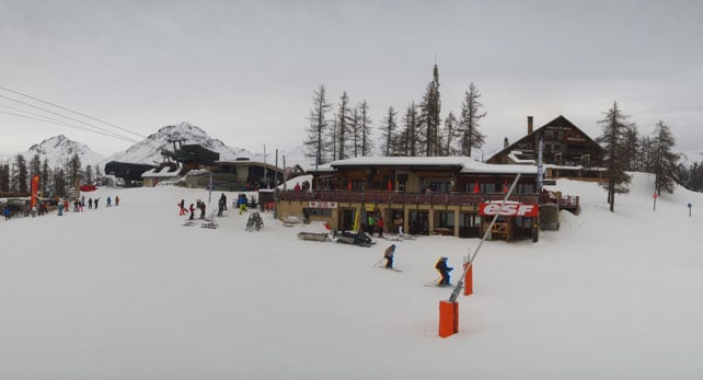
And pictured below is Serre Chevalier, which has had less snow than its neighbours in the north, but can still report a respectable 87-110cm on its upper slopes, though the snow is much thinner on the valley runs.
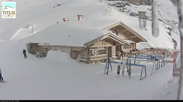
Meanwhile, here’s how it’s looking in Engelberg in Switzerland, where the snow is 80-310cm deep.
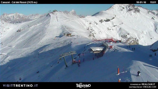
In Italy, the cover is much thinner. Sadly, not many of the early-January storms made it into the southern Alps, although the Aosta Valley did catch a few. Last Monday, the resorts of the Dolomites also saw light to moderate falls – so at least the scene is rather more wintry than it was. However, the resorts are still heavily dependent on their snow cannons for cover.
Here’s how it’s looking above Canazei this afternoon, where the on-piste cover is 25-60cm deep.
As you’ll see from our snow forecast for the Alps some light snowfall is expected across the region over the next three or four days, but it’ll be nothing like the dumps we’ve seen recently. What’s more, it looks as though our old friend high pressure will become increasingly assertive. There’ll be plenty of sunshine, and temperatures will slowly climb until, by the weekend, it will be rather mild for the time of year.
Meanwhile, across the Atlantic…
The weather is getting interesting again after a relatively quiet start to 2016. In Snowbird, in Utah, for example, they notched up around 50cm of snow on Friday and Saturday. In Colorado, Vail’s had 48cm, and in California Kirkwood has reported 84cm of snow in the last week (although the latest storm was a bit soggy). North of the border, Whistler reports 33cm of snow over the weekend. It looks as though there’s plenty more to come this week, too!
I’ll be back with a full snow report on Thursday.


Add Comment