What a way to see out Halloween, Snowfiends. If you want to give yourself a thrill, check out the snow forecast for the coming week from our old friends Meteoblue in Switzerland.
At the start of the month, the central and eastern Alps had a very useful high-altitude dump of snow. I was one of the beneficiaries, when I skied fresh, soft and deliciously grippy pistes on the Hintertux two weeks ago. But if the current forecast is anything like accurate, that snowfall will be nothing compared to what happens next.
Two separate weather fronts are predicted to cross the region in the next four days. The first arrives tonight, and will move steadily eastwards on Monday. Then, just as it clears out of Austria, a second, more protracted and complex weather system will arrive in the French Alps. It’ll favour the southern side of mountains for a while, before jumping over into Austria and exiting northwards.
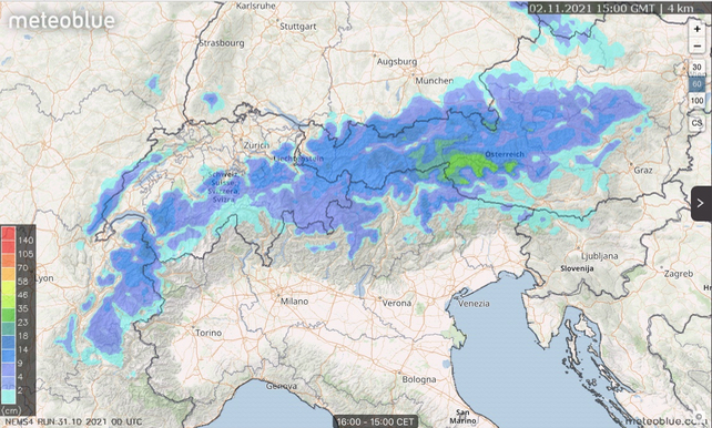
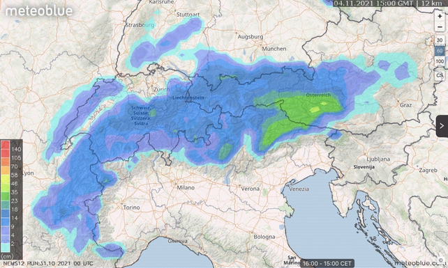
The image at the top of the page shows you how much snow is expected to fall in the 24-hour period to 3pm on Tuesday. The one below shows the 24-hour period to 3pm on Thursday. The scale on the left of the Meteoblue maps gives you an idea of the accumulated snow depths.

This is only snapshot of what will be failing – on two days of a generally snowy week. But it’s already clear that parts of Austria – notably the Osttirol and the Stubai, Hintertux and Kitzsteinhorn glaciers – are going to be walloped by well over a half a metre of snow. Some places could see double that.
Things may get hairy for a while. Watch out for road closures and a soaring avalanche risk. But once the sun comes out and the cover settles, conditions in the glacier resorts are going to be superb.
So if you get the chance, grab your ski boots and get up there. The first turns I had out on the Hintertux 13 days ago were pure, unalloyed joy. Chances are, you’ll feel the same way.


Add Comment