


Since the end of January, the weather in the northern Alps has swung between extremes. One minute, the region is engulfed in stormy, snowy weather. The next, it’s mild and sunny.
This week is no exception. This evening, a spell of wet weather will cross the region. It’ll start fairly mild and soggy, with rain falling as high as 2000m. But as the night wears on, and the snow spreads eastwards, the snow will settle down to 1300m.
A snow/rain line at 1300m is still pretty disappointing for mid-February, but it’ll be cooler for a couple of days after that, with more of the white stuff expected on Wednesday night. For a time, it will fall down to 800m.
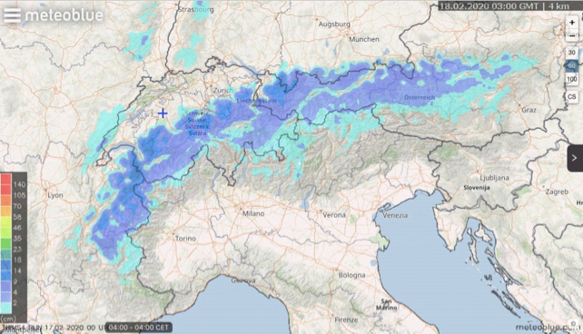
We’re not expecting vast amounts of snow from these two storms – 10-20cm in the French Alps tonight, for example and 5-10cm on Wednesday night.
Here’s Meteoblue’s 24hr snow forecast to 4am on Tuesday.
And this is the 24hr snow forecast to 1am on Thursday.
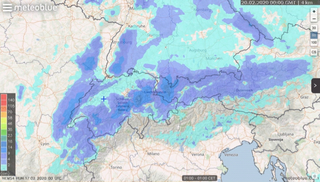
In keeping with the trend of recent weeks the Italian Alps will see very little of this snow.
Then, it’s going to warm up – again. The daytime freezing point will jump to around 2500m. That’s not as mild as it was over the weekend just past (when it was at 3500m, the kind of level you’d expect at Easter): but it’s likely to rise further on Saturday and Sunday.
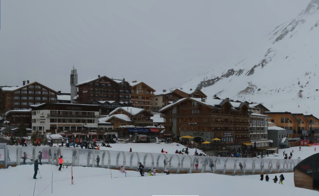
In other words – in the short term you can expect fresh cover on-piste in France, Switzerland and Austria, with gorgeous conditions at altitude when the sun comes out.
However, you will find the skiing trickier below the 2000m mark than above it, because the lower pistes (which are currently being soaked with rain), will harden up once temperatures drop. They will eventually get a coating of soft, fresh snow tonight, but it’s going to be quite thin. So ski them first thing on Tuesday and Thursday morning before the half-term traffic scrapes away the good stuff.
Off-piste, the avalanche risk will be considerable after the fresh snow has fallen, but even so, you’ll need to ski at altitude and on north-facing slopes to find consistently wintry conditions.
After that, expect a spring-like pattern of daytime melting and night-time refreezing to take hold on all but the highest and shadiest pistes.
Let’s hope we get a spell of more consistently chilly weather before spring gets a proper hold on the region in March. There is some hope of that in the mid-range weather forecasts. But I wouldn’t bank on it. If you’re planning anything other than a last-minute ski trip, aim for a high-altitude resort in the northern Alps for the best chance of skiing soft, wintry snow. Even if that means you may have to sit out the occasional stormy spell.


Add Comment