More snow is coming to the Alps.
It won’t be the proper dump that made the beginning of November such a marvel – dropping 90cm on some of the Austrian glaciers and settling at valley level for a time. But after mild and windy weather since Wednesday, it’s going to be welcome all the same.
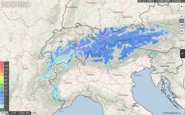
As you can see from Meteoblue’s snow forecast for the 24 hours to noon on Sunday, the snow’s going to be focused on the eastern half of the Alps to start with. The Dolomites, the Austrian Tirol, the Salzbergerland and the Engadin in Switzerland should see most of it. We’re not however talking about more than 20cm.
Winds from the south will strengthen afterwards, too, which is going to blow the new snow about on exposed slopes and ridges. So we can’t expect an immediate return to the spectacular conditions – cold, stable and sunny – I enjoyed on Monday and Tuesday on the Hintertux in the Tirol.
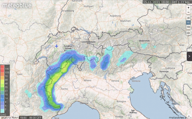
In fact, in the short term we should look to the south-western Alps for the deepest snow. Here’s Monday’s 24hr snow forecast from Meteoblue. Up to 50cm could fall over parts of Italy – with heavy rain lower down.

This is a great forecast for Cervinia and Zermatt on the Swiss-Italian border. Both are open already and we’ll probably see lots more new terrain opening up there once the new snow has settled.
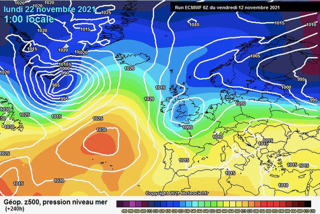
The weather’s going to quieten down for a time after that, and the generally mild theme will continue. But there’s a chance conditions will start to turn colder in nine or ten days’ time. Although it’s much too early to be sure of it. Here’s the ECMWF chart from Meteociel for November 22, just to get us all hoping…


Add Comment