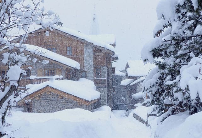
Up to 90cm of snow has fallen across the Alps, thanks to a storm that blew in on Tuesday and lasted in some places until this morning.
There’s more of the white stuff in the forecast, too. A sharp thaw is on the cards tomorrow, but the weather will turn wintry again at the weekend, with heavy snow expected in some areas on both Saturday and Monday.
Here’s Saturday’s snow map – suggesting the central ridge of the Alps will see the heaviest falls, along with resorts south of Grenoble in France, as well as the Aosta Valley and the Dolomites in Italy, and the Jungfrau and Engadin Valley in Switzerland.
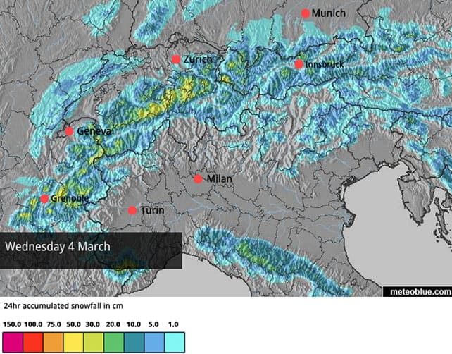
The eastern half of the Italian Alps should see moderate snowfall on Sunday, and then on Monday, the French Alps are in for another decent dump.
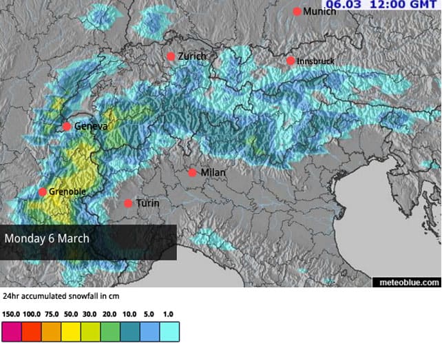
But let’s get back to the snow that’s already fallen…
The French Alps have had the heaviest snow so far
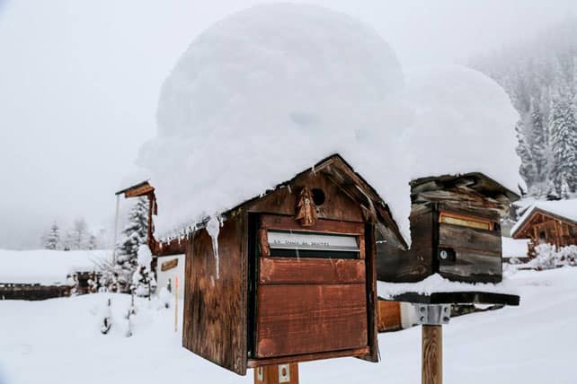
It looks as though the Chamonix Valley has had the most snow so far this week. The picture above was taken in the village of Montroc earlier today – east of Argentiere. Up high, the Meteo France avalanche service reckons on 90cm of the white stuff so far.
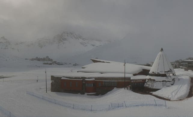
The Haute Tarentaise (home to Val d’Isere and Tignes) has done very well, too. Here, there’s been around 75cm so far. The photo at the top of the page was taken by John Yates-Smith of YSE in Val d’Isere during the storm. Pictured below was Tignes at lunchtime, during a break in the clouds.
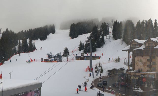
Meanwhile, this was Courchevel in the Three Valleys this afternoon – where low cloud has brought patchy visibility today. There was 55-60cm of snow at altitude during the storm, and the cover here is now 121-166cm deep, depending on altitude.
Further east, there was less snow, and the skies cleared more quickly. Western Switzerland saw 30-50cm, but in the east 10-25cm was more normal. In the Austrian Tirol, the Arlberg (home to St Anton and Lech-Zurs) had 20cm, and most other areas 10-15cm.
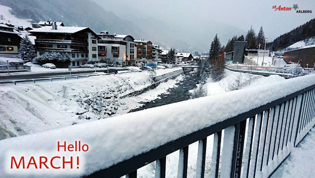
Here’s how it was looking in St Anton yesterday.
In Italy, La Thuile – which hugs the border with France in the Aosta Valley – had 50cm of fresh snow up top, and Madonna di Campiglio in the Brenta Dolomites reported 40cm.
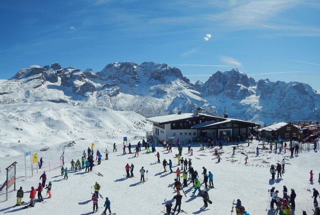
This was Madonna di Campiglio at lunchtime today.
In the main area of the Dolomites the snow was more sporadic. In the Val di Fassa (home to Canazei), there was 5-30cm of snow.
One feature of the storm just gone was the wind. On Tuesday especially conditions were pretty wild at altitude, and a lot of snow was blown around. Exposed slopes were scoured, sheltered gullies have been swamped – and, off-piste, there are unstable cornices and windslabs all over the place. The avalanche risk is 3/5 in many places, and there are warnings even gentle slopes can easily be triggered. Caution is essential if you’re skiing off piste. So is a guide.
Now, temperatures are rising. Already the snow in the Chamonix Valley is wet and heavy below 1800m, and the thaw is quickly gathering strength. In the French Alps the daytime freezing point will be up to 2500m for a time tomorrow. In Austria it will hit 3000m on Saturday.
The mercury will drop back when the next weather fronts arrive: but still, these see-sawing temperatures are worth bearing in mind. Yes, there’s a lot of snow about at the moment, but if you want to enjoy it at its best, you need to be in a resort whose slopes touch 3000m or thereabouts. Check out our guide to the best resorts for spring skiing for some ideas.




Add Comment