February will get off to a flying start across the northern Alps, with heavy snow (and, at times, high winds) expected for both Austria and Switzerland.
The French Alps are expecting light to moderate accumulations.
That’s the forecast this morning as the first of two weather fronts pile in from the northwest. It’s already snowing in parts of the French, Swiss and northern Alps, with the first storm expected to blow itself out tomorrow morning.
The second front, more powerful than the first is due in on Tuesday night. Like the first it will drop snow right across the northern alps, but again it will favour the central and eastern parts of the region.
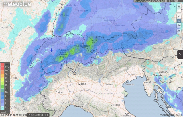
You can see Meteoblue’s 24hr snow forecast to 1am Central European Time tomorrow, (February 1) above.
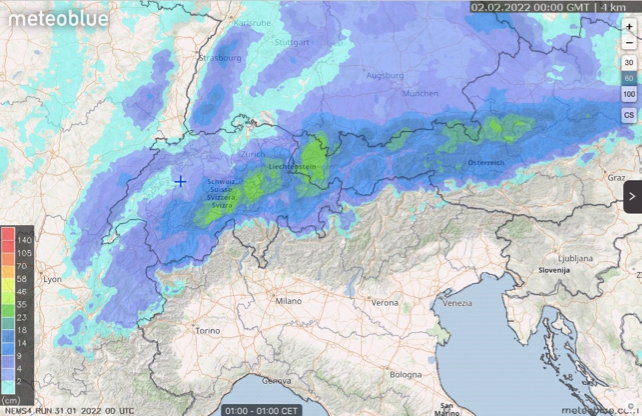
Pictured below is the 24hr snow forecast to 1am on February 2.

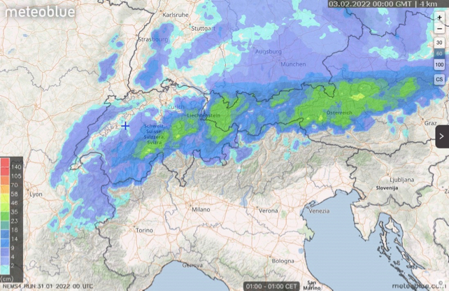
And – saving the best till last – this is the 24hr forcast to 1am on February 3.

There’s a bit more to fall in Austria after this, but not much. But by that time St Antonin the Tirol should have picked up 40-70cm. Little Warth at the northern end of the Arlberg ski area (which it shares with with St Anton) could get 60-100cm. Andermatt in Switzerland will do well too, with 40-70cm. Elsewhere, in Switzerland and Austria, 25-50cm is more likely while in France 15-30cm is more likely.
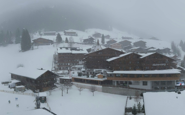
This was how it looked at Inneralbpach in the Ski Juwel ski area in the Austrian Tirol this morning.

There will be snow on the peaks just beyond the Italian border too, in resorts such as Cervina – and a dusting in the Italian Dolomites resorts. Here, Corvara is due a 5-10cm top-up to add to the work of the snow-cannons. On piste on the Sella Ronda the snow is currently 30-60cm deep.
More snow is expected across the northern Alps at the weekend. But once again it’s going to favour Switzerland and Austria, which have had the lion’s share of snow since the New Year.


Add Comment