At last! Here’s the kind of snow forecast for the Alps skiers have been waiting for since the start of December.
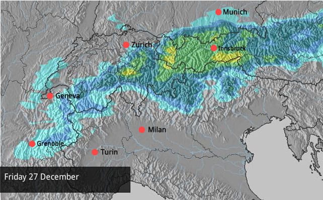
This forecast is for tomorrow, too – so there’s a very good chance it will actually come to fruition: with half a metre of snow expected in the Franch Alps, and temperatures low enough to allow it settle in the valleys, too. French forecaster Meteo Chamonix reckons the snowline will be down to 1000m.
The western end of Switzerland, including Verbier, should see heavy snow too. It’ll be much lighter in the east and in Italy at first, although on Sunday moderate accumulations are expected in eastern Switzerland and Austria.
Of course, skiers are heaving a huge sigh of relief, although the sudden arrival of heavy snow is likely to cause considerable disruption tomorrow, which is changeover day for many holidaymakers. Let’s hope the Alpine airports will be able to cope with the change in the weather.
There’s been some snow already in the Alps this week. Austria saw 5-10cm yesterday, and there’s more expected today. Here’s the Boxing Day forecast.
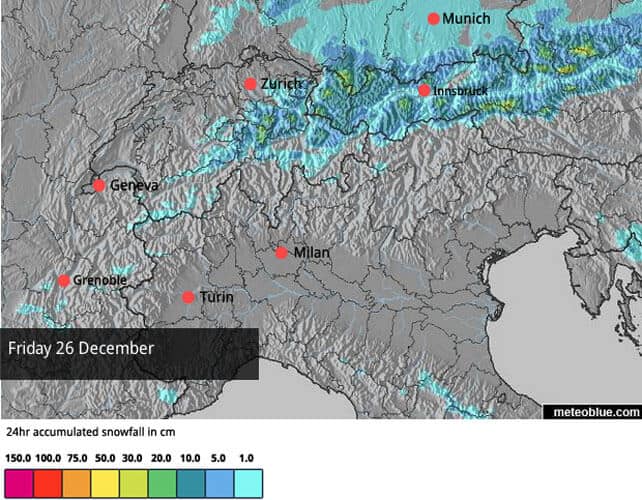
The Tirolean avalanche service reckons that 15-25cm will have fallen on the northern resorts by first thing tomorrow, with 5-10cm in those resorts closer to the Italian border. Just as important has been the drop in temperature, which has allowed snow cannons to run in unison with Mother Nature.
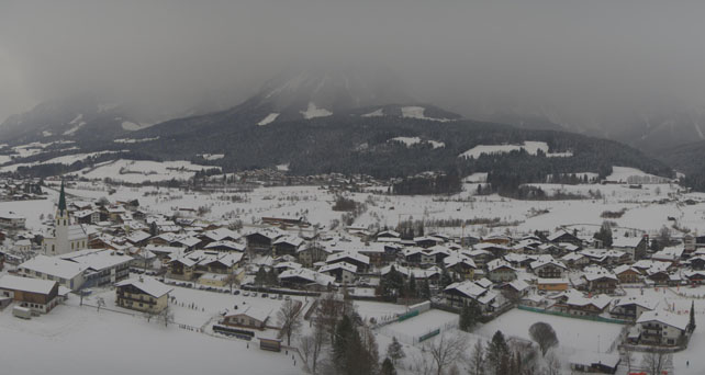
Here’s how it’s looking in Ellmau in the Skiwelt this afternoon: a dramatic transformation since the start of the week. Top temperature there today is expected to be -9C.
Pictured below is the scene in Lech today.
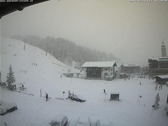
Most resorts in Austria still have only a fraction of their pistes open: in the Skiwelt, 57 out of 280km of pistes are skiable. But there’s a good chance – if the snow falls as expected – that the situation will change dramatically over the weekend.
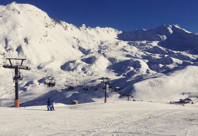
Meanwhile, pictured below is the Solaise above how Val d’Isere, where two of our editors have been skiing this week. There’s no sign of the coming storm just yet: but the temperature today was -10C. 55% of pistes across the Espace Killy (which Val shares with its neighbour Tignes) are currently open.
However, it’s worth noting at this point that the weather may not stay cold for the whole of next week. There’s a lot of mild air still hanging around over the Atlantic, and sometime around New Year’s Day, it’s likely to come drifting back, courtesy of an area of high pressure. So it’s a good idea to target a resort with plenty of altitude if you’re planning to ski in the next ten days. (Saturday update: the latest forecasts are now predicting intense cold for the next four or five days, but a milder, sunnier start to 2015 is still on the cards.)
There’s been more snow in the Rockies
For skiers, it’s been a very festive week in the American Rockies.
You may have already seen mouthwatering video from Breckenridge, showing the conditions on Monday. The Colorado resort claims 89cm in the last week.
Meanwhile, Beaver Creek in Colorado has had 41cm overnight, and has clocked up 81cm in the last seven days. In Utah, Snowbird has had 45cm of fresh snow in the last two days, and in Wyoming, Jackson Hole has had 25cm since Christmas Eve. According to local forecasters in Colorado and Utah, more snow is expected over the weekend, accompanied by very low temperatures, so frigid days of ultra-light powder lie ahead. For the local freeride population, that sounds a lot like heaven…




Merry, merry Christmas Sean thanks for all you reports over the year. I’m out to Cervina Jan 4th – excited already. Hope to see you soon, all the best for 2015. Rob & Lucy
Weather report correct. 40cms so far today in Megeve and mega off piste….even if it did take me 30 mins to find planks after a great faceplant…snow not quite deep enough yet to bury wire fencing.