


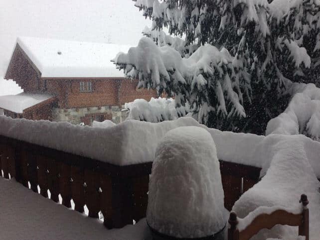
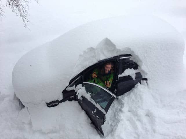
Over half a metre of snow fell at the weekend in many parts of the northern Alps, and in France especially it caused chaos, coinciding with one of the busiest holiday changeover days of the season. It was estimated that 15,000 cars were stuck on the roads at one point. Some holidaymakers reported spending eight or nine hours in transfer buses, before being moved to local gyms and town halls – which were serving as emergency shelters. For those caught in the gridlock it was a miserable start (or finish) to their holiday.
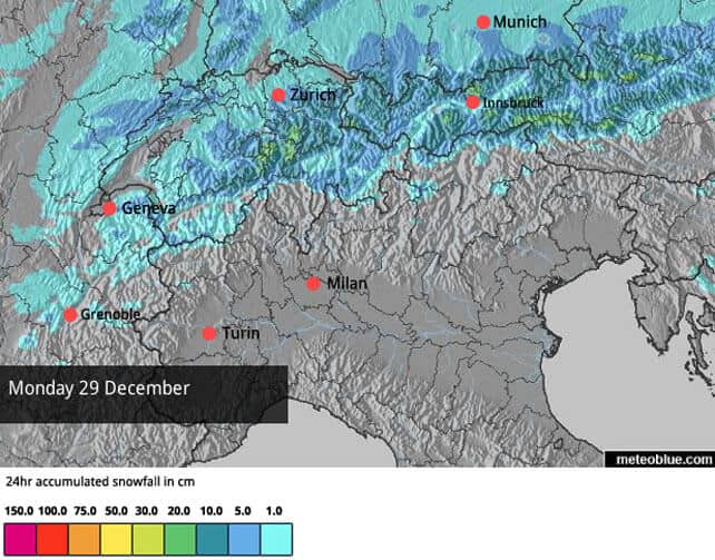
More snow is expected in Switzerland and Austria this afternoon – although not in quite the same quantities as at the weekend – and the white stuff will continue to fall in Austria until Wednesday. By contrast, the French Alps will see only a sprinkling, and in Italy, it’s likely to stay dry. Here’s today’s snow forecast for the Alps.
Needless to say, the snow has made a huge difference to the skiing conditions almost everywhere, although the avalanche risk has now risen significantly, to 3/5 in many areas. The risk above 2000m is acute; not only because the new snow is not bonding well with existing cover, but also because of the wind, which has created unstable slabs of snowdrift on top of the freshly-fallen snow (there’s a good explanation of the difficulties, in English, on the Tirol’s avalanche service website). Off-pisters will need to proceed with caution at altitude. Lower down, they may also find they quickly sink through the powder to hit the rocks and tree roots below.
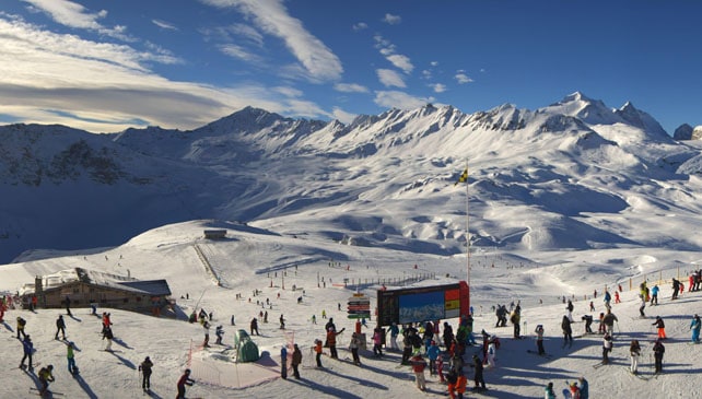
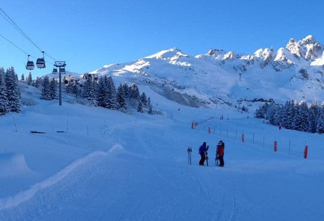
Here’s a quick survey of today’s webcams and social media posts. At last, it’s looking wintry, although it’s worth noting that very few resorts have all their pistes open yet. Lower down, the cover is still quite thin.
Let’s start with Val d’Isere in France – where the snow is now 60-100cm deep. 51% of pistes are open across the Espace Killy area (which it shares with Tignes).
Meanwhile, here’s Courchevel earlier this morning, before the New Year crowds got out. The snow is 60-96cm deep, and that piste must have been an absolute joy to ski…
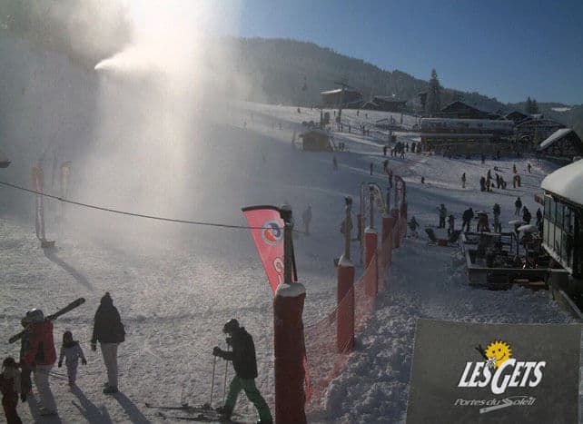
And – significantly – here’s the Front de Neige in Les Gets, which sits at 1200m. Before Christmas, this slope was an ocean of grass, broken only by the occasional mound of melting, man-made snow.
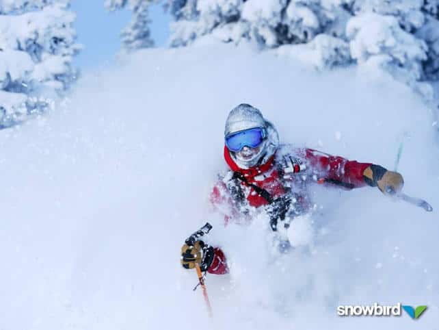
Pictured below is the Serre Chevalier ski area, above Briancon, which had 50cm of fresh snow at the weekend, and reports settled depths of up to 80cm, on-piste.
Here’s how it was looking in Verbier yesterday. The snow here is 47-128cm deep, and 23 out of 39 pistes are skiable. Most of the itinéraires are not yet open, however.
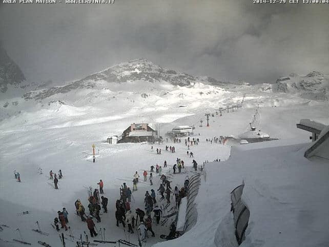
Pictured, below is Cervinia, which shares its ski area with neighbouring Zermatt. During the early-season snow drought Cervinia offered some of the best and most extensive skiing in the Alps, but didn’t see the same quantities of new snow at the weekend as the resorts further north. However, there was 15-20cm of fresh on Sunday, and there’s a metre packed down on the pistes, mid-mountain. The temperature there is -12C.
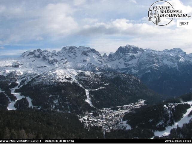
Below is Madonna di Campiglio today. Like Cervinia, it too had a good start to the season, but missed out on the meat of last weekend’s dump. Currently, there’s 95cm of snow packed down on the higher pistes.
Pictured below is Lech, where the snow is now 60-80cm deep on piste. Most pistes are now open across the Arlberg.
There’s been fresh snow in the Pyrenees too
The resorts of the Pyrenees are in good shape today as well. In Andorra, the Grandvalira ski area reports 15cm of new snow, and settled cover of 50-120cm on the pistes.
Yet more snow in the Rockies
| France: see our main report. The situation in France has been improved dramatically by Saturday’s storm which dumped 50cm+ in many resorts. Once this snow has stabilised, many more pistes will be opened. The avalanche risk is currently at 3/5 in many resorts, so caution is needed. Skiers planning a January break in the wake of the new snow should also bear in mind that the current frigid weather won’t last. By Friday, the mild weather will be back, though it’s not certain yet how long it will persist. Val Thorens is a good bet given the current outlook, with 100-140cm of cover on its pistes. Meanwhile, in the Grand Massif, Flaine has 55-100cm of cover. In Alpe d’Huez there’s 60cm of cover, mid-mountain. | |
| Switzerland: as in France, the weekend saw a dramatic transformation in conditions in Switzerland – although there were a few spots where the snow was already deep, such as Andermatt, where there’s now up to 300cm of snow on the Gemsstock. Meanwhile, in the south-east St Moritz, had much less snow than the resorts further north, and snow depths aren’t much changed from last week, with 89cm of cover on the higher pistes. | |
| Austria: the change in Austria’s fortunes began last Thursday, with the first light to moderate snowfall. The weather has continued in the same vein since then, and has favoured the Arlberg above all. It should continue until Wednesday. Bear in mind, however, that temperatures will rise sharply at the end of the week, and the quality of the skiing will suffer in the lower resorts. Currently St Anton reports cover 30-125cm deep. In Ischgl it’s currently 10-50cm deep. | |
| Italy: Much of the Italian Alps missed out on the meat of the weekend storms, and has had to make do with the low temperatures instead. These have at least allowed the snow cannons to run. Currently above Champoluc and Gressoney in the Monterosa there’s up to 85cm on the highest pistes, although the could do with some more lower down. Meanwhile, in the Dolomites, Canazei has up to 50cm of cover on its higher pistes. | |
| Andorra: in Andorra, the Grandvalira ski area reports 15cm of new snow, and settled cover of 50-120cm on the pistes. | |
| Western USA: see our main report. Late November and late December have both been wonderful times to ski the American Rockies, with abundant snowfall in many places. More snow is on its way: in Colorado, local forecaster Joel Gratz thinks the southern resorts should see more snow this week, with the chance of more widespread snow at the weekend. | |
| Western Canada: Whistler is in reasonable shape, with up to 120cm of snow bedded down, mid-mountain. However, it has missed out on the snow that fell last week in western US. The immediate outlook is dry and sunny. Meanwhile, in Banff National Park, the trend is for cold and settled weather. Lake Louise reports 26cm of snow, mid-mountain over the last week, and settled cover of 94cm on its slopes. Top temperature today will be -14C. |


Add Comment