


It’s been a week of rapidly changing weather in the Alps. Snow, rain, high winds, sunshine, more snow…we’ve seen the lot in recent days, and the trend will continue until Friday or Saturday. The wind will keep swinging from west to north-west and back again, the daytime freezing point will yo-yo up and down the mountains, and both heavy snow and rain are in the forecast.
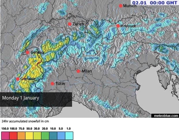
Today, for example, we saw one weather front cross the Alps, just before a second arrived in the west. Both have brought snow to many resorts across the northern half of the region, but especially in France. It’s been chilly, so the snow has settled to village level in most resorts. Some French ski areas are expecting 50cm before the day finishes.
Here’s today’s snow forecast.
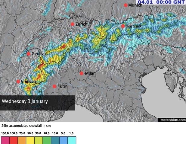
There’ll be more snow tomorrow, followed by a short pause, before the weather warms up on Wednesday. Yet another front is due in – and the precipitation will be even heavier. Up to a metre of snow is expected on the highest peaks and ridges, but it will be raining hard lower down – up to an altitude of 2000m or more.
Here’s Wednesday’s snow forecast.
Thursday should be cooler in the eastern Alps, but it’ll still be mild in the west, with more heavy snow at altitude and rain lower down.
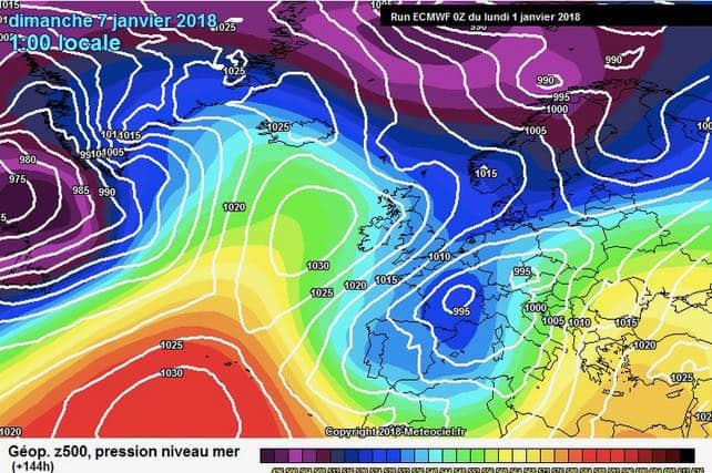
Finally, at the weekend, cold air should move more decisively across the region. Here’s the latest weather chart for Saturday from the ECMWF.
Everywhere, snow depths are very good for the time of year, and by the end of the week they’re going to be really exceptional at altitude in France, Switzerland, and in the Austrian Arlberg. But even in the lower resorts there’s no need to worry about snowless pistes, even if it does rain on Wednesday. The pistes are now too deep to be washed away.
However, the snow lower down will be wet and heavy for a while, and anyone hoping to ski off-piste will need to aim high. They’ll also have to be cautious. With all the wind and snow in the forecast, the avalanche risk will be severe.
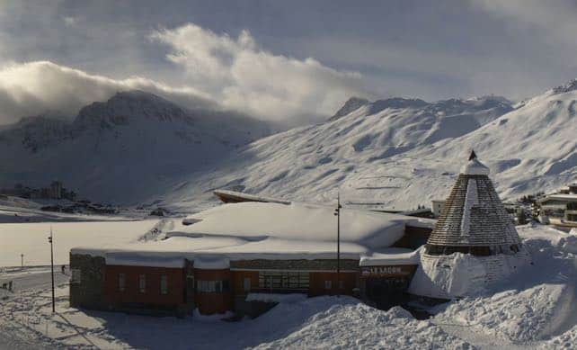
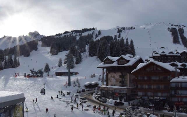
Here’s how it was looking earlier in Courchevel in France, before it started snowing this afternoon. Here, the cover is 129-161cm deep.
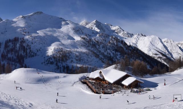
This is how it looked in Serre Chevalier in France earlier today, where the snow is 75-140cm deep.
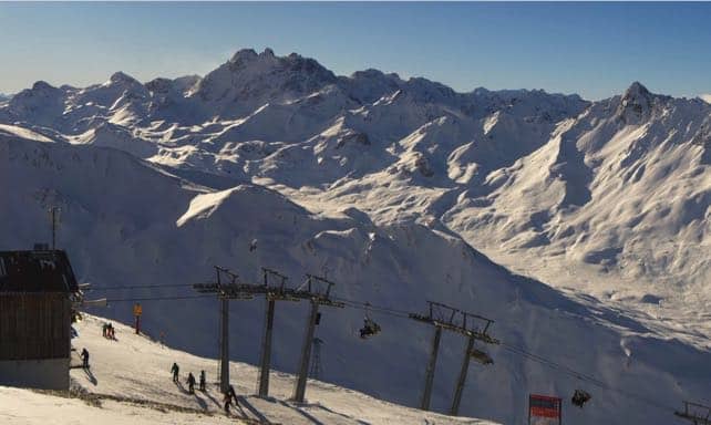
Pictured below was Ischgl in Austria. Here the snow averages 100cm deep across the mountains.
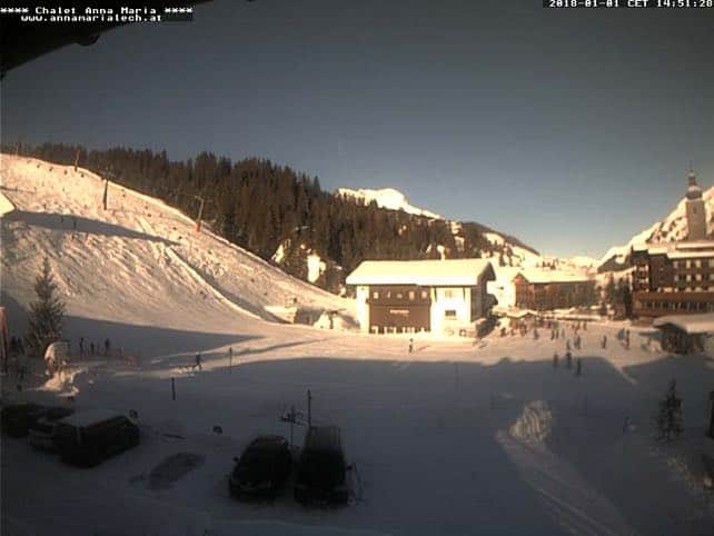
And this was Lech in Austria, which shares its ski area with St Anton. Snow depths here range from 85-310cm deep.
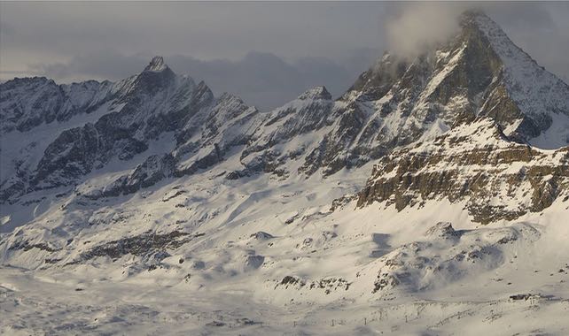
Finally this was how it looked above Cervinia in Italy’s Aosta Valley. They’ve had less snow here than in France and Switzerland, although heavy falls are expected later this week. Currently, the snow is 80-160cm deep.


Add Comment