


Several ski resorts in the Alps are warning guests of travel disruption this weekend – thanks to yet more wild weather.
In France, Tignes issued a travel alert this afternoon, prompted by a forecast of 100-120cm of new snow in 48 hours between midday on Saturday and midday on Monday. Earlier Val Thorens had advised guests that “Given the complicated weather conditions forecast for this weekend, we would advise people travelling to prepare thoroughly for their arrival/departure.”
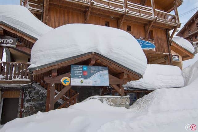
In the valleys, emergency shelters – such as sports halls – are being prepared in case travellers can’t reach their accommodation on Saturday night. With 20,000 cars expected in the Tarentaise on Saturday as the next wave of holidaymakers hit the Alps, it’s no wonder the precautions are being taken. (The Tarentaise is the long, deep valley along which most of the big-name French resorts are set.) Moutiers, Bourg-St Maurice, Albertville and – in the Maurienne Valley – Saint-Jean-de-Maurienne are all now enacting their plans.
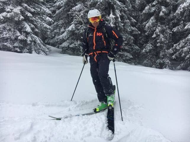
This latest storm comes on top of a four days of snowfall and yo-yoing temperatures. On Tuesday, in the Chamonix valley I skied in heavy rain beween 1300 and 1000m at the bottom of the ski area at Les Houches, but the following day there was 20-30cm of light, fluffy, powder all over the mountain. For those lucky enough to have a guide, and somewhere sheltered to ski amongst the trees, conditions have been – from time to time – fabulous. But up high many lifts have been closed due to the high winds.
Here’s my guide Steph at Les Houches on Wednesday. I don’t want to go on about it, but the snow was gorgeous…
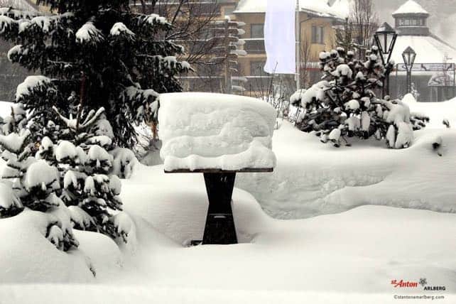
Accumulations of snow this week have already been considerable. In the Austrian Tirol, the the Arlberg has had over a metre of snow, and in Switzerland this morning the SLF reported 80cm in three days near Verbier. In St Anton am Arlberg, roads out of the resort were closed for much of the day yesterday because of the avalanche risk.
Meanwhile in the French Alps, around 70cm of snow has fallen so far this week in the Three Valleys, 95cm in Tignes-Val d’Isere and a whopping 130cm at altitude in Chamonix. In many areas they’ve already passed their snowfall average for the entire winter. And we’re not half-way through the ski season yet.
The avalanche risk is intense. 4/5 in the Tirol and in many parts of the French Alps, which rules out off-piste skiing. “Settling noises (whumpf!), avalanche triggerings by skiers, all speak a message loud and clear: the snowpack is likely to trigger,” warns the Tirol’s avalanche report.
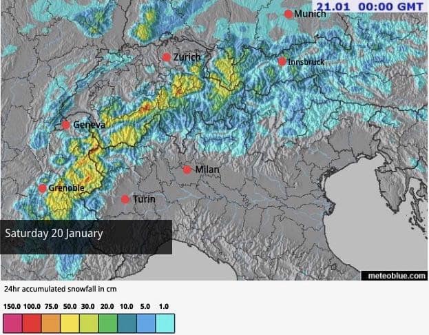
And now, the storm is intensifying. Here’s Saturday’s snow forecast.
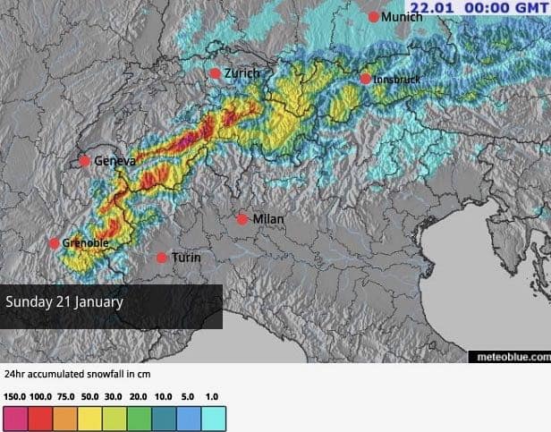
One notable feature of the weekend weather will be the rising temperature in the western Alps. The freezing point will jump to 1800-2000m on Saturday evening, and reach a similar level late on Sunday, so once again rain at village level and on the slopes of the lower resorts will be a feature.
That, in some ways is a blessing, because it should help to stabilise the snowpack, but up high, there’s going to be lot of very unstable snow. Everyone will need to pay close attention to official avalanche warnings, and follow the guidance of resort authorities.
Once again, it’s worth noting that Italy has generally seen much less snow these past few days. In parts of the Dolomites, for example, the last significant snowfall was on January 9. However, snow depths are still good here. Above Canazei, the snow is 40-240cm deep.
One exception to this rule has been the Aosta Valley in Italy, which has shared some of France’s snow. In Pila, the settled snowpack is 100-200cm.
Mind you, compare those figures with snow depths in parts of the northern Alps: 120-355cm in St Anton, for example, and 208-350cm in Val d’Isere. Further south, in Serre Chevalier, there’s been less snow this week, but the depths are still good: 70-207cm depending on altitude.
It looks as though Monday will see the last day of intense snowfall, and then the sun will come out, and temperatures jump. All of a sudden, we’re likely to see balmy, spring-like conditions.
What an extraordinary winter…


Add Comment