


In the western Alps, the weather has taken an ugly – but short-lived – turn. There’s been rain up to 2000m, accompanied by strong winds, and up high, the avalanche risk has jumped to 4/5 in places. Further east, it’s a little cooler, but the wind is still a problem for off-pisters.
Fortunately, a cold snap is coming on Wednesday, and widespread snow is expected to fall across the northern Alps, down to 500m. It could last several days.
Meanwhile, in the Rockies, Colorado’s snow bonanza continues.
Apologies for a rather abbreviated Snow Report this morning, Snowfiends: I’m heading off to the airport. Apologies, also, for its rather annoying content: because after sending six or seven weeks of generally cool and snowy weather our way, Mother Nature is currently showing her mean streak. In the western Alps yesterday there was heavy rain up to 2000m, and it’s still falling in some resorts. The cover is wet and heavy up to mid-mountain level as a result. Above 2200m, there have been some moderate accumulations of snow – and there’s more to come today; but even here the news is not universally good, because off-piste it’s been hustled into unstable, densely-packed slabs by the wind. The avalanche risk is up to 4/5 in places.
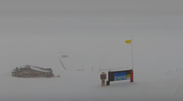
Here’s how it’s looking at the top of the Rocher de Bellevarde above Val d’Isere first thing this morning…
Temperatures should start to drop back this afternoon, and on Wednesday we’ll see the arrival of a cold front from the north. The snow forecasts for Wednesday, Thursday and Friday look good for the whole of the northern Alps, and should repair much of the damage to the lower pistes.

However, it’s worth noting some mid-range weather models are suggesting the cold snap will be followed, at the weekend, by mild and sunny weather. It’s too soon to be sure of that, but we’re in March now, so no-one should be surprised if spring shows its mild and sunny face. If you’re planning a trip before the end of the season, play it safe and pick a resort with plenty of skiing above 2000m to be sure of good-quality snow (and don’t forget to check out Vincent Lalanne’s feature, “How to Find the Best Snow in a Ski Resort”).
By the way, it’s also been mild and wet in the Pyrenees, which is a shame because last week they were walloped by some spectacular snowfalls. On Thursday, for example, St Lary in France reckoned it had 150cm in 48 hours. Of course, the rain isn’t going to wash all that snow away, just as it won’t wash away the lower pistes in the Alps. But it would have been nice if it had stayed cold and dry for at least a few days. Here too, however, the weather should turn colder with more snow by Wednesday.
Meanwhile, in the Rockies…
Lucky me. The plane I’m about to catch is taking me to Utah, where snow fell yesterday, and should fall again today and Tuesday. Yesterday morning Canyons and Snowbird were both reporting 10cm, with more to come: but that figure was dwarfed by little Brian Head resort in the south, which had had 63cm of fresh snow by Sunday morning.
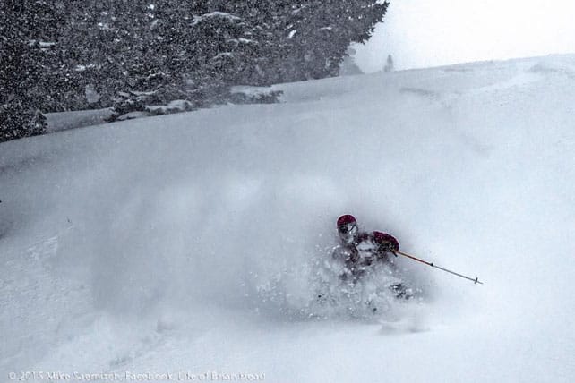
Meanwhile, in Colorado, there’s been more snow – with the southern resorts notching up some impressive totals. Yesterday morning, for example, Telluride reported 38cm from the latest storm – to add to the 75cm that fell last weekend. Further north, Breckenridge reported 18cm in 24hrs and 53cm in the last week – which is handy because that’s where I’m heading on Thursday. Vail’s seven-day total stands at 61cm. Local snow guru Joel Gratz is predicting plenty more of the white stuff before the clouds lift on Wednesday afternoon, and bright sunshine takes over.
Here’s a rather blissed-out video from Vail, shot on February 27, which gives you some idea of the mood there at the moment.
| France: rain in the French Alps, up to 2000m, has put a bit of a dampener on the start of the week, and the cover below 2000m is wet and heavy. However, there has been heavy snow at altitude, and the cold snap in the middle of the week will bring fresh snow to even the lowest slopes. So soft and grippy conditions should be the norm again by Thursday. South of Grenoble, Serre Chevalier reports 40-140cm of cover on its pistes. Meanwhile, in high-altitude Val Thorens in the Three Valleys, there’s 125-200cm packed down on the pistes. | |
| Switzerland: western Switzerland has been wet, too. But let’s not forget there’s snow at altitude – and it’s likely to continue today with temperatures dropping in the afternoon. Over half a metre is expected to fall in places. There’ll be more snow midweek as well, accompanied by much lower temperatures, so it’ll fall down to the valley floors. In the east, it’s a little cooler, and here heavy snow is expected today as well. Currently Verbier reports 15cm of fresh snow at the top of the resort, and has 44-200cm of cover on its pistes, Laax in the east reports snow depths of 40-290cm, and St Moritz in the south has 79-149cm. | |
| Austria: Austria is expecting snow today as well. With the freezing point at 1800m, that means rain on the lower slopes, but above that level decent accumulations are expected. The Arlberg resorts, in the west, could see as much as 50cm on the higher slopes. Lech reports cover 90-175cm deep, and in the northern Tirol the Skiwelt has 50-70cm on its pistes. Meanwhile, in the east, Schladming reports 80-140cm of cover, on-piste. Here too, a cold snap is expected mid-week, with more snow. | |
| Italy: close the borders with France, Switzerland and Austria, Italian resorts are seeing some fresh snow today, although temperatures are mild and the snow is wet and heavy. Generally, however, less snow is likely to fall here than in the northern Alps, although temperatures will drop on Wednesday. Currently, Cervinia, high above the Aosta Valley, has 60-270cm of cover, on piste. Meanwhile, further east in the Dolomites, Canazei reports on-piste cover 40-125cm deep. | |
| Andorra: after heavy snow last week, the weather’s turned rather mild in Andorra, and on the lower slopes of the Grandvalira ski area, temperatures will touch +10C today. Currently settled snow depths range from 140-240cm, and temperatures should drop back sharply on Wednesday. | |
| Western USA: the resorts of southern Colorado and southern Utah have the best conditions at the moment, thanks to a big dump at the start of last week, and another one this weekend. Elsewhere the snowfall has been lighter, but it’s still building up nicely. In Vail, for example, the mid-mountain snowpack is currently 152cm deep, and in Canyons it’s 116cm deep. Further north, in Wyoming, Jackson Hole has 193cm packed down, mid-mountain. An extended spell of dry, clear weather is expected to take hold of the region on Thursday. | |
| Western Canada: snow-wise, Whistler’s season is stubbornly refusing to take flight, with just a sprinkling of snow recorded in the last week, and surface conditions hard-packed. Still, it’s a lot cooler than it was in mid-February, and there is some light snowfall in the forecast. Inland, in Banff National Park, Lake Louise had a lovely sunny day yesterday with a top temperature of -2C. There’s been only a centimetre of fresh snow there in the last seven days, and the mid-mountain snowpack is 127cm deep. In the east, the long cold spell looks to be finally relinquishing its grip. Top temperature in Tremblant yesterday was a balmy -6C. |


Add Comment