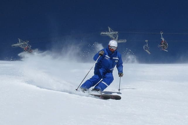
Spring has sprung in both the Alps and the Rockies, and skiers need to take account of the daily melt-freeze cycle which is affecting snow quality on many slopes.
In the eastern Alps, it’s going to get cloudier and much cooler on Wednesday and Thursday, and there should be a few snow showers. But it will stay sunny and mild in the west.
In the Rockies, the mild weather will persist until the middle of the week.
Greetings from Newfoundland, Snowfiends, where your correspondent is sitting out an unscheduled layover, along with all the other passengers from his Denver-Heathrow flight. In a way, it’s a shame I’ll only be here for a day. They’ve got a ton of snow, and there’s at least one lift system not far from here…
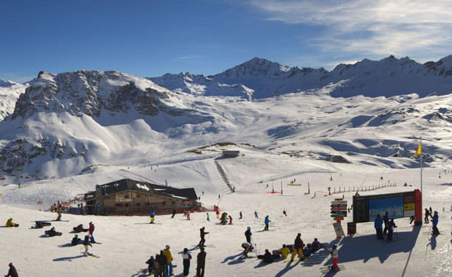
But anyway – let’s get back to the skiing heartlands, where spring has a powerful grip on the weather. Unusually, conditions are very similar in both the Alps and the Rockies at the moment, with clear blue skies and brilliant sunshine the norm. It’s mild too. In the Alps, the freezing point has risen to 2800m in the west, and to 2500m in the east.
This photograph from Val d’Isere earlier today gives you a good idea of how it’s been.
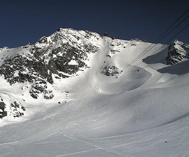
Meanwhile, this was the Mont Fort above Verbier.
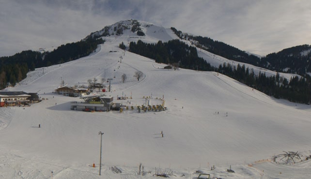
And here’s how it’s looking in Soll, in Austria, which is part of the Skiwelt. Here, there’s been rather more high-altitude cloud around.
The effect of all this warm weather – which settled over the Alps on Friday – is just as you’d expect. On sunny, south-facing slopes, the snow’s been getting wet and heavy during the day, and then refreezing overnight. According to the avalanche reporters on MeteoFrance, you’ll even find this melt-freeze effect on colder, north-facing slopes up to 2200m.
As a result, spring-skiing tactics have been essential to get the best from the conditions. Skiers need to wait till the sunshine warms the rock-hard pistes up each morning, and then ski them hard – and quickly – before they turn properly slushy. If they get the timing right, they’ll enjoy a silky, grippy surface which is almost as good as freshly-groomed winter snow. If they don’t…well, they’ll either be skittering about on hard-packed snow, or wallowing in slush.
Off-piste, the avalanche risk is declining as the snow settles in the sunshine. However, hiring a guide is still a really good idea, as he/she will know where to find the most skiable cover.
The forecast is for a wintry interlude on Wednesday or Thursday in Austria and eastern Switzerland, but only light snowfall is expected. Sunshine should return by Friday, although it will be cooler than it is now. Elsewhere, it’ll stay warm for the foreseeable future.
Meanwhile, in the Rockies…
I’ve just been skiing in Breckenridge, Colorado, which is just where you want to be in a mild spell. The slopes start at 2,926m and rise all the way to 3,963m, and despite brilliant sunshine over the weekend the snow was still cold and wintry on the top half of the mountain. Here’s how it was looking on Peak 6 on Friday.
By the way, although the slope above was skiing like a piste, it was in fact part of a big (avalanche-protected) off-piste area. There was a lot of wind here just before I arrived, and the snow was dense and windblown on all but the shadiest slopes. It was a shame not to have powder, but this was a very good second best: firm, grippy and extremely easy to ski. We covered a lot of ground as a result, and skied big, steep, mountain bowls, bump runs, trees and velvety pistes. It’s the sheer variety of skiing on offer in Breck, often in a single descent, that’s the abiding memory of the trip. And the deep blue of the cloudless sky…
The forecast for the region is for change on Wednesday, with moderate snowfall in parts of western Canada, and lighter, more showery snow elsewhere. But there’s no sign yet of the more significant storms that are needed to recharge the slopes with powder.
| France: there was fresh snow across the French Alps last week – especially in the resorts north of Geneva. However, the theme this week is mild spring sunshine, and the warmth has affected the snow quality. You need to be skiing above 2200m on north-facing slopes to find consistently cold, wintry snow, and considerably higher than that on south-facing slopes. In other words, aim high to find the best conditions, and adopt spring-skiing tactics to take account of the effects of the sun.
South of Grenoble, Serre Chevalier reports 29-130cm of cover on its pistes. Meanwhile, in the Tarentaise, Les Arcs has 85-155cm bedded down on its groomed runs, while high-altitude Val Thorens has 130-215cm. |
|
| Switzerland: snow depths are pretty good across the Swiss Alps, thanks to fresh snow last week, but here too spring weather is the theme, and the lowest runs are thinning fast in the sunshine. Currently Verbier reports 46-225cm of cover on its pistes, Laax in the east reports snow depths of 35-320cm, and St Moritz in the south has 50-142cm. | |
| Austria: Austria had a decent dump of snow last week, but it’s been mild since Saturday, and the snow quality has been affected in much the same way as France. However, it is likely to be cooler later in the week, and there is the chance of snow showers on Wednesday and Thursday. In the Arlberg, Lech currently has 95-225cm of cover, on piste, and in the northern Tirol the Skiwelt has 55-75cm. Meanwhile, further the east, Zell am See reports up to 122cm of snow packed down on the Schmitten, above town. | |
| Italy: Italian resorts close to the French, Swiss and Austrian borders had a little fresh snow last week, but for the most part it was dry. Now it’s warm too, and spring-skiing tactics will be essential if you want to enjoy the conditions. Currently, high-altitude Cervinia reports cover 55-270cm deep, on-piste. Meanwhile, Canazei in the Dolomites has 40-130cm of cover on its pistes. | |
| Andorra: the Pyrenees saw heavy snow at the end of February, some rain, then a cold snap and now – as in the Alps – mild sunshine. In the Grandvalira ski area, snow depths range from 140-210cm, on-piste, and the high today was +6C. | |
| Western USA: last week there was fresh snow in both the Rockies and California, but it’s been replaced by mild spring sunshine. Currently, the high-altitude resorts of Colorado have the best conditions, given the warmth. In Vail, the mid-mountain cover is 147cm deep. In Utah, the Canyons reports 124cm of settled snow, mid-mountain, and a high today of +10cm. In Wyoming Jackson Hole reckons on 182cm of snow, mid-mountain, and a high of +7C. | |
| Western Canada: it’s mild in Canada too. In Banff National Park, for example, Lake Louise is predicting a high today of +7C. The mid-mountain snowpack there is currently 120cm deep. Near the west coast, Whistler’s season remains underwhelming with mid-morning highs of +4C half way up the slopes and a daily freeze-thaw cycle on the slopes. The snowpack is up to 142cm deep, mid-mountain. |


Hi Sean, I have just read your article, imagine my surprise – we are also in Newfoundland on the unscheduled layover! In fact as I write this my husband is writing a missive to Willie Walsh, CEO British Airways (cc: Guardian, Times & Daily Mail!) about our return flight from 2 weeks skiing in Colorado. I wish us all good luck for tomorrow’s flight. Kim Jardine
Kim! See you in St John’s airport at 5am this morning…