


In the Alps a spell of mild spring weather is coming to an end, as the high pressure which created it moves north and settles over Scandinavia and Russia. It’s allowing much cooler air in from the east, and the freezing point has slipped a long way downhill as a result.
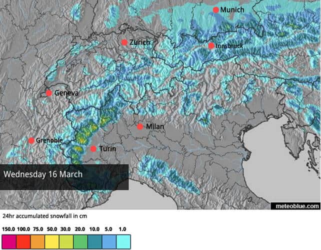
The weekend will see snow in the Pyrenees and south-western Alps, which could bring 50cm of fresh to parts of Piedmont, the Aosta Valley, Lombardy and Trentino.
Meanwhile, in the Rockies, a short-lived snowy spell won’t disrupt the overall spring-like pattern of the weather.
There were times, last week, when I thought the mild and sunny spell sitting over the Alps would stay put for a couple of weeks at least –thinning the snowpack significantly in the run-up to Easter. Fortunately, the high-pressure that created the thaw has shifted north, and much cooler air has come flooding in from the east. For the time being, temperatures have dropped.
Today in the French Alps the 0C level will be at 2200m, and 1700m tomorrow. In Austria – where there was some light snow yesterday – it’s currently at 1200m. Overall, that’s good news, because it’ll stop the snowpack thinning so quickly. But it does also mean that there will be more icy pistes around over the next few days. Anyone who doesn’t enjoy skiing them should migrate to the sunny side of their ski areas as a result, and wait for the warmth to soften the snow a little.
The fresh snow is coming on Saturday, and should top-up the cover nicely in the western half of the Italian Alps, with up to half a metre forecast in places. Here’s our current snow forecast for Monday, which is likely to see the heaviest snowfall.
It’ll be very welcome as the last significant snowfall in this part of the Alps was on February 21 – nearly three weeks ago.
Resorts close to the Italian border in France and Switzerland should see some fresh snow, too – especially those south of Grenoble, in France. The western half of the Pyrenees should also benefit. Thereafter, it will probably warm up for a bit: but it’s hard to say, because the weather models take strikingly different paths from the middle of next week. Some are forecasting more spring weather; some, a wintry blast and more snow.
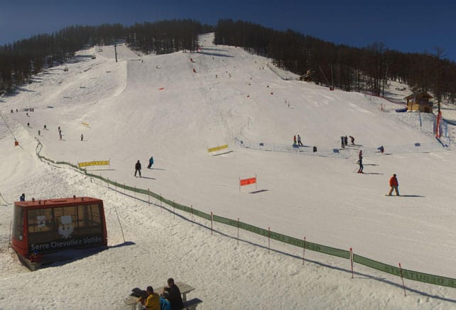
Here’s a quick survey of the webcams this morning, starting with Serre Chevalier, which is one of the resorts that should see snow at the weekend, and Monday. Here, the snowpack is currently 20-130cm deep.
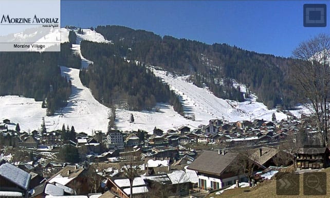
Meanwhile, pictured below are the pistes immediately above Morzine. As you’ll see, there’s still cover on the pistes in the photo, which face north-east, and the lower temperatures over the next four or five days will help preserve their snow. Currently, the resort reports up to 150cm of settled cover at 1800m (which in Morzine is mid-mountain level).
Meanwhile here’s some video, shot yesterday, of the rather amazing terrain park created especially in Les Arcs for the B&E Invitational. With the snow now much firmer, it’ll be a good day for freestyle skiing. Snow depths across resort vary between 85 and 152cm.
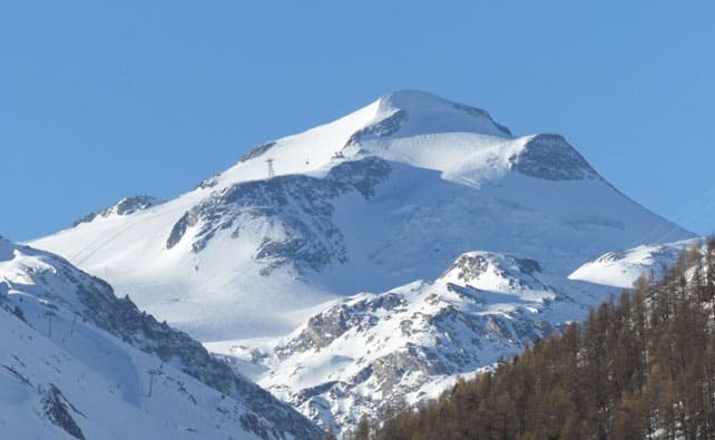
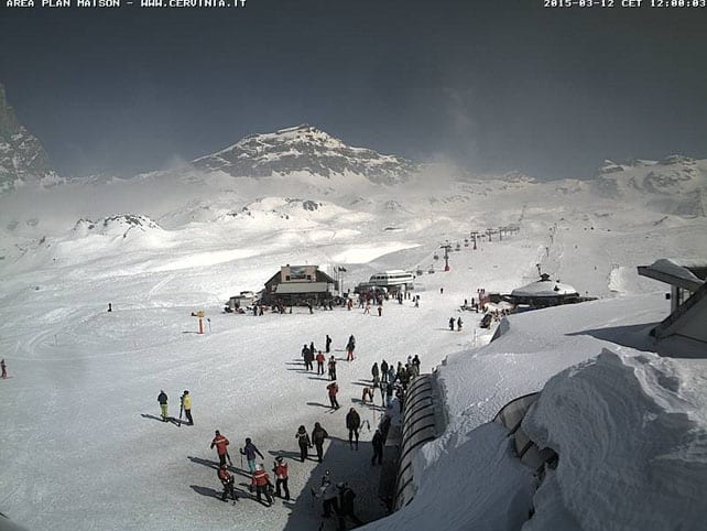
Pictured below is Cervinia, above the Aosta Valley in Italy, which should see snow at the weekend, and Monday. Here the cover is currently 45-250cm deep.
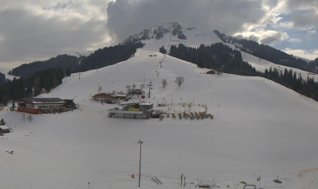
Below is Soll, in the Skiwelt in Austria, where the snow is 50-70cm.
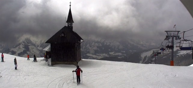
Meanwhile, picture below is the top of the Schmitten above Zell am See, where there’s currently up to 128cm of cover. 7cm of snow fell here yesterday.
Meanwhile, in the Rockies…
There’s some snow blowing around in the Utah and Colorado Rockies today, but local forecasters Evan Thayer and Joel Gratz aren’t expecting significant quantities. And the snow won’t affect the overall spring-like pattern of the weather, which will persist until the middle of next week. This will mean icy pistes on the lower slopes in the morning, after the overnight refreezing of the snow, which will then soften up during the day. By contrast, up high in places like Breckenridge – where I had some blissful, effortless skiing last week – the snow should stay chalky and soft all day, if a little bumpy on the off-piste routes which have been heavily skied.
On the west coast of Canada, Whistler is at last expecting decent snowfall at the weekend. The current forecast is calling for 20cm or more on the top half of the mountain, and by way of a prelude there’s already been 3cm of fresh overnight.
| France: last weekend and the first half of this week were both very mild in the French Alps. South-facing slopes below 2500m and north-facing slopes below 1800m all went through a daily freeze-thaw cycle. Now temperatures are dropping, many of these slopes will tend to stay firm all day, which means skiers will need sharp edges and precise technique to enjoy them. Otherwise, they should tackle pistes which aren’t as steep as they normally ski. Off-piste, the snowpack is now settling, and the avalanche risk is generally at 2/5.
Overall, the period from late January until the end of February was a snowy one in France, and the cover is pretty good in most resorts. However, this is the time of year when skiers should focus on the higher resorts, which can withstand spring thaws more comfortably. Currently, in the Three Valleys, high-altitude Val Thorens reports 125-210cm of cover on its pistes. |
|
| Switzerland: conditions in Switzerland are very similar to those in France, although it is cooler in the east. As a result, the phenomenon of icy pistes will be more pronounced here. It’s best to stay very high, or very low, or on the sunniest slopes to avoid the hard-pack. Currently Verbier reports 33-220cm of cover on its pistes, Laax in the east reports snow depths of 30-310cm, and St Moritz in the south has 50-140cm. | |
| Austria: there was a little bit snow in central and eastern Austria yesterday, and temperatures dropped sharply at the same time. In resorts such as Zell am See, where the fresh snow fell, there’s good piste skiing today as a result. Further west, mid-mountain slopes will be rather icy today, so stay high, or low, or in the sunshine, for a softer skiing surface. Off-piste the avalanche risk has dropped and is either 2/5 or 1/5 – although there are still some unstable, wind-blown slabs to be found on steep north-facing, slopes. In the Arlberg, Lech currently has 85-215cm of cover, on piste, and in high-altitude Obergurgl it’s 31-175cm deep. Meanwhile, further the east, Schladming reports 80-140cm of on-piste cover. | |
| Italy: it’s been three weeks since most Italian resorts have seen significant snowfall, so they’ll be looking forward to the weekend, especially in the west, where half a metre or more could fall. Currently, in the Aosta valley, Gressoney in the Monterosa ski area reports cover 105-255cm deep, on-piste. Meanwhile, Canazei in the Dolomites has 40-130cm of cover on its pistes. | |
| Andorra: the Pyrenees saw heavy snow at the end of February, some rain, then a cold snap and then – as in the Alps – mild sunshine. However, fresh snow is on the way this weekend. In the Grandvalira ski area, snow depths range from 140-210cm, on-piste, and the high today was +8C. | |
| Western USA: last week there was fresh snow in both the Rockies and California, but it’s been replaced by mild spring sunshine. Today, Colorado and Utah are expecting a snowy interlude, but it won’t break the overall mild pattern, and temperatures are going to jump at the weekend. It could be +10C mid-mountain in many resorts on Saturday. Currently, the high-altitude resorts of Colorado have the best conditions, given the warmth. In Vail, the mid-mountain cover is 140cm deep. In Utah, the Snowbird reports 198cm of settled snow, mid-mountain, and in Wyoming Jackson Hole reckons on 180cm of snow, mid-mountain. | |
| Western Canada: at last, western Canada is expected a decent top up of snow. Near the west coast, Whistler should get 20cm of more at the weekend, to add to the 140-odd centimetres packed down on the upper slopes. In Banff National Park, Lake Louise should see snow, too. It’ll be welcome here as well, after a mild and dry spell. Currently the mid-mountain snowpack there is 119cm deep, and a high of +3C is expected. |


Add Comment