The weather in the Alps is about to get more interesting.
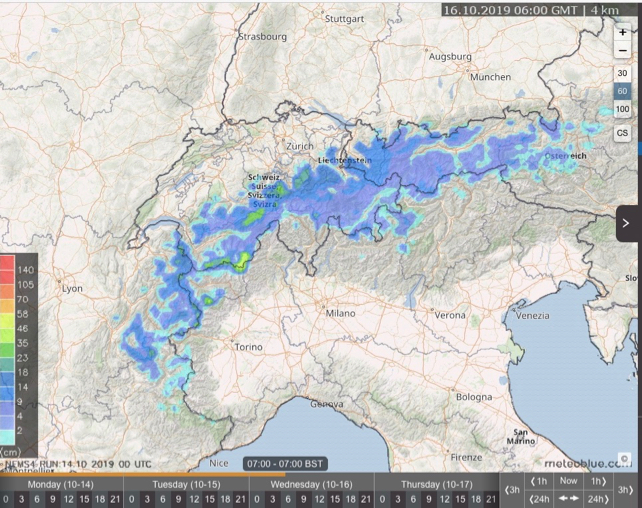
Two separate spells of snowy weather are forecast for the region, starting at around 10am tomorrow, with snowfall along the main Alpine ridge between Italy, France and Switzerland.
Later in the day, and overnight, the snow will become more widespread, reaching into Austria and central Switzerland. The stretch of the Swiss-Italian border between Zermatt and Saas Fee is likely to see the heaviest falls, with more than 35cm expected at altitude.
The snow will settle down to 1500m for a time.
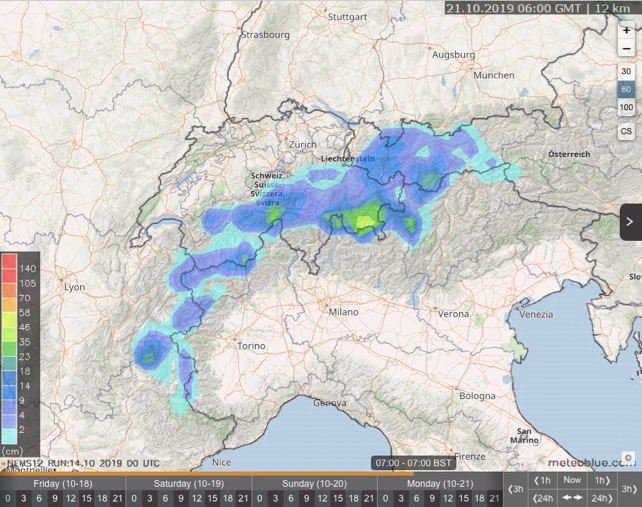
Then, on Sunday – after a mild interlude – we’re likely to see another dose of light to moderate snow in the high Alps, with the focus just a little further east than on Tuesday. St Moritz and the Engadin valley should do best from this second storm, as you’ll see from Meteoblue’s 24hr snow forecasting map, below. There, 35-48cm of snow is expected.

Of course, we’ve got six or seven weeks yet before anyone can start talking sensibly about winter. In the meantime, we can expect virtually all this upcoming snow to vanish once the skies clear and sunshine returns.
But it’s good to see the weather getting more energetic after a slow start to autumn. Tignes’ decision to postpone the opening of its glacier from September 28 to a moment “determined by future snowfall” was symptomatic of the mild weather, which followed on from another hot summer. This new snow will no doubt help up there – as it will on those glaciers further east, where skiing is already underway.
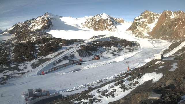
Here’s one of them earlier today: the Pitztal, in the Austrian Tirol.

Other resorts already open to skiers include Zermatt and Saas-Fee in Switzerland, and the Hintertux, Kauntertal, Stubai and Kitzsteinhorn glaciers in Austria. You can also ski on both of Solden’s two glaciers. Here, the opening races of the FIS Alpine Skiing World Cup take place on October 26 and 27.
It’s time we all started to work on our ski fitness…
Check out our guide for tips on the best early-season ski resorts.


Add Comment