


Just in the nick of time, Mother Nature is going to deliver a proper, wintry storm.
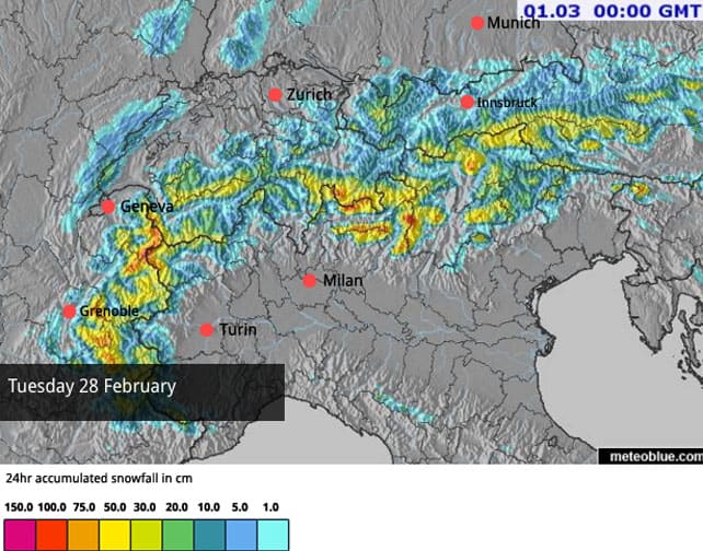
According to our Welove2ski’s latest snow forecast, there will be heavy snow tomorrow in the French Alps, and across parts of Switzerland, Italy and Austria too. 75cm could fall on the Mont Blanc massif, above Chamonix, and on Les Deux Alpes, south of Grenoble. Passo Tonale in Italy could even see a metre. In many other areas 30-50cm of the white stuff are expected.
Generally, Austria is expecting lighter snowfall. However, by the end Thursday, the Arlberg resorts of St Anton and Lech-Zurs should have done well – along with ski areas lining the Italian border such as Obergurgl, and the resorts of the East Tirol.
Here’s tomorrow’s snow map. In terms of the quantity of snowfall expected, and its extent, it’s one of the best-looking maps we’ve seen this season. Let’s hope the day lives up to its billing.
Of course, while the snow’s falling, conditions on the slopes will be tough, thanks to poor visibility and high winds. Expect lift closures, and a rapidly increasing avalanche risk. Off-pisters should hire a guide and pay close attention to the detail of local avalanche risk assessments if they want to tackle the fresh powder.
It looks as though the snow will continue to fall in the northern Alps until Thursday, favouring the resorts of France and Switzerland. Then, a short thaw is expected, with the chance of another, lighter dose of snow on Saturday and Sunday.
As I said, the white stuff will be very welcome. Admittedly, there was light snow above about 1500m across the northern Alps on Friday. St Anton reported 20cm on its highest peak, the Valluga, and there was enough on sheltered slopes in Lech-Zurs, next door, to cushion some lovely powder turns on Saturday.
But generally only 5-10cm fell elsewhere, and after two weeks of mild temperatures, a substantial top-up is sorely needed. Spring conditions are the rule below 2500m, and below 2000m on the sunniest slopes the cover off-piste is threadbare. The valley runs in the lower resorts are now ribbons of white against the grass. Thank heavens for the coming storm.
Here’s a quick squizz at the mountains today. It’s another mild one: with the freezing point up around the 2500m mark.
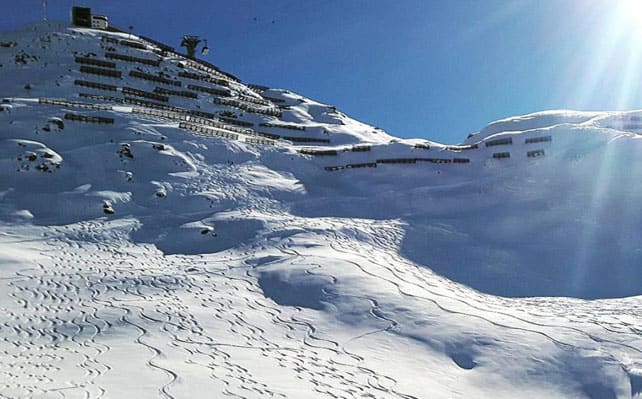
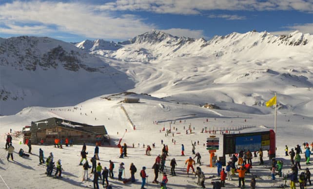
Pictured below is the top of Courchevel, in the Three Valleys, where the snow is currently 74-122cm deep.
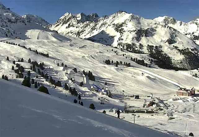
Pictured below is how it’s looking in Serre Chevalier, where the snow is 20-140cm deep.
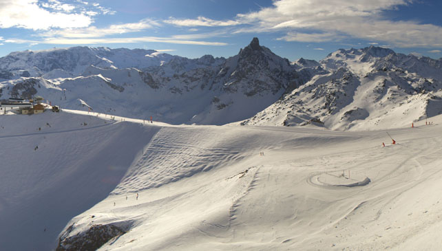
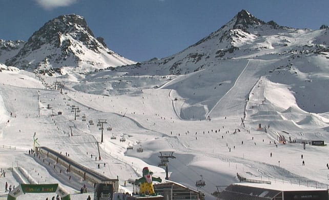
This is Val d’Isere, where the snow is 87-180cm deep, on piste.
This is the scene in Kuhtai today, in Austrian Tirol, where the snow is 68-78cm deep.
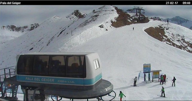
Pictured below is Ischgl, also in the Tirol, where the snow is 85cm on the higher pistes.
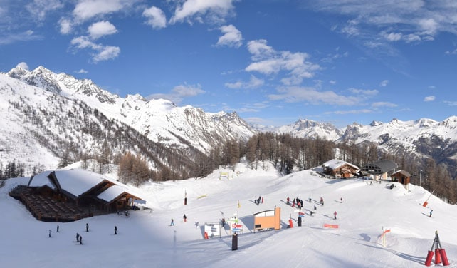
And this is one of the pistes above Canazei in the Italian Dolomites. On piste, the snow here is 15-60cm deep.
Meanwhile, in North America…
The resorts of California and Utah were hit by yet another epic storm last week, in what has been an extraordinary winter. The upper slopes of Squaw Valley, near Lake Tahoe in California, had more than 4 feet (122cm) of snow last week. Opening up the mountain in the aftermath wasn’t easy: but here’s how it was looking on Thursday.
And this is how it looked in Snowbird, Utah on Friday, at the tail end of a storm which dropped 130-odd cm of snow on the resort.
Now, another weather front has brought snow to the northern end of the American Rockies, and will move down into Colorado and Utah today. 15-40cm is expected from this one – after which high pressure will take over, and along with rising temperatures. Local skiers will need to get to the powder quickly: before the sun affects the quality of the cover.
North of the border, it’s been drier (yesterday, Whistler reported a modest 17cm of new snow in the past week). But Wednesday to Friday should bring more of the white stuff to the resorts of the Canadian west.


Add Comment