


The south-western Alps were hit by heavy snow over the weekend – and howling winds. According to Meteo France’s avalanche reporters, the wind was gusting at speeds above 160km/h for a short time above Val d’Isere on Saturday night. Up to 60-80cm of the white stuff fell on the higher slopes.
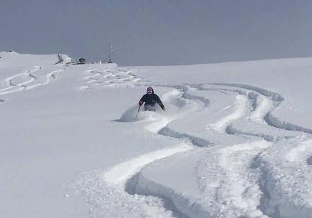
As a result, the guides at Alpine Experience (who posted the photo, above), said there was almost too much snow on Sunday morning. Most off-piste routes were off-limits because of the avalanche risk, and the gentle slopes were heavy going.
Still, the mountains looked magnificent in their fresh white coats.
As the forecast suggested at the end of last week, this bout of extreme weather was very localized. Val Cenis and the top end of the Maurienne Valley also saw 80cm overnight on Saturday, the Three Valleys had about 50cm and the slopes above Serre Chevalier saw 40-60cm over a three-day period. There was also 40-50cm in the Monterosa ski area in Italy. By contrast, Chamonix had just 10cm, and the central and eastern Alps stayed more or less dry.
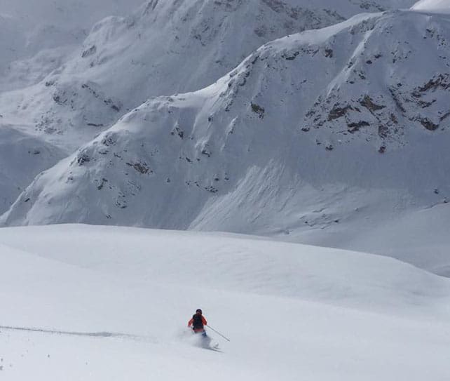
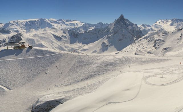
Here’s how it looked yesterday in the Monterosa ski area.
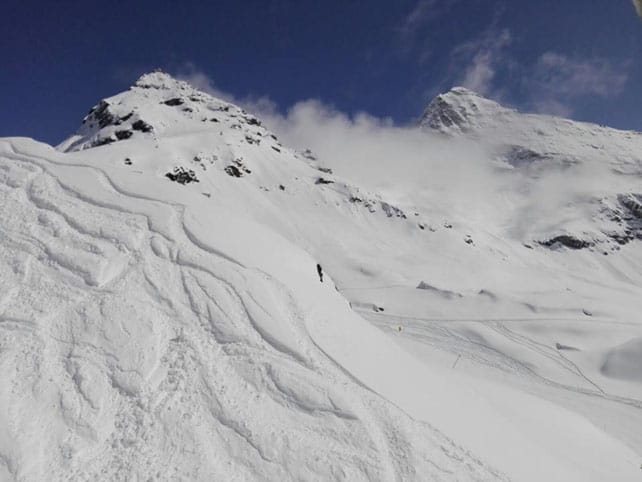
Pictured below the scene yesterday above Sauze d’Oulx.
Sadly, this big dump of snow is not symptomatic of a sudden drop in temperatures. It was raining up to 2200m for a time at the start of the storm, and since the skies cleared on Sunday morning, it’s been mild. As a result, much of the snow got wet and heavy soon after it fell. If you’re looking for light, fluffy powder, you’ll need to be skiing above the 2800m mark.
Today, the weather is generally mild and sunny – though there is a veil of low cloud at mid-mountain level in some resorts. In France the daytime freezing point is 2700m, and 2800m in Austria. Spring-skiing tactics are essential to get the best out of these conditions, and you’ll be able to ski much longer each day if you target a high-altitude resort.
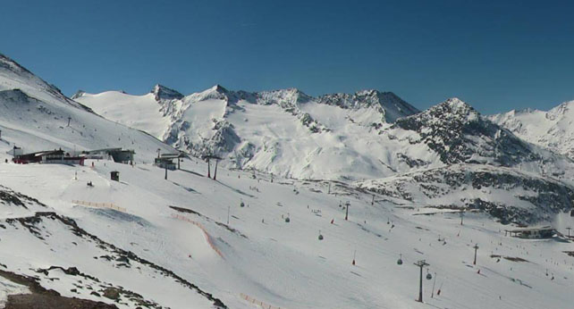
Here’s how it was looking this lunchtime in high-altitude Obergurgl in Austria – where the snowpack is 20-105cm deep, on-piste, depending on the altitude.
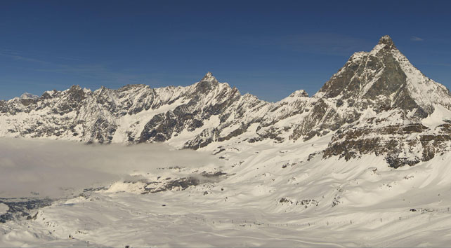
This is the scene above Cervinia in Italy, where there’s 30-240cm of settled snow, on-piste.
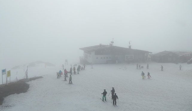
Here’s some of that low cloud I was talking about, in the normally spectacular Madonna di Campiglio. Here the cover is 60cm deep, mid-mountain.
And this is Courchevel in France, where there’s 86-181cm of settled on-piste cover.
The immediate outlook is for more mild sunshine over the next five days, with the chance of a wet/snowy interlude at the weekend.
Meanwhile, in North America…
Whistler’s memorable March continues. The resort has had about 270cm of snow since March 1 – and temperatures have been low for the time of year, too. Mid-mountain, the temperature was -7C yesterday.
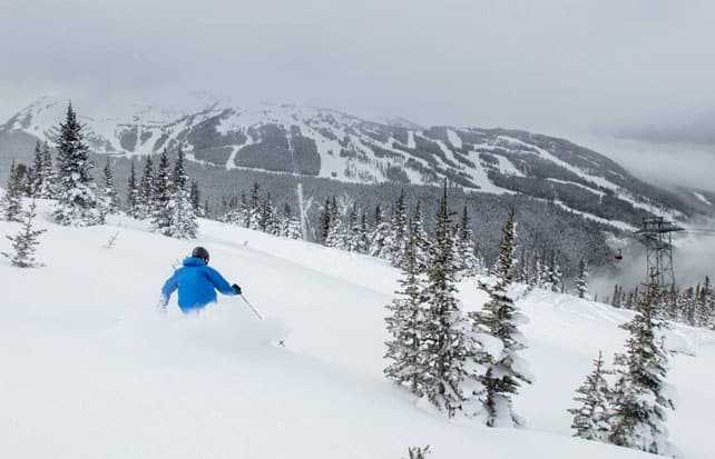
Currently, the mid-mountain snowpack is 328cm deep, and the outlook is for the cold, snowy weather to continue until the weekend at least.
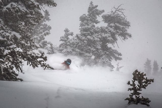
Further south, the weather took a much more spring-like turn at the start of March, with record-breaking highs recorded in Utah as a result of the prolonged sunny spell. Last week, the high-pressure broke down, and many Rocky-Mountain resorts are in the midst of another snowy spell. Pictured below was how Snowbird in Utah looked on Saturday. Two more snowstorms are expected there this week.


Add Comment