Well, that got the autumn off to a great start, didn’t it? As anticipated in last week’s snow report, fresh snow fell across the northern half of the Alps on Friday and Saturday. It settled as low as 2000m, and in places was over 50cm deep.
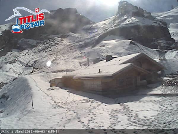
Engelberg in Switzerland had some of the heaviest snow – and over half a metre accumulated on the glacier before the storm subsided. There’s still plenty of it around this morning, as this webcam shot of the Stand ski hut, at 2450m, shows.

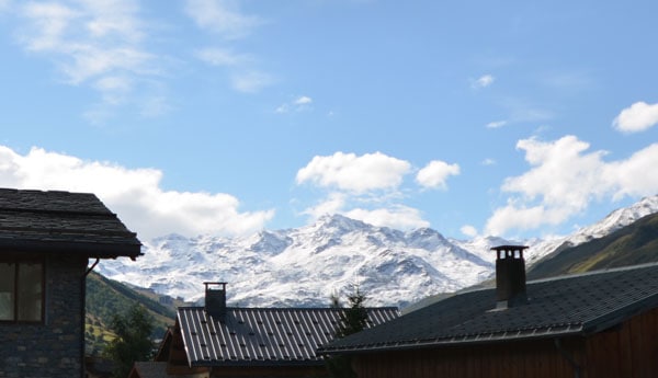
But many other resorts had at least a dusting. Below is a shot of the top of the Belleville valley (home to St Martin de Belleville, Les Menuires and Val Thorens), seen from The Alpine Club in St Martin yesterday.

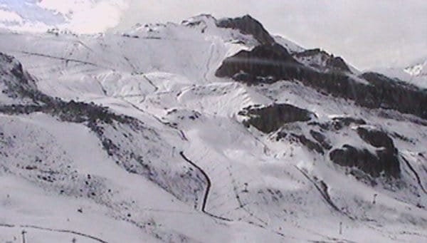
Below, was how the slopes above Ischgl looked yesterday.

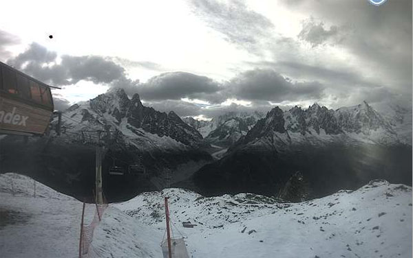
And here was the scene in the Flégère sector above Chamonix.

Of course, this is not the start of winter. It may not even be the end of summer – and just to emphasise the fact, temperatures have shot up again. On the glacier above Engelberg it’s already +4C, and on the Hintertux glacier in Austria it’s +3C. The snow line is scurrying back uphill, and on the handful of glaciers currently open for off-season skiing, the cover will be getting heavy and wet.
Nevertheless, the glaciers were in desperate need of a top-up after a long, mild summer, so the new snow is very welcome.
In the short term, there’s no sign of any more snow in the Welove2ski snow forecast. What’s more we notice that Switzerland’s federal weather service, Meteosuisse, is currently saying that a warmer-than-average autumn is more likely than a colder-than-average one. Let’s hope it’s wrong.
Meanwhile, in the USA, NOAA’s Climate Prediction Centre has said “there is increased confidence for a weak-to-moderate El Niño during the Northern Hemisphere fall and winter 2012-13”. We’ll be following that story with interest. As regular visitors to Welove2ski know, the Pacific Ocean climate anomaly El Niño – and its sister La Niña – can have a marked effect on snowfall in American and Canadian ski resorts – especially in the west. But of critical importance is how strong they are – as the last two winters have shown. The powerful La Niña of 2010-11 helped to generate record-breaking snowfall across much of the Pacific Northwest and the northern American Rockies. Last winter’s La Niña was weaker: it boosted snowfall in the Pacific Northwest but didn’t save the American Rockies from a poor season.
A powerful El Niño tends to boost snowfall in the south: ski resorts in California, New Mexico and southern Colorado can have epic seasons as a result, while it’s often warmer than average further north. But this is by no means a certainty for the season ahead.
And what of the southern hemisphere? Well, it continues to be south-eastern Australia’s winter, when it comes to snowfall. In the Snowy Mountains, the resort of Perisher has had around two metres of snow in the last month, and reports a settled snowpack of two metres. It’s been warm today, and there may be rain on Tuesday – but it looks as though it could turn to snow Wednesday as temperatures drop. The resort has decided to extend its season until October 5 in recognition of an exceptional second half of the season.
Here’s today’s video snow report
In the Andes, they’re still feeding off the 20-30cm of fresh snow that fell about ten days ago. It’s provided enough powder to provide decent conditions for the Swatch Skier’s Cup in Valle Nevado, Chile. The competition is between a team of skiers from Europe and another from the Americas – and as you’ll see from the video below, pitches competitors into some pretty steep terrain.
Finally, in the south island of New Zealand, it’s been a windy and mild day – and the forecast is for these conditions to continue for much of the week. Currently Mt Hutt has the deepest cover – thanks to a big dump a couple of weeks ago. There’s up to two metres of cover on the slopes, though it’s soft and wet at the moment thanks to the spring weather.
| France: The glaciers above Les Deux Alpes and Tignes, are currently closed. | |
| Switzerland: Four pistes were open today for summer skiing above Saas-Fee and five pistes above Zermatt. Thanks to the fresh snow, there’s now 128cm of snow cover on Saas-Fee’s glacier compared with 119cm last week. | |
| Austria: Conditions are now much improved on the Austrian glaciers, although mild temperatures will have made the fresh snow a bit soggy. It’ll freeze again overnight and be hard and fast in the morning. On the Hintertux glacier, 22km of piste were open for skiing today. The cover is up to 65cm deep. | |
| Italy: Glacier skiing will resume above Val Senales later this month – if conditions are good enough. Meanwhile, in the Aosta Valley, you can access the glacier between Zermatt and Cervinia from the Cervinia side until September 9. | |
| Andorra: Andorra’s ski areas are closed. | |
| Western USA: All the mainstream resorts in the US are now closed for skiing. However, there is skiing (and a terrain park) on offer at Timberline Lodge on Mount Hood in Oregon. | |
| Western Canada: The glacier above Whistler is now closed. |


RT @welove2ski: Temperatures are on the way back up today in the Alps…but still, wasn’t it great to see the white stuff again?
https:// …
RT @welove2ski: Temps are on the way back up today in Alps…but still, wasn’t it great to see the white stuff again? https://t.co/XeZyiGfm
RT @welove2ski: Temps are on the way back up today in Alps…but still, wasn’t it great to see the white stuff again? https://t.co/FsIn3YAd