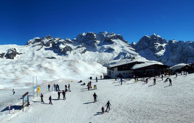
Heads up, Snowfiends, the weather in the Alps is about to get interesting again.
The high pressure that’s dominated the weather since March 6 is losing its grip. We saw the first sign of that at the weekend, when it shuffled west, and allowed colder, more humid air down from the north: a dusting of snow in Switzerland and Austria was the result. It’s going to do the same again on Wednesday – before being muscled off the scene completely by a powerful area of low pressure that’s due to sweep across north-western Europe at the weekend.
As you’ll see from our Snow Forecast for the Alps, a little snow is expected in the eastern Alps on Wednesday. Much heavier precipitation is expected from Saturday – although it will fall initially as rain in many places, thanks to a mild south-westerly airstream.
Gradually, temperatures will drop after that. But although the unsettled theme looks set to continue next week, there’s no sign of a genuinely cold snap coming.
In other words, skiers will still need to aim high if they’re planning an end-of-season trip: and accept that every now and again white-out conditions will prevail and force them back down to base. That, however, will be a small price to pay if the next day, the skies clear, and there’s fresh powder on the slopes…
All of which is good news. Yes, the sunshine has been dazzling and gorgeous. But it’s time the slopes got a top-up of snow in time for Easter.
Below is a sense of how the slopes are looking today. The sun’s out. It’s warm. But remember: it won’t be like this for much longer.
Pictured, below, is Serre-Chevalier, in France, where the cover on-piste is 55-235cm deep. Top temperature today in the valley is expected to hit +20C.
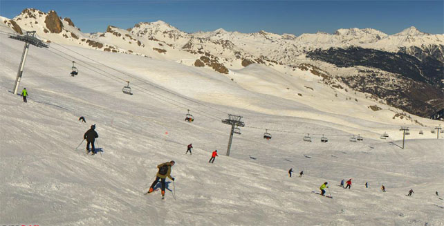
Meanwhile, below is the scene in high-altitude Tignes – where the snow is 105-210cm deep, on-piste. Top temperature will be +10C this afternoon at resort level.
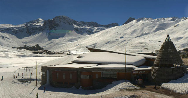
Pictured below is the hamlet of Findeln, above Zermatt, Switzerland. It’s +14C in town this afternoon, and the snow on the valley runs is only 20cm deep. But up high there’s plenty of cover: 215cm, in fact, at 2900m.
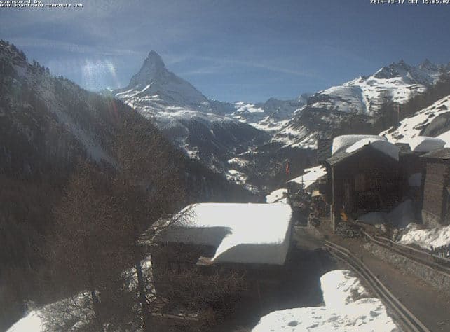
Below is high-altitude Obergurgl in Austria, where the snow is now 49-123cm deep, depending on altitude and the temperature at village level is +9C.

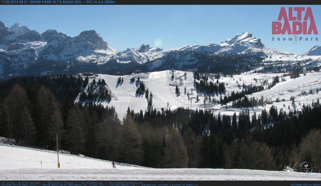
Finally, below is San Cassiano in the Italian Dolomites, where the temperature is +13C at village level and the snow is 90-240cm deep.
Fresh snow in Canada
In Lake Louise, Canada, winter has made a comeback after a short spell of mild weather. There’s been over 60cm of fresh snow there in the last seven days, with 31cm falling overnight on Saturday. Here’s how it was looking first thing yesterday morning…
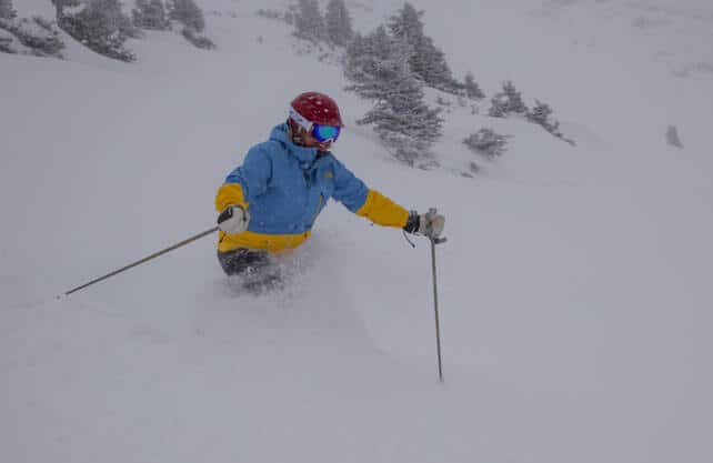
In fact, most resorts in western Canada saw fresh snow this weekend. Fernie had 37cm, Whistler 47cm and Kicking Horse 48cm. With temperatures set to stay fairly low, and more snow due in at the end of the week, it’s a canny place to be skiing right now.
| France: the snow at the beginning of March now seems like a distant memory, burnt off by the brilliant sunshine which took its place. There’s still plenty of good skiing about though – provided you aim high, and attack the slopes just as the snow is softening in the morning sunshine. Change is coming at the weekend. Currently, Val d’Isere reports 105-163cm of settled snow on its pistes, and Val Thorens 115-220cm. | |
| Switzerland: western and southern Switzerland had plenty of fresh snow in February and early March, but now spring-skiing tactics are essential if you want to get the best from the mild and sunny conditions. Currently, in Saas-Fee the cover is 96-355cm deep, on piste. Meanwhile, little Andermatt reports cover 85-400cm deep on its slopes, and Verbier 40-166cm. | |
| Austria: in the low-lying resorts north of Innsbruck, the valley runs are suffering terribly in the spring sunshine. For the best conditions, head south, where Nassfeld in Carinthia reports cover 60-350cm deep, or to reliable, high-altitude Obergurgl, which reports 49-123cm of cover on its pistes. Meanwhile, in the west St Anton reports snow depths of 35-125cm depending on altitude, which is a little underwhelming by the high standards of the Arlberg. Austria is expecting a little more snow on Wednesday – and then a more profound change in conditions at the weekend. | |
| Italy: there’s no shortage of snow in the Italian resorts. However, in common with the rest of the Alps, the warm weather is thinning the snow quickly on the lower slopes. Spring-skiing tactics are also essential if you want to get the best from current conditions. In the Aosta Valley, Cervinia has 100-320cm of settled snow on its pistes, and Canazei in the Dolomites 75-255cm. | |
| Andorra: there was a good dump of snow across the Pyrenees ten days ago – but as in the Alps, it’s been warm since then. Currently, Soldeu in the Grandvalira ski area reports 140-250cm of settled snow on its pistes. Across the border in Spain Baqueira reports its snowpack is 175-335cm deep. | |
| Western USA: it’s cooler in the American Rockies than it has been of late, and a brief blast of snow – and high winds – is expected this afternoon. Currently, Jackson Hole in Wyoming, is king of the snow scene, with 11.27m of snowfall recorded on its upper slopes so far this season, and a settled mid-mountain snowpack of 287cm, mid-mountain. In Colorado, Breckenridge in Colorado reports 9.22m of snow this season, and a mid-mountain snowpack of 226cm. and in Utah, The Canyons reports 5.13m of snow this winter, and a settled snowpack of 165cm. | |
| Western Canada: see our main report. There was excellent skiing to be had yesterday in western Canada, thanks to a foot or more of fresh snow in most resorts. In Whistler, the snowpack is currently 266cm deep, mid-mountain, as a result. In Fernie it’s 330cm deep, and Revelstoke it’s 255cm. |


Looks as though the heatwave in the Alps has almost run its course. Big change is expected at the weekend. https://t.co/II2zWubmf9
“@welove2ski: Looks as though the heatwave in the Alps has almost run its course. change is expected at the wkend https://t.co/l2I300mqGy”