


You might want to dig out your bobble hats again, Snowfiends. A big change in the Alpine weather is coming on Saturday; and heavy snow is on the cards. There’s going to be a precipitous drop in temperatures too. Today, for example, the freezing point in the French Alps is expected to be at 3000m. On Sunday, Meteo-Chamonix expects it to be at 1000m, and maybe down to 500m on Monday. To begin with, the precipitation will fall as rain to mid-mountain level in many resorts – and the only significant accumulations of snow will be at altitude, as you’ll see from our Snow Forecast for the Alps.
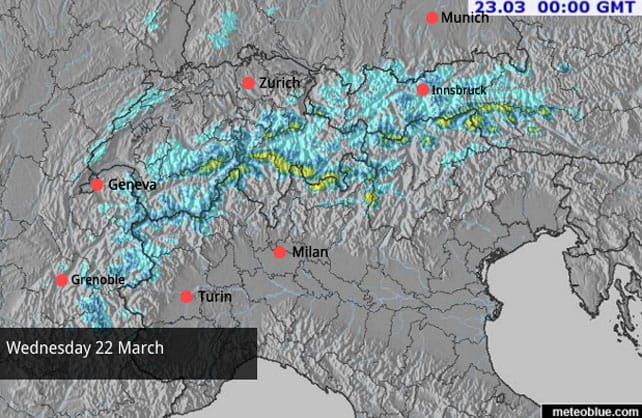
But on Monday – wallop.
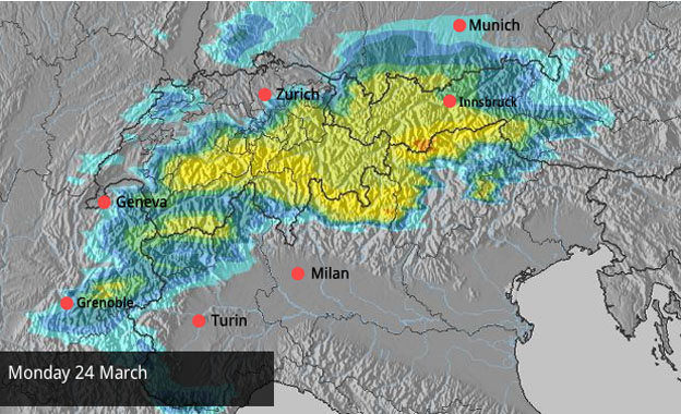
As you’ll see from our snow maps, the white stuff is going to favour the northern Alps – although it will spread across the Italian border into a few areas such as the Aosta Valley and the northern Dolomites. Thereafter it looks as though the weather will stay unsettled, too. There’s no sign of an immediate return to the hot, settled weather of the last fortnight. In the short term, skiers will have to be very cautious off-piste, because the fresh snow will be bonding poorly with the crust left behind by the long thaw. On piste, however, there’s going to be some superb skiing on offer from the get-go. It’ll be a miraculous transformation.
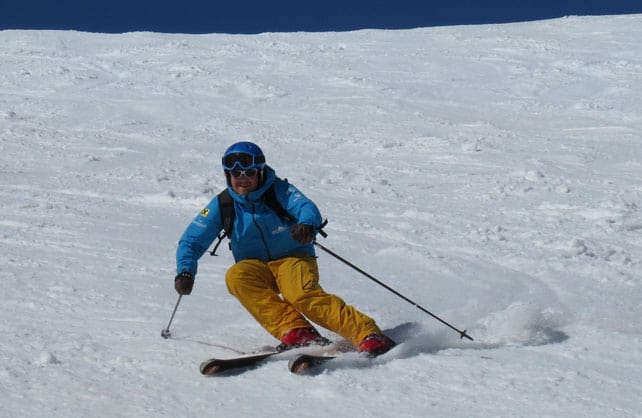
I was skiing yesterday in the extraordinary Osttirol – a little bit of Austria that was cut off from the rest of the Tirol at the end of the First World War – and had a blast in the dazzling spring sunshine. I was following local guide and instructor Piet Mitterrutzner down the pistes of Sillian, and we both agreed the softening pistes were a joy to ski, mid-morning. In the first half of winter the Osttirol was walloped by a series of powerful storms that came out of the Gulf of Genoa, and the talk here is of the snowiest winter for 100 years. So there’s no shortage of cover. But even so, there’s no arguing with the power of the current thaw, and any slope facing south was a slush-fest by lunchtime. The change in the weather is going to be welcome. Here’s a quick sample of the day’s webcams, starting with Les Deux Alpes, in France.
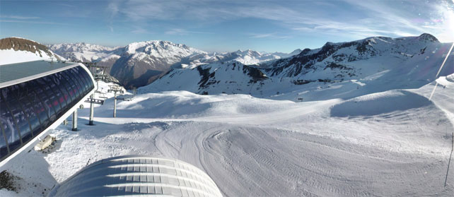
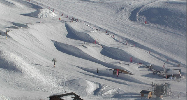
Pictured below is the snowpark at Val Thorens. Here, the snow is currently 115-220cm deep, depending on altitude.
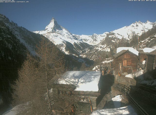
Pictured, below, is the hamlet of Findeln, above Zermatt. The slope behind the huts gives you an idea of how hard the thaw has bitten on the lower slopes. However, the cover up top is still very deep here – 215cm deep at 2900m. Top temperature today in town will be around 12C.
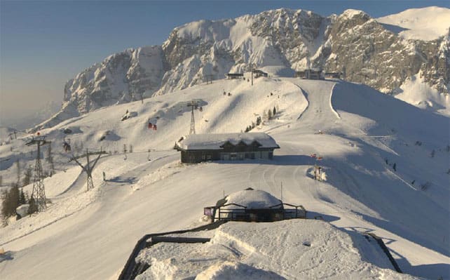
Pictured, below, is Nassfeld, in southern Austria, where the snow is now 40-320cm deep, on-piste.
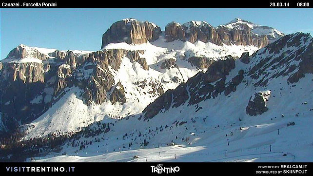
Finally, pictured below is Canazei in the Italian Dolomites this morning. The snow here is 75-245cm deep.
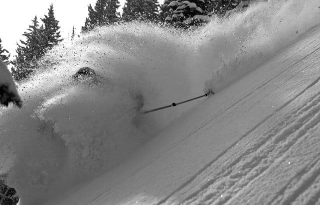
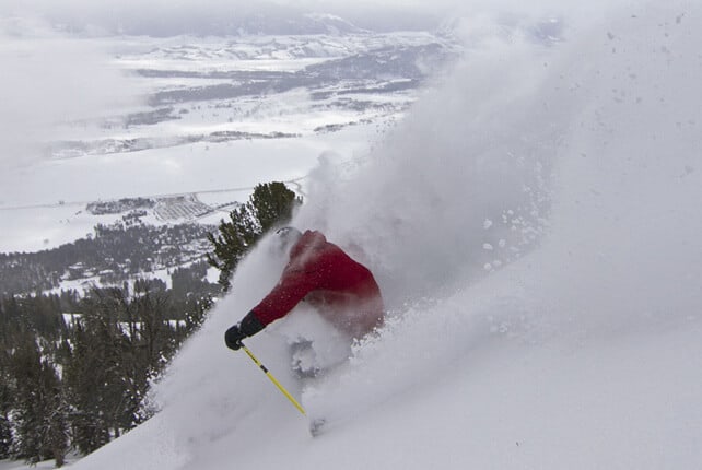
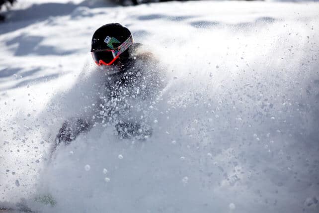
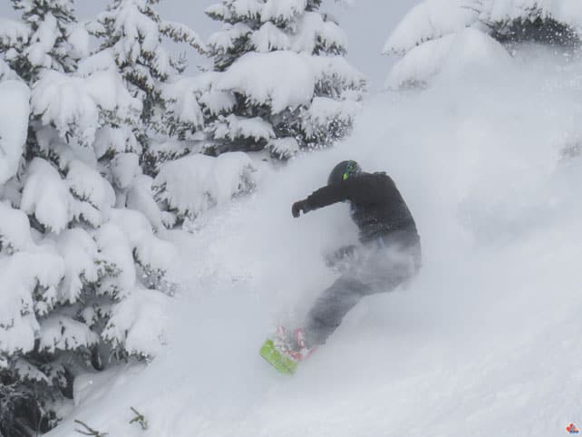
A powder day in the American Rockies
The resorts of the American Rockies were expecting a little snow on Monday/Tuesday – but in the end got rather more than that. Several reported a foot or more of the white stuff. Snowbird in Utah had 36cm. Alta, its neighbour, reported 20cm. Vail in Colorado had 30cm, and Jackson Hole in Wyoming had 33cm – bringing its season total past the 450 inch/11.43m mark. Here’s a selection of the exultant powder-skiing shots that emerged yesterday as a result…
There’s been fresh snow north of the border, too – in the Canadian Rockies. Lake Louise, for example, reported over 60cm in the four days to March 19. They should see a little more snow there in the next two days.
| France: all eyes are on the forecast. But there are still a couple of days of spring left – so enjoy the sunshine while you can: and don’t bother with skiing pistes below 1800m. Currently, Val d’Isere reports 102-158cm of settled snow on its pistes, and Val Thorens 115-220cm. | |
| Switzerland: as in France, everyone is now waiting for the fresh snow. For the next two days, however, it’s still spring skiing in the Swiss Alps. Currently, in Saas-Fee the cover is 88-340cm deep, on piste. Meanwhile, little Andermatt reports cover 80-400cm deep on its slopes, and Verbier 30-160cm. | |
| Austria: the fresh snow will be welcome everywhere across Austria – nowhere more so than in the low-lying resorts north of Innsbruck, which have had a threadbare winter. Elsewhere, the cover is in much better nick, especially in Nassfeld in Carinthia which still has 320cm of snow bedded down on its higher piste. Meanwhile, in reliable, high-altitude Obergurgl, the snow report records 44-119cm of cover on its pistes. | |
| Italy: there’s no shortage of snow at altitude in the Italian resorts. In common with all the Alps, however, south-facing slopes are getting very slushy by midday, and the valley runs are thinning fast. Resorts near the central Alpine ridge should see heavy snow from the coming storm: by contrast, those further south are likely to miss out. In the Aosta Valley, Cervinia has 90-310cm of settled snow on its pistes, and Madonna di Campiglio in the Brenta Dolomites 220-270cm. | |
| Andorra: the Pyrenees have just had two weeks of warm spring weather, but they’re expecting a change to much snowier conditions at the weekend. Currently, Soldeu in the Grandvalira ski area reports 140-250cm of settled snow on its pistes. Across the border in Spain Baqueira reports its snowpack is 145-325cm deep. | |
| Western USA: see our main report. There was a welcome top-up of snow at the beginning of the week in the Rockies, but the outlook is now fairly dry. Currently, Jackson Hole in Wyoming, reports a settled mid-mountain snowpack of 292cm. In Colorado, Breckenridge in Colorado is reporting its fifth snowiest season ever, and a mid-mountain snowpack of 232cm. In Utah, The Canyons reports a settled snowpack of 170cm. | |
| Western Canada: Whistler had a 20cm top-up of snow on Sunday, and some further sprinklings of the white-stuff since then, bringing its one-week total to 60cm. The snowpack is currently 261cm deep, mid-mountain, as a result. In Fernie the snow is 341cm deep after 64cm of fresh snow this week, and Revelstoke it’s 254cm deep. |


“@welove2ski: You might want to dig out your bobble hats again, Snowfiends. https://t.co/wXKCqo7xjl https://t.co/LuD1gT8FuZ” @Skilodgey