


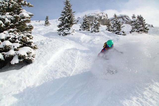
Winter made a spectacular comeback to the northern Alps last week – and it’s still snowing in parts of Austria today. As a result, there’s some lovely skiing to be had on cold, soft snow.
However, the main story this week will be the return of spring. The sun’s already out in the west, and from Wednesday temperatures will jump.
In the northern Alps, the first week of Easter skiing turned out to be one of the snowiest of the season. In parts of Austria, well over a metre of the white stuff fell at altitude, and in the northern half of the French Alps, 50-90cm was quite common. There was more snow on Saturday: 20-25cm fell above Chamonix in France, there was 15-30cm in the northern Swiss Alps, and 10-15cm in Austria, with another dusting yesterday.
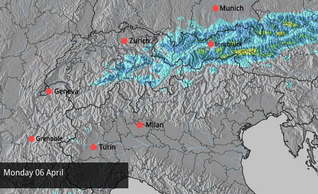
There’s a little more snow expected in Austria and eastern Switzerland today, especially around the middle of the day. Here’s the current snow forecast.
Aside from the snowfall totals, winter’s return last week had two other characteristics. One was the strong wind, which helped to send the avalanche risk through the roof. Across most of the French, Swiss and Austrian Alps, it’s still considerable (3/5) at altitude, and caution is needed if you’re planning to ski off-piste.
The other remarkable feature has been the low temperatures since Wednesday last week – and it’s still cool for the time of year, thanks to a north-easterly airflow across the region. In France today, the freezing point is at 1300m, and in Austria 900m. Of course, the April sunshine has a lot of power, and whenever it’s been out, it’s had an impact on the cover above that level on south-facing slopes. But all the same, from about 1800m upwards conditions are remarkably wintry, on piste. Above 2200m they’re superb.
Right now, the most consistent conditions are in Austria. Not only has it had more snow, on more days, it’s also enjoyed lower temperatures. It’ll stay that way for a day or two more, as well.
Below is a quick squizz at the webcams, starting with the view over the Bellevarde sector of Val d’Isere, in France. Here, the snow is currently a healthy 102-190cm deep.
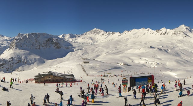
Pictured below is the scene above Val Thorens, in the Three Valleys of France. Here the snow is 150-260cm deep, and preparations are well under well for Sunday’s 3 Vallees Enduro – the muscle-melting race for teams of three which takes you all over the Three Valleys ski area. Registration is still open if you fancy a challenge this weekend.
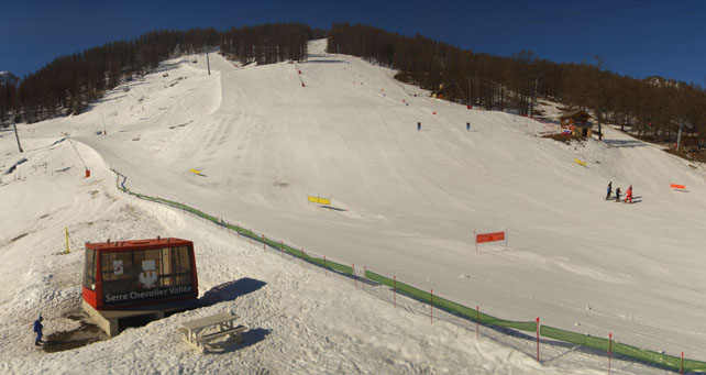
Pictured below is Serre Chevalier this morning. In common with other French resorts south of Grenoble, Serre Chevalier had less snow from last week’s weather than its rivals in the north. But there’s still good spring skiing to be had on the higher pistes. Here the snow is 13-108cm deep, depending on altitude.
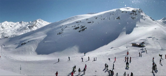
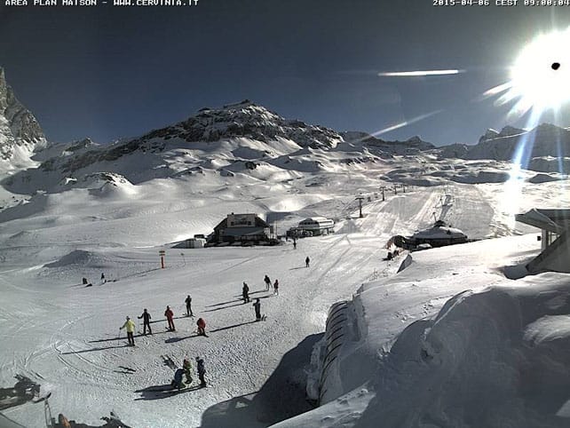
Pictured below is high-altitude Cervinia in Italy – one of the key late-season resorts in the Alps. It’s caught a fair bit of snow from the storms in the northern Alps – and had a 10cm top-up on Saturday. The snow here is 30-290cm deep.
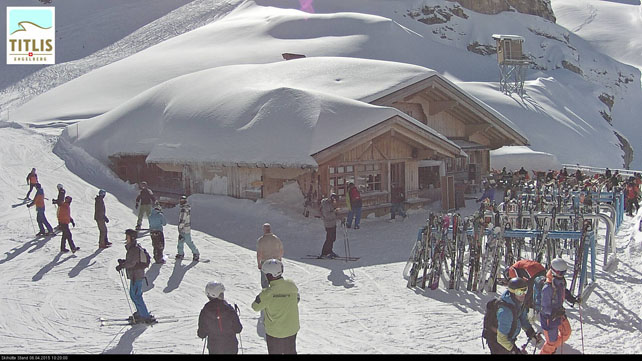
Below is how it’s looking this morning at Engelberg in Switzerland, where the snow is 240cm deep mid-mountain and 360cm at the top.
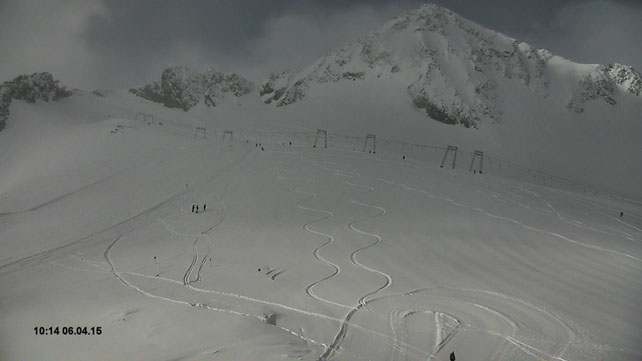
Below is how it’s looking on the Stubai Glacier, south of Innsbruck today. Here the snow is up to 240cm deep, and there’s clearly some fresh powder to be enjoyed there still.
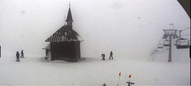
Finally, this is how it’s looking at the top of the Schmitten, above Zell am See – where today’s snow is already falling.
What’s coming next?
In a word: spring. The sunshine will spread to all parts of Austria by midweek, and the north-easterly winds will be replaced by much warmer air from the west or south-west. The freezing point will be up to 2600m in France on Thursday, and maybe 3000m in Austria.
On all but the highest, shadiest slopes, the change in the quality of the snow will be sudden and dramatic, and despite the deep cover, you’ll need to adopt spring-skiing tactics to make the most of it.
Meanwhile, across the Atlantic…
Yesterday, the Canadian Rockies were the place to be, thanks to a 30+cm dump on Saturday. In Banff National Park, Sunshine Village reported 37cm of fresh, and Lake Louise 34cm.
Here’s how it was looking in Sunshine village…
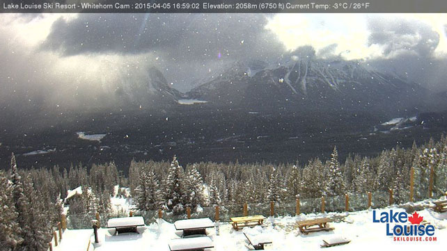
This was the scene above Lake Louise at the end of the day, with another snow shower passing through.
South of the border, it looks as though Wednesday could see some snow in both the Utah and Colorado Rockies, after another mild and sunny spell. Parts of northern Utah could see 20-odd cm of fresh snow.
| France: there was a top-up of snow in the northern half of the French Alps on Saturday. Combined with the low temperatures, it’s created a soft and wintry covering on most pistes, and brought another day of great skiing to the region. Off-piste, the avalanche risk is generally 3/5, and conditions are mixed to say the least, with dust on crust on lower, shady slopes, wet and heavy snow on lower, sunny slopes, and a mix of powder and hard, wind-scoured patches at altitude. It’ll stay coolish until Wednesday, at which point temperatures will jump. The end of the week will be very mild.
Currently in high-altitude Tignes in the Espace Killy there’s 102-190cm of settled snow on the pistes, and in the Chamonix Valley, the Grands Montets sector reports 150-200cm of settled cover. |
|
| Switzerland: conditions in Switzerland are similar to those in France. In the east, however, they had the benefit of more frequent top-ups of snow last week. Currently Verbier in the west reports a mid-mountain snow depth of 193cm, and 290cm at the top, while St Moritz in the south has 26-159cm of cover across its pistes. | |
| Austria: more snow is expected today in Austria, and conditions are remarkable given it’s April 6. There’s good skiing right down to village level even in low-lying resorts. Currently, in the Arlberg, Lech has 95-245cm of cover, on piste. In neighbouring St Anton, there’s over four metres of snow bedded down on the Valluga. Meanwhile, on the Hintertux glacier the white stuff is up to 270cm deep. | |
| Italy: there was widespread snow across the Italian Alps two weeks ago, but most resorts have missed out on the big dumps last week. Only those close to the northern frontier have benefitted. Above the Aosta valley, Champoluc currently has cover 25-190cm of cover, on-piste. Meanwhile, in the east Canazei in the Dolomites reports 40-120cm of settled snow on its slopes. | |
| Andorra: temperatures dropped over the weekend in the Pyrenees and despite the sunshine, a top temperature of just +2C is expected in the Grandvalira ski area. The snow on the lower slopes is thinning, though. Currently there’s 50-170cm of cover, on-piste. | |
| Western USA: after a top-up of snow at the end of last week, spring has resumed its dominance of Rocky-Mountain weather, with sunshine and mild temperatures the predominant theme. There’s likely to be another snowy interlude on Wednesday in Utah and Wednesday night/Thursday in Colorado. Currently, in Vail, Colorado, the mid-mountain snowpack is 117cm deep, and the daytime high is expected to hit +11C. In Utah, Snowbird has 175cm of settled mid-mountain snow. Meanwhile, in Wyoming, Jackson Hole closed yesterday – it’s always one of the first to shut down as spring takes hold. | |
| Western Canada: the Rocky-Mountain resorts were the place to be this Easter, although conditions in Whistler’s were pretty good too. Currently, the mid-mountain snowpack is 184cm deep, and there’s been 21cm of fresh snow over the last seven days. Meanwhile, in Fernie the snow pack is 165cm deep and there’s been 16cm of snow over the last seven days. |


Stuben Arlberg is great at the moment. never pass a powderday!!!