


We’ve got two significant snow stories to consider today.
The first concerns the west coast of Canada and America, where a week of heavy snow is well underway. Whistler has had 67cm in the last 48 hours, and even the ski patrol dogs are happy…

There’s more in the forecast too. A further 60cm could fall by close of play on Thursday, although it’s worth noting that it’ll be carried on a mild south-westerly wind, and there’ll be rain at times, especially at lower elevations.
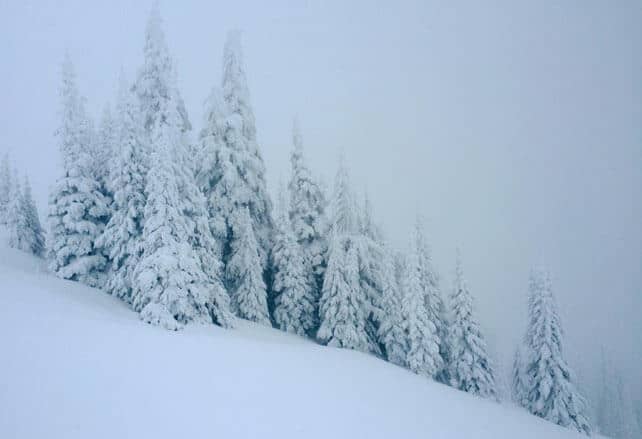
There’s also been snow inland. Pictured below was the scene at Sun Peaks yesterday. This morning, it reported 32cm of snow in 48 hours, and it should see more on Tuesday and Wednesday. This band of moderate to heavy snowfall should push all the way to Banff National Park, although at the moment I see that Lake Louise has only had a dusting.
Meanwhile, south of the border, in Washington State, little Mount Baker (which holds the record for the highest snowfall ever recorded in a ski resort – 29m in the 1998-9 season), reports a metre of snow since Friday. Here too, the freezing point is bouncing around, and at lower elevations the snow turned to rain this morning.
On Wednesday night the action shifts south to California. Around Lake Tahoe, local snow-meister Bryan Allegretto reckons 45-90cm of snow could fall at altitude. That’s on top of healthy snowfalls already in the region, and likely impact of the powerful El Nino in the Pacific. The storm should push inland, but not with the same power. Both Utah and Colorado are expecting moderate snowfall on Thursday/Friday.
The second story is the continuing mild and sunny spell over the Alps.
Proper Snowfiends will know already that two weeks ago there was wonderfully snowy weather across parts of the northern half of the region, which brought decent early-season accumulations from the northern French Alps to the Arlberg in western Austria. This was followed by an unseasonably warm spell last week: and after a cooler, cloudier spell at the weekend the sunny, mild weather has returned.
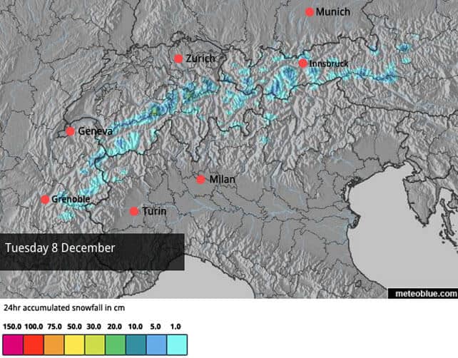
It’s not as toasty as it was last week. Daytime freezing points are likely to be around 2600m, rather than 3000m or more which was the case last week. However, at night, it’s not going to cool off significantly, except on Tuesday and Wednesday, when some light snowfall could reach the northern Alps.
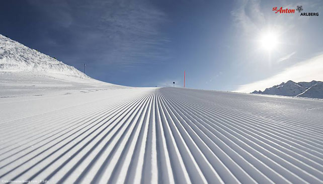
Here’s our current snow forecast for Tuesday. As I said, it will only be a sprinkling.
Saturday could see another pulse of light snow as a second cold front reaches the Alps. However, it’s going to peter out at just the wrong moment, and won’t deliver significant accumulations. What’s more, it’s unlikely to reach the Italian resorts, most of which are still awaiting their first significant snowstorm. Tireless work by snow-making and grooming crews has meant that pistes are being opened there, but in many places these are ribbons of white against the grass.
Crucially, the high pressure dominating the Alps is unlikely to shift in the near future. Last week, it seemed probable that the weather would break down between December 12 and 14: but the mid-range weather models are now in broad agreement that this won’t happen. One of the models suggests the high pressure might lose its force in the middle of next week, but there’s no consensus about that yet.
Of course, there’s still time yet for another snowy interlude before Christmas. But the high-pressure trend seems quite embedded right now, and there’s a lot of warm air still sitting over the Med. Even if we do get snow, it could be followed by another sharp thaw. So if you’re planning to ski in the near future, the best policy is to aim high.
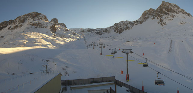
Here’s how it was looking in Tignes earlier this afternoon, on the long and lovely Double M piste down to Tignes Val Claret. As you’ll see, it’s far from snowless, though the cover lower down on its lower reaches will be quite firm in the mornings.
I’ll be back on Thursday with another update – from the slopes of Courchevel. In the meantime, if you’ve got a moment, sacrifice a few chickens to the Snow Gods, will you?


Add Comment