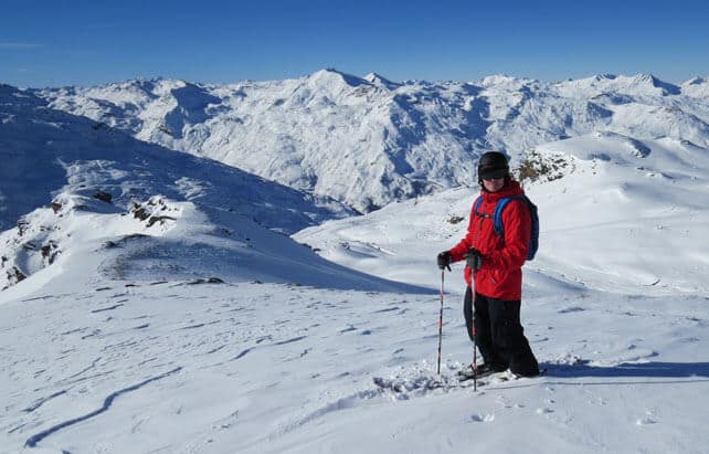
Holy smoke, it’s beautiful in the Alps right now.
But it’s also WARM. I’m in Val Thorens at the moment: and chuffed to bits to be here, because in a thaw like this a high-altitude resort is exactly what’s needed. But even in Val Tho you have to take your helmet off if you stand around in the sun for too long. Otherwise, it feels like you’re brain is going to boil.
That said, two days into this warm-wave, there’s still some lovely snow to be skied on the north-facing slopes: both fast grippy pistes, and packets of sumptuous, calf-deep powder. To get la poudreuse you need to hit the leeward side of a ridge, where all the snow was blown in last week’s snowstorms. If you find the right spots, you’ll make some gorgeous turns.
By contrast, on the windward side of many slopes, there’s barely enough snow to support a mouse. Given the extremely variable depth of the cover, everyone has got their old “rock skis” out, and is expecting plenty of gouges from hidden boulders.
Meanwhile, on slopes that get a lot of sunshine, the snow is going through a daytime melting/overnight refreezing cycle more typical of spring than early December. Here, you need to wait for the sun to soften the cover if you don’t like skiing hardpack.

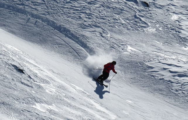
Here’s a photo of my guide yesterday, Antoine Diet, making one of those powder turns I was talking about. He’s an amazing skier – and full of the joy of being in the mountains. Shame I wasn’t in the right place to take the shot…
Meanwhile, below is a little video taster of how the snow was in Verbier on Monday.
But how long will the thaw last?
Ay, there’s the rub. Last week’s excitement – caused by a week of snowy weather across the northern Alps – has turned to dismay, as another sunny and unusually mild spell has settled over the region. The daytime freezing point has shot back uphill, and is likely to hit a giddy 3300m across much of the northern Alps today. What’s more, despite a slight cooling off at the weekend, it’s not yet certain when the weather is going to change. Once again, memories of last season’s grotty Christmas have been reawakened.
If you’ve booked a skiing holiday at some point in the coming month, and you’ve chosen a high-altitude resort, with plenty of skiing above 2200m, I wouldn’t be too downhearted. Yes, the cover is going to thin in the warm sunshine, and in a week’s time almost nothing will be skiable off-piste, except on the very highest and most sheltered slopes. But there’s already a decent base on many pistes which the resorts will be topping up overnight with snow cannons. And with three weeks still to run until Christmas, there’s time for a significant shift in weather patterns.
In fact, in the last 24 hours the mid-range weather charts have started to suggest the high pressure will slip westwards at some point between December 12 and 14. Ten days out, this is merely a hypothesis, not a forecast. But if it comes, the change could be very abrupt, as it was last week. After all, it is December.
All the same, if you haven’t booked a holiday yet, make sure your choice has plenty of high-altitude slopes, to be safe.
Despite the warm weather, lots of ski resorts are going ahead with their openings this week. There are too many to list here, but they include Lech and St Anton in the Austrian Arlberg, Madonna di Campiglio and the resorts of the Sella Ronda in Italy, Meribel, Courchevel and Les Deux Alpes in France. Serre Chevalier is also opening for a weekend preview from December 5-8.
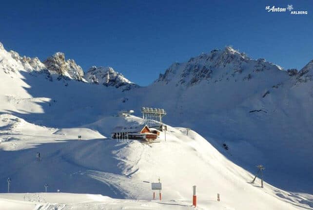
Here’s how it was looking at the top St Anton’s ski area earlier today. As you can see, the Austrian Arlberg did very well from the recent cold and snowy spell, and on piste there’s plenty of cover. However, here as everywhere in the Alps, the quality of the snow is going to suffer over the next few days.

Meanwhile, in North America…
Colorado enjoyed a five-day spell of unsettled weather over Thanksgiving, which brought wildly varying amounts of snow to the state’s ski areas. Little Wolf Creek, in the south, notched up a meaty 86cm, Beaver Creek had 53cm and Vail 41cm, while other ski areas got a measly 15cm.
Here’s Monday’s “we’ve got powder!” video from Vail.
ARVE Error: For the maxwidth (maxw) option you need to have normal or lazyload mode enabled, either for all videos in the plugins options or through shortcode e.g. [youtube id=123456 mode=normal maxw=999 ].
The Californian resorts saw snow too – though most of it fell a week ago. Heavenly, Squaw and Kirkwood all report 45cm of snow in the last week, and it looks as though there will be more here on Thursday. This next storm will be a fast-moving one, and is likely to drop no more than 15cm in most of Lake Tahoe’s ski areas.
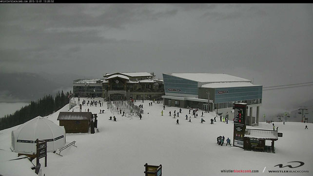
Now, the action is shifting north of the border. After a dry patch (just 3cm of snow in the last week), Whistler is now in the midst of a snowy spell of weather – which is due to last until next Monday at least. Last night’s storm has dropped 7cm of new snow so far, there’s 25-35cm more expected on Thursday and Friday, and two more active weather fronts are due in after that.
Here’s how it was looking yesterday as the first.snowflakes fell…
The storm should push inland too, bringing snow to resorts such as Big White and Sun Peaks, as well as resorts south of the border such as Big Sky in Montana and Jackson Hole in Wyoming. However it’s likely to stay dry in Colorado, with milder temperatures than of late.
This week’s snow report comes to you from the lounge of the Altapura in Val Thorens, which is a rather cool and lovely place. Thanks for having me to stay, guys!
| France: last week the snow was settling at village level in many French resorts, but now it’s thinning fast. Higher up, the cover is still very good for the time of year in those resorts which are already open. Currently, in Tignes, there’s 30-90cm of settled cover, on-piste and in Val d’Isere 28-60cm. Val Thorens has 85-115cm of cover on piste, but the even at 2300m the temperature hit +5C today. There’s only one rule at the moment: aim high if you plan to ski in the next couple of weeks. | |
| Switzerland: the weather is much the same in Switzerland as in France – beautiful sunshine and spring-like temperatures. I’d target one of the glacier resorts if you’re planning to ski over the next couple of weeks – either Saas Fee or Zermatt. Zermatt currently claims 140cm of cover, mid-mountain. Other resorts currently open include Engelberg, Laax and St Moritz. | |
| Austria: the cover is deep enough in the Arlberg to resist the thaw, but all the same I’d target one of the glacier resorts if you’re planning to ski in the next week or two – or high-altitude Obergurgl. From the glacier ski areas, you can take your pick from Hintertux, the Molltal, the Pitztal, the Kaunertal, the Stubai, the Rettenbach, above Solden, the Kitzsteinhorn and the Dachstein. | |
| Italy: most Italian resorts are still waiting for the their first significant snowstorm, having missed out on last week’s storm. However, brilliant work by the snow-making and grooming teams have ensured that pistes have opened with little help from Mother Nature. As is the case everywhere at the moment, the best skiing will be at altitude, in the likes of Cervinia, and on the Presena glacier above Passo Tonale. | |
| Andorra: in common with much of the Pyrenees, Andorra’s ski resorts were walloped by snow last week, but are now in the grip of the thaw. In the Grandvalira ski area, Pas de la Casa has up to 50cm of snow packed down, on-piste. Afternoon temperatures hit +6C on the slopes today. | |
| Western USA: early-season cover is pretty good in the western US – although Colorado is now expecting a milder, drier spell. Currently, Vail reports 58cm of mid-mountain snow, Snowbird 55cm, and Heavenly 55cm. There should be more snow in the Pacific Northwest, California and the northern Rockies this week. | |
| Western Canada: Whistler’s season is looking up, with lots of snow in the forecast. It could get half a metre by the beginning of next week. Meanwhile, in Banff National Park, Lake Louise reports 70cm of cover on its pistes, mid-mountain. |


Add Comment