


In the Alps, last week’s excellent, wintry skiing conditions have been spoilt by a blast of very warm air from the south-west. Temperatures have jumped, and there’s been rain up to 2000m in many places in the north.
It’s not a disaster. Except on the lowest slopes, the snow depths are more than adequate to deal with a short, sharp thaw like this. But what annoys me is the way the quality of the snow has been affected. Up to a dizzying 3000m on south-facing slopes, the snow became wet and heavy at the weekend, and is now going through a daily thaw-refreeze cycle. You’ll be hard pressed to find powder off-piste, except on the highest, north-facing slopes. Meanwhile, the pistes are hard-packed in the mornings. It’s quite a contrast with last week.
Combined with strong winds, the thaw has also jacked up the avalanche risk, off-piste. It’s most pronounced in the east, where thick, unstable wind-slabs have been formed by drifting snow. Lower down, the rain has made the snowpack looser too, and prone to spontaneous wet slides. In the Tirol, the risk is currently 3/5, but according to today’s avalanche report, it’s close to 4/5. Great caution is necessary if you’re venturing beyond the groomed and waymarked trails.
Fortunately, change is coming.
Thankfully, cooler air is heading to the rescue. What’s more, it looks like it will mix with an area of low pressure which will cross the Bay of Biscay on Saturday, before hitting the Pyrenees. It’s too soon to be certain of it, but it could produce some spectacular snowfalls.
Meanwhile, in the Alps, it’s not clear exactly when winter will make its return. Some forecasts think it will be tomorrow, but our Snow Forecast is predicting more rain at lower elevations on Tuesday. It’s only on Wednesday that it suggests more widespread snow.
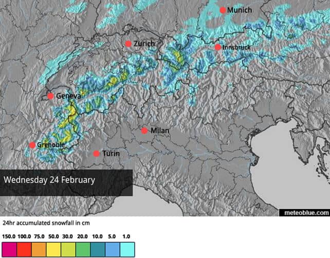
There should be more light to moderate snowfall Thursday and Friday, but the days to really watch out for are Saturday and Sunday. If the intense storm due in the Pyrenees moves east, the resorts of the Italian Alps could get a dump.
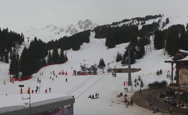
Here’s how it’s looking in Courchevel, in the Three Valleys, at the moment. There may well be the odd flake of snow blowing around this afternoon, up high, with rain lower down. Currently, the settled snow depths are 134-180cm deep, on-piste. The freezing level is expected to be at 2700m this afternoon.
Meanwhile, this is Serre-Chevalier. Here, the snow is 25-148cm deep, on-piste. The resort is expecting a high of +7C today.
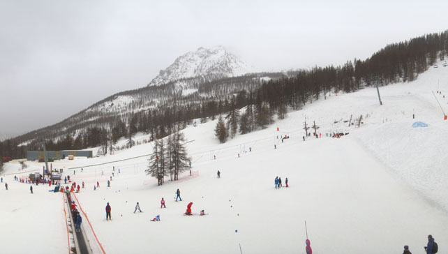
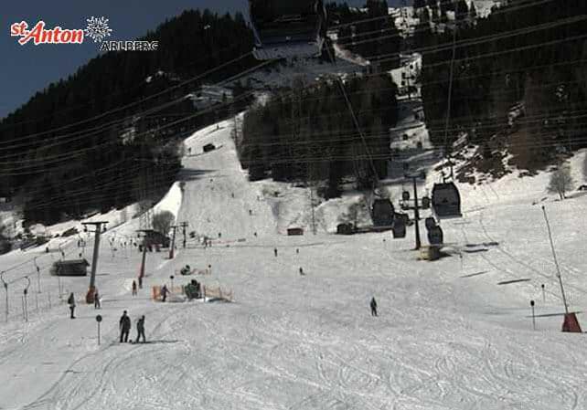
Further east, the sun is out. Pictured below is the home run into Nasserein in St Anton in Austria. Here the snow is 70-275cm. At 2000m, the temperature in the Tirol could reach +7C this afternoon.
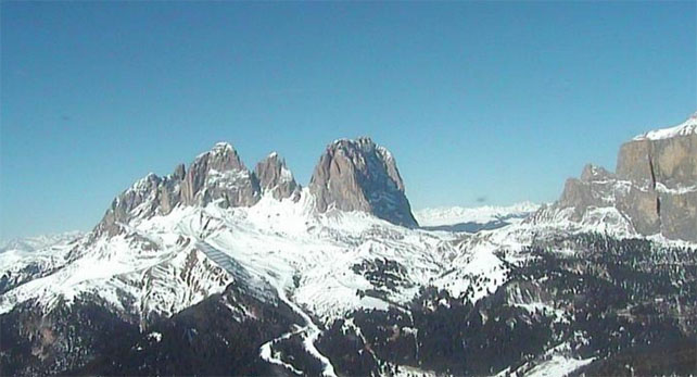
Pictured below are the both the Sassolungo massif and the Sella massif, in the Italian Dolomites. Here, the pistes in Canazei have 40-95cm of settled cover.
Meanwhile, in North America…
There’s going to be some snow around today in the Canadian Rockies, and further south in Colorado and Utah. Thereafter, high pressure will regain control, and it’s likely to get very mild again, until the weekend at least.
I’ll be back with a full Snow Report on Thursday.


I am just about to book a skiing trip for next week, looking for some good snow coverage, where would you suggest, given the weather conditions?