


Hold onto your bobble hats everyone – and keep your sunglasses handy. Weather-wise, we’re expecting a bit of a roller coaster over the next few days in the Alps.
It’s not storminess that’s going to be the problem, but wildly varying temperatures. Today, across much of the region, the weather is settled, sunny and cool – but not frigid. Tomorrow, temperatures will dip sharply, and there’ll be some snow. Then – on Sunday – we’re going to have a mini-heatwave.
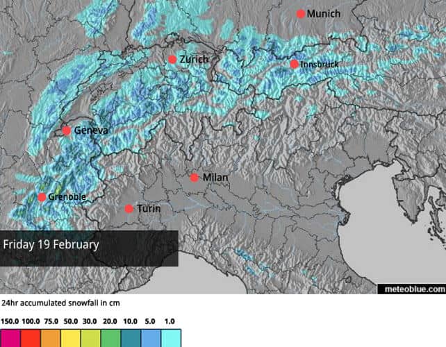
Take Les Menuires in the Three Valleys for example. It’s expecting a high of -2C at village level tomorrow and then, on Sunday, +10C. The daytime freezing point will be up to 3600m, and with plenty of sunshine about we can expect the snow to become wet and heavy on all but the highest, shadiest slopes. It’ll refreeze overnight, and hard-packed pistes and crusty off-piste conditions will be a problem on Monday morning – before the snow softens again in the mild air.
On Tuesday, the wind is expected to switch round to the north and temperatures will drop sharply again. This isn’t absolutely certain yet – but the freezing point could be down to 800m, accompanied by moderate to heavy snowfall. Let’s hope it stays that way for a while. We don’t want spring to take hold in the middle of February.
But I’m getting ahead of myself, because today conditions are really lovely in the Alps. In the north west it’s been largely dry since the weekend dumps, and the windless weather has allowed the snowpack to settle off-piste. In many places the risk is now at 2/5. On piste, conditions are very good, especially at altitude.
Meanwhile, in Austria and easter Switzerland, there was fresh snow last week and at the beginning of this week too – although not in the same quantities as France and western Switzerland. Here in the east, the avalanche risk is higher, at 3/5 in many places, thanks to the stronger winds creating snow drifts on the higher slopes.
And in the south-east, they’ve just had more snow. The East Tirol in Austria picked up a very useful 35cm on Tuesday and Wednesday, and in the Italian Dolomites 20-30cm fell in the same period.
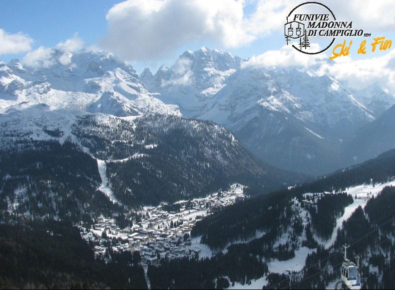
Pictured below are the Brenta Dolomites, seen from Madonna di Campiglio, this morning. There’s been 30cm of snow here over the last couple of days, and the cover is 95-175cm deep.
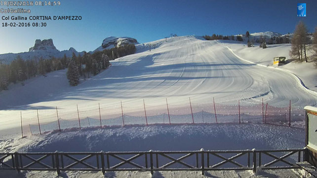
Below are some rather tasty conditions in Cortina d’Ampezzo this morning. Here, there was 20cm of snow on Tuesday and Wednesday.
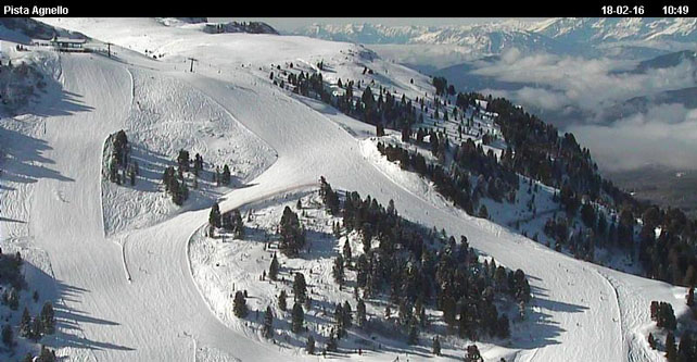
Pictured below is the Ski Centre Latemar near Moena in the Dolomites, where the snow is 40-60cm deep. There was 20cm of fresh snow here yesterday.
Here’s a quick squizz at the rest of the webcams this morning, starting with Val d’Isere in France, where the snow is currently 132-255cm deep.
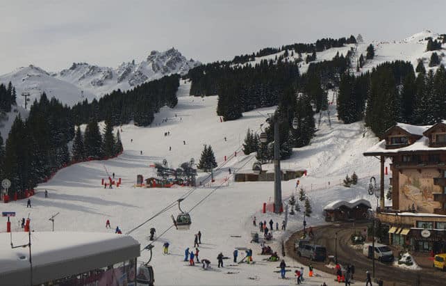
Pictured below is La Croisette in Courchevel. Here, the the snow is 132-175cm deep.
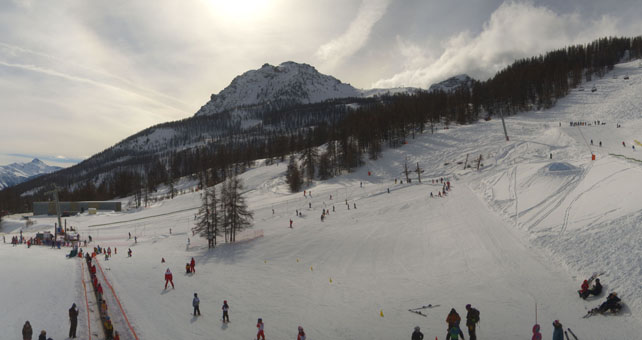
Pictured below are the mid-mountain nursery slopes above Serre Chevalier, south of Grenoble. The resort reports 30-170cm of settled snow.
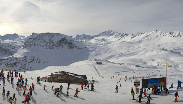
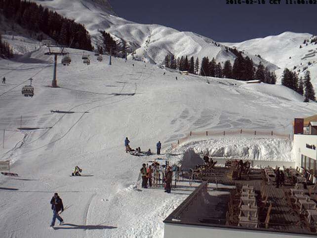
Here’s how it’s looking above Zermatt, Switzerland, this morning. The settled cover here is 20-200cm deep.
And this is the view of the lower slopes of little Warth am Arlberg in Austria, where the settled cover is 165-205cm deep.
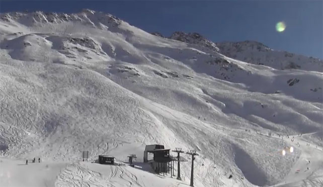
Finally, pictured below is the Rendl sector of St Anton, where the snow is 85-260cm.
Once again, the week of February half-term has delivered some lovely skiing…
Meanwhile, in North America…
The last couple of weeks have seen much quieter weather in the resorts of the American west – with sunshine and mild temperatures the norm. Yesterday, however, things got more interesting, thanks to an intense, but short-lived storm which is currently crossing the region. It started warm, and brought rain to the lower slopes in both California and Utah, but it’s cooling rapidly as it goes, and by the time it’s finished, the forecasters at Open Snow reckon it will have dumped nearly 60cm of snow on some of the Lake Tahoe resorts in California, 15-30cm in Utah, and maybe 15cm in the central and northern resorts of Colorado, such as Vail and Steamboat. In Colorado, they’re expecting the odd rumble of thunder, too.
Thereafter, another dose of mild sunshine is on the cards.
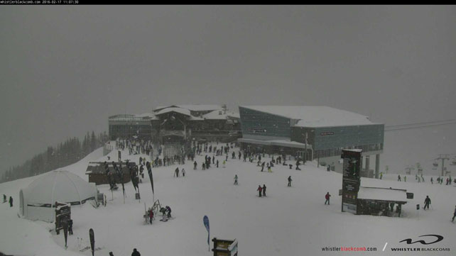
Further north, Whistler has seen plenty of precipitation this week, although there’s been rain on the lower slopes. Yesterday it reported 28cm of the white stuff in 48hrs and 64cm in the last week. Click on this link to see a rather tasty snippet of video from February 16.
Here’s how it was looking at the top of the Whistler gondola late yesterday morning.
Temperatures should be dropping back a little as the weekend approaches, so the lower slopes should see some of the white stuff too.
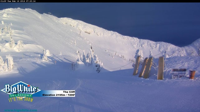
Meanwhile, the resorts inland have also seen snow. Big White reports 52cm in the last week, and Lake Louise 38cm.
Here’s a rather magnificent shot from Lake Louise on Tuesday.
And this was Big White.
| France: February half term has come up trumps again – with cool weather and deep snow. The weather has calmed down considerably over the last three days as well – which will have been a boon for anyone with young children. Currently, Tignes has 132-255cm of settled cover, on-piste, and Chamonix 195-285cm on Flegere. Watch out for yo-yoing temperatures at the weekend. | |
| Switzerland: conditions across the northern and western resorts of Switzerland are quite similar to the northern resorts of France: the snow’s settled nicely and low temperatures have kept it in good nick. Light snow is expected at the weekend and then a heatwave on Sunday. Currently, Verbier, reports 45-220cm of cover, on piste, and Engelberg 30-345cm. | |
| Austria: Austria’s resort are in good condition thanks to fresh snow last week and again on Monday. However, with the exception of the Arlberg, the cover isn’t nearly as deep as it is in the west. Currently, the Skiwelt has 55-65cm of cover, and St Anton 85-260cm. | |
| Italy: over the last couple of weeks, Mother Nature has finally got her act together in Italy, with fresh snow adding to the cover created by the snow cannons. Currently, high-altitude Cervinia reports 75-240cm of settled snow. In Canazei in the Dolomites it’s 40-95cm deep. | |
| Andorra: conditions in the Pyrenees have significantly improved, thanks to fresh snow at the weekend, followed by another dump at the beginning of the week. In Andorra, Pas de la Casa reported 30cm of new snow at the start of the week, and has up to 100cm of cover packed down, on-piste. | |
| Western USA: see our main report. The second half of January saw the snowstorms coming thick and fast across the American west – followed by a mild and sunny spell. A short-lived and intense storm is currently crossing the region, but it will be followed by more sunshine. Currently, in Colorado, Breckenridge reports a healthy 150m of mid-mountain snow, in Utah Snowbird a whopping 213cm, and in California Heavenly has 210cm. | |
| Western Canada: in Whistler the mid-mountain snowpack is 260cm deep, with more of the whitestuff in the forecast. In Banff National Park, Lake Louise reports just 38cm of new snow this week, and a mid-mountain snowpack of 114cm. |


Add Comment